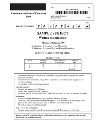
The Victorian Certificate of Education (VCE) is one credential available to secondary school students who successfully complete year 11 and 12 in the Australian state of Victoria as well as in some international schools in China, Malaysia, Philippines, Timor-Leste, and Vietnam.

Haileybury is an Australian private school with campuses in Keysborough, Brighton East, Berwick, Melbourne's CBD, Darwin, Northern Territory and online campus, Haileybury Pangua. It also has an international campus in the Tianjin outer district of Wuqing, China. Middle School at Haileybury introduces parallel education where students are separated into single-gender classrooms for their academic studies and for Sport and Camping programs. Although learning in separate classes, boys and girls share the same campus and socialise in co-curricular activities together. Haileybury has been described as the largest independent school in Australia.

The Victorian Tertiary Admissions Centre (VTAC) is an independent shared admissions service facilitating access to tertiary education and further study opportunities and pathways for learners in Victoria and beyond. Formed in 1967 and incorporated as a company by limited guarantee in 2023, VTAC is a not-for-profit organisation and a member of the Australasian Conference of Tertiary Admission Centres (ACTAC).

Glen Waverley Secondary College is a non-selective public government school located in Glen Waverley, Victoria, Australia. It is one of the largest secondary schools in Victoria, with 2,250 students and 181 teachers as of 2024. In addition, the college is one of the highest performing state high schools in Victoria, it ranked 59 out of all 530 Victorian high-schools in 2013, based on the Australian Tertiary Admission Rank (ATAR).
St Joseph's College is a Salesian Roman Catholic boys' secondary school in the outer-eastern suburb of Ferntree Gully, Melbourne, Victoria, Australia.

Gisborne Secondary College is a co-educational secondary school located in Gisborne, Victoria, established in 1981. The current enrolment is 1071 students. Students attend from years seven to twelve. The college serves a large proportion of the southern Macedon Ranges district in Victoria, with over 800 students attending school via school bus. The College has a large range of subject offerings, including electives from Year 9 onwards, and at the Senior School, VCE, VCE-VM, and VET programs.

Essendon Keilor College was founded in 1992 from the amalgamation of Queens Park Secondary College, Essendon High School, Niddrie High School and Keilor Heights Secondary College.

Melbourne Girls' College is a semi-selective girls’ secondary school located in Richmond, an inner-city suburb of Melbourne.
Ave Maria College is a Catholic secondary school for girls, established in 1963 by the Franciscan Missionaries of Mary (FMM). The college is located in Aberfeldie, a suburb of Melbourne, Australia.
The Federation of Catholic Regional Colleges (CRC) is a collaboration of five Catholic, coeducational secondary colleges, located in the north Western suburbs of Melbourne, Australia. Each College within the Federation is partially autonomous with its own administrative structures. As a complex, the federation is governed by the Catholic Regional Colleges Board and its students are identified in the community by a single uniform and College crest. The name of each college is a combination of its campus location prefixed with 'Catholic Regional College'.
Loreto Mandeville Hall Toorak is an independent Roman Catholic single-sex primary and secondary day school for girls, located in Toorak, a suburb of Melbourne, Victoria, Australia. It is one of many Loreto schools around the world, established by the Loreto Sisters founded some 400 years ago by Mary Ward.
A Select Entry Accelerated Learning (SEAL) program is a form of streaming used in government secondary schools in Victoria, Australia to provide a focused educational environment for academically gifted children.

Heathmont College is a coeducational government secondary college located in Heathmont, Victoria. It is located between Waters Grove, Marlborough Road and Hardy Crescent.
The Grange P–12 College is a Prep to Year 12 government school located in the outer western suburb of Hoppers Crossing, Melbourne, Australia.

Glen Eira College (GEC) is a co-educational, public secondary school located in Caulfield East, Victoria, Australia. It is situated on Booran Road and backs on to Caulfield Racecourse Reserve.

Mentone Girls’ Secondary College is a government secondary school for girls located in Melbourne's southeast beachside suburb of Mentone, Victoria. Over 1100 students are enrolled throughout Years 7 to 12, with students transitioning to the college in Year 7 from over 50 primary schools throughout Victoria.

Highvale Secondary College is a state high school located in the eastern Melbourne suburb of Glen Waverley, Victoria, Australia.

Gilson College is a Christian school, located in the Melbourne suburbs of Mernda and Taylors Hill, Victoria, Australia. It is a private co-educational early learning, primary, and secondary day school. The College caters to students from early learning through Year 12. The original campus, located in Taylors Hill, was established in 1988. The second campus in Mernda was acquired by the school in December 2012 and classes began in January 2013. The College is part of the Seventh-day Adventist education system, the world's second largest Christian school system.

Auburn High School is a public co-educational high school located in Hawthorn East, Melbourne, Victoria, Australia, serving Year 7 to Year 12. Formerly known as Hawthorn Secondary College, it was re-established under its current name in January 2014.
Wyndham Central College, formerly the Werribee Technical School and Galvin Park Secondary College (GPSC) is the former name of a government high school in the outer Melbourne suburb of Werribee, Victoria, Australia. In 2013, Galvin Park Secondary College was renamed Wyndham Central College.
