
LaRue County is a county in the central region of the U.S. state of Kentucky, outside the Bluegrass Region and larger population centers. As of the 2020 census, the population was 14,867. Its county seat is Hodgenville, which is best known as the birthplace of United States President Abraham Lincoln. The county was established on March 4, 1843, from the southeast portion of Hardin County. It was named for John P. LaRue, an early settler. LaRue County is included in the Elizabethtown-Fort Knox, KY Metropolitan Statistical Area, which is also included in the Louisville/Jefferson County-Elizabethtown-Bardstown, KY-IN Combined Statistical Area. It is a dry county.

Hodgenville is a home rule-class city in LaRue County, Kentucky, United States. It is the seat of its county. Hodgenville sits along the North Fork of the Nolin River. The population was 3,206 at the 2010 census. It is included in the Elizabethtown metropolitan area.

Kentucky Route 61 is a 151.333-mile (243.547 km) long Kentucky State Highway extending north from the Tennessee state line in Cumberland County to Columbia in Adair County through to Greensburg in Green County. From there, the route traverses LaRue, Hardin and Bullitt counties to terminate in Jefferson County at the junction of U.S. Route 31E in downtown Louisville.

Kentucky Route 80 (KY 80) is a 483.55-mile-long (778.20 km) state highway in the southern part of the U.S. state of Kentucky. The route originates on the state's western border at Columbus in Hickman County and stretches across the southern portion of the state, terminating southeast of Elkhorn City on the Virginia state line. It is the longest Kentucky State Highway, though the official distance as listed in route logs is much less due to multiple concurrencies with U.S. Route 68 (US 68) and US 23.

The Wendell H. Ford Western Kentucky Parkway is a 98.5-mile-long (158.5 km) freeway running from Elizabethtown to near Nortonville, Kentucky. It intersects with Interstate 65 (I-65) at its eastern terminus, and I-69 at its western terminus. It is one of seven highways that are part of the Kentucky parkway system. The road was renamed for Wendell H. Ford, a former Kentucky governor and United States senator, in 1998. Previously, it was simply the Western Kentucky Parkway, and often called the "WK Parkway" or "the WK" because of the initials that were once used on its signs prior to the 1998 renaming. The parkway carries the unsigned designation Kentucky Route 9001 for its entire length.

Kentucky Route 3005 serves as a northern bypass of Elizabethtown. Locally, it is known as Ring Road. It originates outside the western limits of Elizabethtown at an interchange with Western Kentucky Parkway. The road then takes a wide circuit to the north of the city, eventually entering the city limits. Its eastern terminus is at U.S. 62, here known as Mulberry Street, within the city limits and approximately 1 mile (1.6 km) west of Interstate 65.

U.S. Route 31E (US 31E) is the eastern parallel route for U.S. Highway 31 from Nashville, Tennessee, to Louisville, Kentucky.

U.S. Route 31W is the westernmost of two parallel routes for U.S. Route 31 from Nashville, Tennessee to Louisville, Kentucky.

Interstate 65 (I-65) is part of the Interstate Highway System that runs 887.30 miles (1,427.97 km) north–south from Mobile, Alabama, to Gary, Indiana. The highway crosses Kentucky from south to north, from the Tennessee state line near Franklin to the Indiana state line in Louisville. I-65 passes through three of Kentucky's ten largest cities—Bowling Green, Elizabethtown, and Louisville—and serves Mammoth Cave National Park and Fort Knox. Kentucky was the first state to complete its portion of I-65, with the final section, located near Franklin, opening in 1970.

U.S. Route 62 (US 62) in Kentucky runs for a total of 391.207 miles (629.587 km) across 20 counties in western, north-central, and northeastern Kentucky. It enters the state by crossing the Ohio River near Wickliffe, then begins heading eastward at Bardwell, and traversing several cities and towns across the state up to Maysville, where it crosses the Ohio River a second time to enter the state of Ohio.

Kentucky Route 255 (KY 255) is a 16.977-mile-long (27.322 km) south-north state highway located in south central Kentucky. It provides access to Interstate 65 and Mammoth Cave National park to residents of southern Barren County.

Kentucky Route 224 (KY 224) is a 27.024-mile-long (43.491 km) state highway in Kentucky that runs from U.S. Route 62 and Vanmeter Street in Clarkson to Kentucky Route 357 west of Magnolia via Upton.
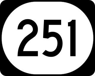
Kentucky Route 251 (KY 251) is an 11-mile-long (18 km) state highway in the U.S. state of Kentucky, split into two sections. The highway connects Elizabethtown and Fort Knox with rural areas of Hardin County; the second section, separated from the first by Fort Knox, is near Belmont in Bullitt County.

Kentucky Route 1136 is a north–south rural secondary state highway located entirely in Hardin County in north-central Kentucky. The route is 10.655 miles (17.148 km) long and it mainly traverses the southern part of the county.

Kentucky Route 361 (KY 361) is a 16.463-mile-long (26.495 km) state highway in Hardin County, Kentucky, that runs from U.S. Route 31W in Elizabethtown the entrance to Fort Knox at Bullion Boulevard.

