
Jakarta, officially the Special Capital Region of Jakarta and formerly known as Batavia until 1949, is the capital and largest city of Indonesia. Lying on the northwest coast of Java, the world's most populous island, Jakarta is the largest metropole in Southeast Asia and serves as the diplomatic capital of ASEAN. The Special Capital Region has a status equivalent to that of a province and is bordered by two other provinces: West Java to the south and east; and Banten to the west. Its coastline faces the Java Sea to the north, and it shares a maritime border with Lampung to the west. Jakarta's metropolitan area is ASEAN's second largest economy after Singapore.

Sumatra is one of the Sunda Islands of western Indonesia. It is the largest island that is fully within Indonesian territory, as well as the sixth-largest island in the world at 482,286.55 km2 (182,812 mi.2), including adjacent islands such as the Simeulue, Nias, Mentawai, Enggano, Riau Islands, Bangka Belitung and Krakatoa archipelago.

East Java is a province of Indonesia located in the easternmost third of Java island. It has a land border only with the province of Central Java to the west; the Java Sea and the Indian Ocean border its northern and southern coasts, respectively, while the narrow Bali Strait to the east separates Java from Bali by around 2.29 kilometres (1.42 mi). Located in eastern Java, the province also includes the island of Madura, as well as the Kangean islands and other smaller island groups located further east and the Masalembu archipelago to the north. Its capital is Surabaya, the second largest city in Indonesia, a major industrial center and also a major business center. Banyuwangi is the largest regency in East Java and the largest on the island of Java.

Seram is the largest and main island of Maluku province of Indonesia, despite Ambon Island's historical importance. It is located just north of the smaller Ambon Island and a few other adjacent islands, such as Saparua, Haruku, Nusa Laut and the Banda Islands.

Ujung Kulon National Park is a national park at the westernmost tip of Java, located in Sumur District of Pandeglang Regency, part of Banten province in Indonesia. It once included the volcanic island group of Krakatoa in Lampung province, although current maps has suggested the Krakatoa island group as its own protected area, the Pulau Anak Krakatau Marine Nature Reserve.

Komodo National Park is a national park in Indonesia located within the Lesser Sunda Islands in the border region between the provinces of East Nusa Tenggara and West Nusa Tenggara. The park includes the three larger islands Komodo, Padar and Rinca, and 26 smaller ones, with a total area of 1,733 km2. The national park was founded in 1980 to protect the Komodo dragon, the world's largest lizard. Later it was dedicated to protecting other species, including marine species. In 1991 the national park was declared a UNESCO World Heritage Site and a Man and Biosphere Reserve. It is considered one of the world's 25 biodiversity hotspots.

Tourism in Indonesia is an important component of the Indonesian economy as well as a significant source of its foreign exchange revenues. Indonesia was ranked at 20th in the world tourist Industry in 2017, also ranked as the ninth-fastest growing tourist sector in the world, the third-fastest growing in Asia and fastest-growing in Southeast Asia. In 2018, Dénpasar, Jakarta and Batam are among of 10 cities in the world with fastest growth in tourism, 32.7, 29.2 and 23.3 percent respectively. The tourism sector ranked as the 4th largest among goods and services export sectors.

Manado is the capital city of the Indonesian province of North Sulawesi. It is the second largest city in Sulawesi after Makassar, with the 2020 census giving a population of 451,916, and the official estimates for mid 2023 showing 458,582 inhabitants, distributed over a land area of 157.26 km2. The Manado metropolitan area had a population of 1,377,815 as of mid 2023. The city is situated on the Bay of Manado, and is surrounded by a mountainous area.

Bunaken is an island of 8 km2, part of the Bunaken National Marine Park. Bunaken is located at the northern tip of the island of Sulawesi, Indonesia. It belongs administratively to the municipality of Manado. Scuba diving attracts many visitors to the island.

Mount Rinjani National Park is located on the island of Lombok, Indonesia in the North Lombok Regency. The park covers about 41,330 hectares and consists of mountainous areas. Mount Rinjani, which is the third highest volcano of Indonesia at 3,726 metres (12,224 ft), is located in this national park, giving this park its name.

Bunaken National Park is a marine park in the north of Sulawesi Island, Indonesia. The park is located near the centre of the Coral Triangle, providing habitat to 390 species of coral as well as many fish, mollusks, reptiles and marine mammal species. The park is representative of Indonesian tropical water ecosystems, consisting of seagrass plains, coral reefs and coastal ecosystems.

Manusela National Park is located on Seram island, in the Maluku archipelago of Indonesia. It is made up of coastal forest, swamp forest, lowland and montane rainforest ecosystem types. Mount Binaiya at 3,027 meters, is the highest of the park's six mountains. Seram is remarkable for its high degree of localised bird endemism. The park also includes important karst landscapes. On Mount Hatu Saka, near the coast of Saleman-Sawai, it is the Goa Hatusaka, currently the deepest cave of the whole Indonesia.

Karimunjawa National Park, also Crimon Java National Park, is a national marine park designated in the Karimun Java archipelago, Jepara Regency, Central Java, Indonesia. It lies 80 km north west of Jepara, Central Java in the Java Sea. The national park was formally declared as Marine Protection Area in 2001. Based on popular local myth, this archipelago was discovered by Sunan Nyamplungan, the nephew of Sunan Kudus who is one of the Wali Sanga.

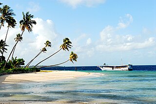
Taka Bonerate National Park is a marine park which includes the Takabonerate atoll islands, located in the Flores Sea, south of Sulawesi island of Indonesia.

Aketajawe-Lolobata National Park is a national park on Halmahera, the biggest island in the North Maluku province of Indonesia. The park is considered by BirdLife International to be vital for the survival of at least 23 endemic bird species. Aketajawe-Lolobata, which has an area of 167,300 hectares, was declared a national park in 2004.

Teluk Cenderawasih National Park is the largest marine national park of Indonesia, located in Cenderawasih Bay, south-east of Bird's Head Peninsula. It includes the islands of Mioswaar, Nusrowi Island, Roon, Rumberpon, Anggrameos and Yoop. The park protects a rich marine ecosystem, with over 150 recorded coral species, for which it is considered a potential World Heritage Site.
Wakatobi National Park is a marine national park in Southeast Sulawesi, Indonesia. The name of Wakatobi is a portmanteau of the four main Tukangbesi Islands: Wangi-wangi, Kaledupa, Tomia, and Binongko. Since 2005 the park is listed as a tentative World Heritage Site.

The Thousand Islands are a chain of islands to the north of Jakarta's coast. It forms the only regency of Special Capital Region of Jakarta, the metropolitan province of Indonesia. It consists of a string of 342 islands stretching 45 km (28 mi) north into the Java Sea at West Jakarta Bay and in fact are located to the north of Banten Province. Pramuka Island is the regency seat. The islands, along with North Jakarta City, are the only administrative divisions of Jakarta Special Capital Region with a coastline.
