
The Ural Mountains, or simply the Urals, is a mountain range in Eurasia that runs north-south mostly through Russia, from the coast of the Arctic Ocean to the river Ural and northwestern Kazakhstan. The mountain range forms part of the conventional boundary between the continents of Europe and Asia. Vaygach Island and the islands of Novaya Zemlya form a further continuation of the chain to the north into the Arctic Ocean. The average altitudes of the Urals are around 1,000–1,300 metres (3,300–4,300 ft), the highest point being Mount Narodnaya, which reaches a height of 1,894 metres (6,214 ft).

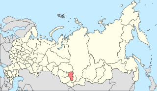
Kemerovo Oblast — Kuzbass, also known simply as Kemerovo Oblast or Kuzbass (Кузба́сс), after the Kuznetsk Basin, is a federal subject of Russia. Kemerovo is the administrative center and largest city of the oblast. Kemerovo Oblast is one of Russia's most urbanized regions, with over 70% of the population living in its nine principal cities. Its ethnic composition is predominantly Russian, but Shors, Ukrainians, Tatars, and Chuvash also live in the oblast. The population recorded during the 2021 Census was 2,600,923.
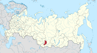
Khakassia, officially the Republic of Khakassia, is a republic of Russia located in southern Siberia. It is situated between Krasnoyarsk Krai to the north and the Altai Republic to the south.

The Central Siberian Plateau is a vast mountainous area in Siberia, one of the Great Russian Regions.

Kuznetsk Alatau is a mountain range in southern Siberia, Russia. The range rises in the Altai-Sayan region of the South Siberian Mountains, northwest of Mongolia. The Siberian Railway skirts the northern limit of the range.
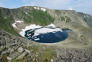
Abakan Range is a mountain range in Southwestern Siberia, located mainly in Khakassia, Russia: It is mostly covered by taiga, up to 1,500 m (4,900 ft), followed by mountainous tundra. The range also consists sparse areas of granite, gabbro, and diorite.

Ile Alatau, also spelt as Trans-Ili Alatau, is a part of the Northern Tian Shan mountain system in Kazakhstan and Kyrgyzstan. It is the northernmost mountain range of Tian Shan stretching for about 350 km (220 mi) with a maximal elevation of 4,973 m (16,316 ft). The term "Alatau" refers to a kind of mountain. The range is bounded from the north by the Ili Depression of the Ili River, hence the name.

The Bely Iyus is a river in the Republic of Khakassia in Russia. It is the right source river of the Chulym. It is 224 kilometres (139 mi) long, with a drainage basin of 5,370 square kilometres (2,070 sq mi).
South Central Siberia is a geographical region north of the point where Russia, China, Kazakhstan and Mongolia come together.
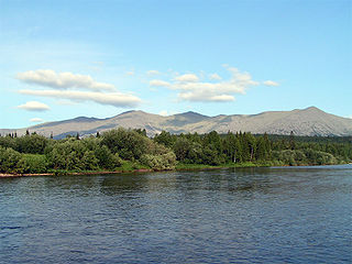
Tulymsky Kamen is a mountain range in North Ural. Located in northeastern portion of Krasnovishersky District, Perm Krai, Russia, the range stretches about 24 km north–south. At 1,496 m elevation, it is also the highest point of Perm Krai.
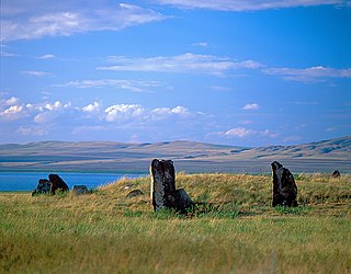
Khakasski Nature Reserve is a Russian 'zapovednik' covering two large mountain areas, and a cluster of seven steppe sites located within the left bank of the Minusinsk depression. The reserve is situated in the Tashtypsky District of Khakassia. It was originally created to preserve steppe ecosystems, wetlands and waterfowl nesting sites, and a historical complex of monuments and cemeteries from the 4-11 centuries BC. The reserve is particularly noted for its variety of large lakes on the Yenisei River migration route for birds. The current configuration of protected sectors was established in 1999, and covers a total area of 267,483 ha (1,032.76 sq mi).

Kuznetsk Alatau Nature Reserve is a Russian 'zapovednik' on the Kuznetsk Alatau, a mountain ridge in the Altai-Sayan mountain region in southwestern Siberia. The Kuznetsk Alatau consists of several ranges of medium height, between which there are river valleys. The reserve is in the watershed of the Tom River and the Chuly River. It is spread over three districts of Kemerovo Oblast: Tisulsky District, Mezhdurechensky District, and Novokuznetsky District. The reserve was established in 1989 and covers an area of 412,900 ha (1,594 sq mi).

The Sayan montane conifer forests ecoregion covers the mid-elevation levels of the Sayan Mountains, the high mountain range between the taiga of Siberia, Russia to the north, and the steppes of Mongolia to the south. The slopes of the mountains at the mid-altitudes are covered by Temperate coniferous forest. The ecoregion is in the Palearctic realm, with a cold semi-arid climate. It covers 35,741,835 km2 (13,800,000 sq mi).
The Kondakov Plateau is a mountain plateau in the Sakha Republic, Far Eastern Federal District, Russia. The town of Chokurdakh is located on the other bank of the Indigirka, facing the plateau. The nearest airport is Chokurdakh Airport.

The South Siberian Mountains are one of the largest mountain systems of the Russian Federation. The total area of the system of mountain ranges is more than 1.5 million km². The South Siberian Mountains are located in the Siberian and Far Eastern Federal Districts of Russia, as well as partly in Mongolia. The territory of the mountain system is one of the Great Russian Regions.
Almaty State Natural Reserve is a 71,700 ha (177,000-acre) nature reserve in the Almaty Region, Kazakhstan, in the central part of the Trans-Ili Alatau ridge. In 1966, the “Singing Mountain” desert area was added to the reserve, but in January 1983 the natural monument was placed under the jurisdiction of the Kapchagai Hunting Sector. The area is located within the territory of the Altyn-Emel National Park.
Verkhny Zub is a peak in Kemerovo Oblast, Russia. It is the highest point of the federal subject.

The mountain range Sunduki is a natural and historical monument of local significance in the Ordzhonikidzevsky and Shirinsky districts of the Republic of Khakassia, Russia. Since June 18, 2011, the Sunduki museum has been operating on the territory of the mountain range.
Koshkulak is a mountain range in Shirinsky district, Khakassia, Russia. West of the village Shira 18 km (11 mi) and south of the village Topanov 10 km (6.2 mi).
Cherny Iyus is a mountain river in the northern part of Khakassia, Russia. It flows through the territories of the Shirinsky and Ordzhonikidze districts. Merging with the Bely Iyus it forms the Chulym River, the right tributary of the Ob.


