
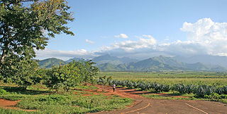
Morogoro is a city located in the eastern part of Tanzania, approximately 196 kilometers west of Dar es Salaam. It serves as the capital of the Morogoro Region. Informally, it is referred to as Mji kasoro bahari, which translates to city short of an ocean/port.
The Mahenge Mountains are a mountain range in Ulanga District, Morogoro Region, Tanzania. The town of Mahenge is located in the northeastern mountains. The mountains are southeast of Iringa, in the Eastern miombo woodlands ecoregion.
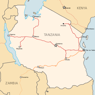
Morogoro Region is one of Tanzania's 31 administrative regions. The region covers an area of 70,624 km2 (27,268 sq mi). The region is comparable in size to the combined land area of the nation state of Ireland. Morogoro Region is bordered to the north by the Manyara Region and Tanga Region, to the east by the Pwani and Lindi Regions, to the south by the Ruvuma Region and to the west by the Iringa Njombe and Dodoma Regions. The regional capital is the municipality of Morogoro. According to the 2022 national census, the region had a population of 3,197,104.
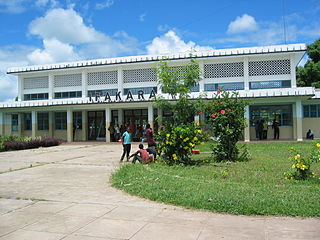
Ifakara is a town in the Kilombero District, Morogoro Region, south central Tanzania. It is the headquarters of the Kilombero District administration and the main trading centre for Kilombero and Ulanga districts. The town is located near the Tanzania-Zambia Railway (TAZARA) line, at the edge of the Kilombero Valley, a vast swampland flooded by the mighty Kilombero River.

Kilosa District is one of the six districts of the Morogoro Region of Tanzania. Its administrative seat is the town of Kilosa. Kilosa District covers 14,918 square kilometres (5,760 sq mi). It is bordered to the north by the Manyara Region, to the northeast by the Tanga Region, to the east by Mvomero District, to the southeast by Morogoro Rural District, to the south by Kilombero District, to the southwest by the Iringa Region and to the west by the Dodoma Region. Kilosa District is home to Mikumi National Park.

Morogoro Rural District is one of the six districts of the Morogoro Region of Tanzania. Morogoro Rural District covers 19,056 square kilometres (7,358 sq mi). It is bordered to the north and east by the Pwani Region, to the south by Kilombero District, to the southwest by the Kilosa District and to the west by the Mvomero District and the Morogoro Urban District.
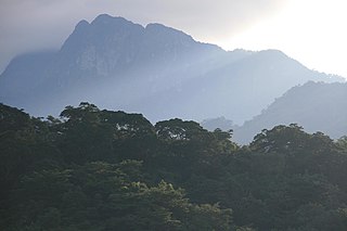
The Udzungwa Mountains are a mountain range in south-central Tanzania. The mountains are mostly within Iringa Region, south of Tanzania's capital Dodoma. The Udzungwa Mountains are part of the Eastern Arc Mountains, and are home to a biodiverse community of flora and fauna with large numbers of endemic species.
Kihansi Hydroelectric Power Station, is a 180 megawatts (241,384 hp) hydroelectric power station located in Kilombero District of southeast Morogoro Region in southern Tanzania. The power station is one of the largest dams in the country. The Tanzanian electricity company, Tanesco operates the power station on behalf of the government of Tanzania.
Kidatu is a town in central Tanzania, located in Kilombero District, Morogoro Region. The local population is about 3,300. The primary economic activity is the large Illovo sugar cane plantation and factory which produces 130,000 tonnes of sugar per year.
Railway stations in Tanzania include:
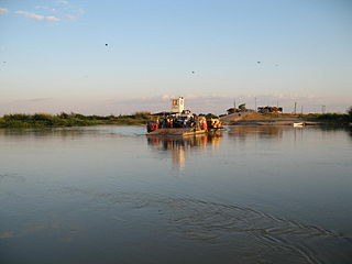
The Ulanga River, also known as the Kilombero River, rises in the highlands of the southwest of Morogoro Region, Tanzania, on the eastern slope of the East African Rift. The river flows northeast along the northeastern border of the Lindi Region before it flows into the Rufiji River. The Rufiji eventually flows into the Indian Ocean on the southern coast of the Pwani Region.

Ulanga District is one of the six districts of the Morogoro Region of Tanzania. the administrative seat is in Mahenge. It covers 24,460 square kilometres (9,444 sq mi) of which 4,927 square kilometres (1,902 sq mi) is in forest reserves. Ulanga District is bordered to the north and west by the Kilombero District, to the east by the Lindi Region and to the south by the Ruvuma Region.
The diocese of Ifakara is a see of the Roman Catholic Church suffragan of the Roman Catholic Archdiocese of Dar-es-Salaam. In 2012, it counted 287,000 baptized people among a population of 322,779 inhabitants. Its current bishop is Salutaris Melchior Libena.

The St. Francis University College of Health and Allied Sciences (SFUCHAS) is a constituent college of St. Augustine University of Tanzania.
Mfalikuivahaas are of chieftain bloodlines, 'Mfalmes', 'Chiefs', from Southern Africa at a time when Sub-Saharan African civilizations were rich in luxury products including incense, gold, ivory, and ebony. The name Mfalikuivahaa was better known when many areas in Africa were ruled through forms of governance that place power in the hands of a small, privileged ruling class of elders, leaders, and Shamans. Such a tribal assembly played an important role in the lives of many Africans contrasting as a form of governance to direct democracy today.

Yetu Microfinance Bank Plc. (YETU) is a microfinance bank in Tanzania. It is the first microfinance institution to be listed in the Dar es Salaam Stock Exchange. Yetu is a Swahili word which means Ours.

Malinyi District is a district of the Morogoro Region of Tanzania.
The Rubeho Mountains are a mountain range in central Tanzania. The mountains in Dodoma and Morogoro regions, southeast of Tanzania's capital Dodoma. The Rubeho Mountains are part of the Eastern Arc Mountains, and are home to a biodiverse community of flora and fauna with large numbers of endemic species.
The Ukaguru Mountains are a mountain range in central Tanzania. The mountains are in Morogoro region, east of Tanzania's capital Dodoma. The mountains are named for the Kaguru people. The Ukaguru Mountains are part of the Eastern Arc Mountains, and are home to a biodiverse community of flora and fauna with large numbers of endemic species.
Regia Estelatus Mtema (1980-2012) was a Tanzanian politician. She was a Special Seats Member of Parliament for the Chadema party, and Shadow Minister for Labor and Employment.


