
Aitkin County is a county in the U.S. state of Minnesota. As of the 2020 census, the population was 15,697. Its county seat is Aitkin. Part of the Mille Lacs Indian Reservation is in the county. The county was created in 1857 and organized in 1871.
Aitkin is a city in Aitkin County, Minnesota, United States. The population was 2,168 at the 2020 census. It is the county seat of Aitkin County.

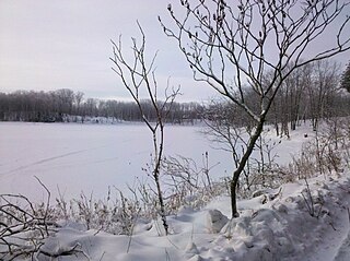
Farm Island Township is a township in Aitkin County, Minnesota, United States. The population was 1,099 as of the 2010 census.
Malmo Township is a township in Aitkin County, Minnesota, United States. The population was 337 as of the 2010 census.

Palisade is a city in Aitkin County, Minnesota, United States. The population was 167 at the 2010 census.
Swan River is an unincorporated community in southeast Itasca County, Minnesota, United States.
Glen is an unincorporated community and business district in Aitkin County, Minnesota, United States. The community is located southeast of the city of Aitkin at the junction of State Highway 47, Aitkin County Road 12, and 280th Street.
Malmo is an unincorporated community and business district in Aitkin County, Minnesota, United States. The community is located on the northeast corner of Mille Lacs Lake at the junction of State Highway 18, State Highway 47, and Aitkin County Road 2.
Giese is an unincorporated community in Wagner Township, Aitkin County, Minnesota, United States, located near Finlayson.
Big Lake is an unincorporated community and census-designated place (CDP) in Perch Lake Township, Carlton County, Minnesota, United States. Its population was 443 as of the 2010 census.
Ball Bluff is an unincorporated community in Ball Bluff Township, Aitkin County, Minnesota, United States. The community is located between Jacobson and McGregor along State Highway 65. The Mississippi River flows nearby.
Libby is an unincorporated community in Libby Township, Aitkin County, Minnesota, United States. The community is located between McGregor and Jacobson along State Highway 65. The Mississippi River flows nearby. Libby is located immediately northwest of Big Sandy Lake.
East Lake is an unincorporated community in Spalding Township, Aitkin County, Minnesota, United States.
Glory is an unincorporated community in Aitkin County, Minnesota, United States. The community is located along 360th Avenue near Aitkin County Road 12. 280th Street is also in the immediate area. Glory is located within Nordland Township and Wealthwood Township. Nearby places include Aitkin and Glen. State Highway 47 and Aitkin County Road 28 are both nearby. Glory is four miles north of Mille Lacs Lake.
Wealthwood is an unincorporated community in Wealthwood Township, Aitkin County, Minnesota, United States, along the north shore of Mille Lacs Lake. The community is located along State Highway 18 near the junction with Aitkin County Road 51, 385th Avenue. Nearby places include Garrison, Malmo, Glen, and Aitkin.
Rossburg is an unincorporated community in Spencer Township, Aitkin County, Minnesota, United States. The community is located along 350th Avenue near the junction with Aitkin County Road 5, 360th Street. Nearby places include Aitkin, Glen, and Kimberly. State Highway 47 is nearby.
Ronald is an unincorporated community in Beaver Township, Aitkin County, Minnesota, United States. The community is located along State Highway 27 near 100th Place. Nearby places include Kettle River, Lawler, Arthyde, and Moose Lake.
Rabey is an unincorporated community in Aitkin County, Minnesota, United States, within the Savanna State Forest. The community is located between Hill City and Jacobson along State Highway 200 near Rabey Road and Elliot Road. Rabey is located within Northwest Aitkin Unorganized Territory of Aitkin County.
Hassman is an unincorporated community in Morrison Township, Aitkin County, Minnesota, United States. The community is located near the junction of U.S. Highway 169 and State Highway 210, north of Aitkin. The Mississippi River and the Rice River both flow nearby.
Iron Hub is an unincorporated community in Rabbit Lake Township, Crow Wing County, Minnesota, United States, near Deerwood and Aitkin. It is along Iron Hub Road near Crow Wing County Road 32 and State Highway 210.


