
The Rainbow Range, formerly gazetted as the Rainbow Mountains, is a mountain range in British Columbia, Canada, located 40 kilometres (25 mi) northwest of Anahim Lake. Located on the western edge of the Chilcotin Plateau, the range adjoins the Coast Mountains Pacific Ranges to the south, and the Kitimat Ranges to the north. In some classification systems it is considered part of the Coast Mountains. It lies north of the Bella Coola and Atnarko Rivers and south and west of the Dean River, which curves around its north flank, and is relatively drier in climate and easier of terrain than more mountainous areas immediately west.

Officially Good Hope Mountain but commonly known as Mount Good Hope is one of the principal summits of the Pacific Ranges of the southern Coast Mountains in British Columbia, Canada. It stands immediately west of Chilko Lake, with the highest peak on the massif rising between the lake's southern arms.
Mount Raleigh, elevation 3,132 m (10,276 ft), is one of the principal summits of the Pacific Ranges of the Coast Mountains of southern British Columbia in Canada. It is located just southeast of the confluence of the Southgate and Bishop Rivers, northeast of the head of Bute Inlet, and is the highest summit south of the Bishop River's divide with the Lillooet River at Ring Pass, which is at the southeastern edge of the Lillooet Icefield and just north of the Pemberton Icecap. It is also the highest peak south of the pass between the upper basins of Chilko Lake and the Taseko Lakes, just north of which is Monmouth Mountain at 3,182 m (10,440 ft).
Dean Channel is the upper end of one of the longest inlets of the British Columbia Coast, 105 km (65.2 mi) from its head at the mouth of the Kimsquit River. The Dean River, one of the main rivers of the Coast Mountains, enters Dean Channel about 9.5 km (5.9 mi) below the head of the inlet, at the community of Kimsquit.
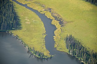
The Dean River is one of the major rivers of the Kitimat Ranges subrange of the southern Coast Mountains in British Columbia. It begins at Aktaklin Lake on the Chilcotin Plateau and winds north around the Rainbow Range to enter Dean Channel at the now-uninhabited, remote community of Kimsquit. It is one of the few rivers to fully penetrate the wall of the Coast Mountains between the Fraser's mouth and the mouth of the Skeena River.

The Three Sisters is a mountain immediately north of Fernie, British Columbia, northwest of the confluence of Fairy Creek with the Elk River. It should not be confused with the Alberta Rockies' peaks of the same name, located further north outside Canmore.

Edge Peak is a summit in the Golden Ears Group, located in Golden Ears Provincial Park north of Maple Ridge, British Columbia. The peak is not named for its shape but rather for Sam Edge who climbed it in 1876. Other mountains in this area include Golden Ears and Blanshard Peak.
Kimsquit is a former village of the Nuxalk at the mouth of the Dean River on the northeast side of Dean Channel in the Central Coast region of British Columbia, Canada. Kemsquit Indian Reserve No. 1 is nearby at 52°49′00″N126°58′00″W, which is on Kimsquit Bay; Kimsquit Mountain is nearby.

The Britannia Range is a small mountain range of the Coast Mountains that runs along the eastern shore of Howe Sound just north of Vancouver, British Columbia, Canada. It is a subrange of the Pacific Ranges and often considered part of the North Shore Mountains. The range is bounded by the Howe Sound to the west, the Stawamus River to the north, Loch Lomond on the upper Seymour River to the east, and Deeks Lake to the south. However, some official maps extend the range further south of these boundaries and many local sources such as hiking guidebooks will often include all of the peaks along the Howe Sound between Deeks Lake and Cypress Mountain as part of the range.
The Cadwallader Range, originally named the Cadwallader Mountains, is a sub-range of the Pacific Ranges of the Coast Mountains in the Bridge River-Lillooet Country of the South-Central Interior of British Columbia, Canada, located between the south end of Anderson Lake (E) and the Hurley River. According to the provincial basemap, the precise alpine boundaries of the range are McGilliray Pass, at its eastern extremity and beyond which is the Bendor Range, and the pass between Noel and Sockeye Creeks on its west, which is immediately north of the lower end of Birkenhead Lake. The officially unnamed range west of that has been called the Noel Range, after its main peak Mount Noel. At the foot of the range along its northeast flank is Cadwallader Creek, scene of the historic and once-rich Bralorne and Pioneer Mines and the ghost town of Bralorne.
Chatsquot Mountain, 2365 m, is a high-prominence summit in the Kitimat Ranges of the Coast Mountains in British Columbia, Canada, located northwest of Kimsquit Lake, east of the lower Kitlope River, and at the upper end of the basin of the Kimsquit River. It is part of the Kitimat Ranges which in turn form part of the Coast Mountains. With a topographic prominence of 1,981 m (6,499 ft), it is one of Canada's Ultra peaks and is the 98th most prominent summits of North America. It is also one of the most isolated mountain peaks of Canada.

Resplendent Mountain, or Mount Resplendent is a peak in the Canadian Rockies, located at the northern end of Mount Robson Provincial Park in British Columbia, Canada. It is a part of the Rainbow Range, and is a sister peak to the more famous Mount Robson, its nearest neighbour. Together they form a classic panorama seen by travellers on Via Rail trains and Highway 16. The mountain was named by Arthur P. Coleman, and Arthur O. Wheeler wrote, "On the east side it is clad from top to bottom in pure white snow, and presents with the sun shining upon it a spectacle of such wonderful brilliance that the aptness of the name became immediately apparent." The first ascent was achieved on the same historic 1911 trip in which Conrad Kain first scouted the climbing routes later to be used on the first ascent of Mount Robson.
The Bella Coola Valley is a relatively small but distinct region located in the Central Coast region of British Columbia, Canada, comprising the valley of the Bella Coola River and its tributaries. The region is served by BC Hwy 20, which runs from Williams Lake to the town of Bella Coola at the head of North Bentinck Arm, from where there is seasonal ferry service to Vancouver Island and Prince Rupert.
Mount Gallatin, also known as Boundary Peak 67, is a mountain in the Boundary Ranges along the British Columbia-Alaska border.
The Kimsquit River is a river in the Kitimat Ranges of the Coast Mountains in British Columbia, Canada, flowing into the head of Dean Channel, one of the major inlets of the Central Coast region.
Chatscah Indian Reserve No. 2, officially Chatscah 2 is an Indian reserve of the Nuxalk Nation band government, located at the mouth of the Kimsquit River at the head of Dean Channel. Like nearby Kimsquit, at the mouth of the Dean River to the southeast, this Indian reserve was one of two reserves set aside of the once-populous Kimsquit subgroup of the Nuxalk, whose surviving post-smallpox population gathered at Bella Coola.
Kimsquit Ridge, 1827 m, is a mountain ridge on the west side of the Kimsquit River in the Kitimat Ranges of the Coast Mountains in British Columbia, Canada. It is north of the head of Dean Channel in between Foresight and Robson Creeks. There is a secondary peak, slightly lower than the northern peak, named Whitecone Peak, which is 1823 m elevation. The Bivouac Mountain Encyclopedia has dubbed the northern, slightly higher summit, Bluecone Peak.
Cornice Peak, 2093 m, is a mountain in the Kitimat Ranges of the Coast Mountains in British Columbia, Canada. It is located on the west side of the Kimsquit River just northwest of the head of Dean Channel. The Kapella River, a tributary of the Kitlope, rises on the west side of Cornice Peak.
Mount Saugstad is a mountain in the northernmost Pacific Ranges of the Coast Mountains in the Central Coast region of British Columbia, Canada. It is located just south of the community of Hagensborg in the Bella Coola Valley and is immediately southeast of Snootli Peak and also southeast of Big Snow Mountain. The Smitley River has its origins on the west side of the summit at the Saugstad Glacier, which is at 52°15′48″N126°31′36″W
The Sakumtha River is a river in British Columbia, Canada, flowing south out of the Kitimat Ranges from an origin west of the Tsaydaychuz Peak massif into the Dean River north of Bella Coola.
