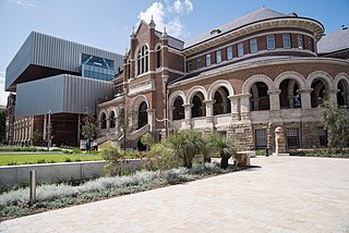
Perth is the capital and largest city of the Australian state of Western Australia. It is the fourth most populous city in Australia and Oceania, with a population of 2.1 million living in Greater Perth in 2020. Perth is part of the South West Land Division of Western Australia, with most of the metropolitan area on the Swan Coastal Plain between the Indian Ocean and the Darling Scarp. The city has expanded outward from the original British settlements on the Swan River, upon which the city's central business district and port of Fremantle are situated. Perth is located on the traditional lands of the Whadjuk Noongar people, where Aboriginal Australians have lived for at least 45,000 years.

Fremantle is a port city in Western Australia, located at the mouth of the Swan River in the metropolitan area of Perth, the state capital. Fremantle Harbour serves as the port of Perth. The Western Australian vernacular diminutive for Fremantle is Freo.

Subiaco is an inner-western suburb of Perth, the capital of Western Australia. It is approximately 3 km (1.9 mi) west of Perth's central business district, in the City of Subiaco local government area. Historically a working-class suburb containing a mixture of industrial and commercial land uses, since the 1990s the area has been one of Australia's most celebrated urban redevelopment projects. It remains a predominantly low-rise, urban village neighbourhood centred around Subiaco train station and Rokeby Road.
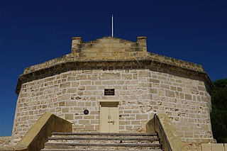
The Round House was the first permanent building built in the Swan River Colony. Built in late 1830 and opened in 1831, it is the oldest building still standing in Western Australia.

The City of Subiaco is a local government area in Western Australia. It covers an area of approximately 7 km² in inner western metropolitan Perth and lies about 3 km west of the Perth CBD. The City includes the historically working-class suburb of Subiaco centred around Rokeby Road. Since the 1990s the area has been extensively redeveloped and gentrified.

Fremantle Town Hall is a town hall located in the portside city of Fremantle, Western Australia, and situated on the corner of High, William and Adelaide Streets. The official opening, on 22 June 1887, coincided with the celebration of Queen Victoria's Jubilee and it was formally named by the mayor, Daniel Keen Congdon and the state governor, Frederick Broome, as the Town and Jubilee Hall.
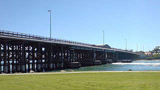
Queen Victoria Street is the main road entering the city centre of Fremantle, Western Australia from the direction of Perth. The road was originally named Cantonment Road, but was subsequently renamed Victoria Road, and a few years later Queen Victoria Street, after Queen Victoria of the United Kingdom, to avoid confusion with similarly named roads in the area.

The City of Fremantle is a local government area in the south of Perth, Western Australia. The City covers an area of 19.0 square kilometres (7.3 sq mi), and lies about 19 kilometres (12 mi) southwest of the Perth central business district.

The Fremantle tramway network linked the central business district of Fremantle, the port city for Perth, Western Australia, with nearby suburbs. Small but comprehensive, it operated between 1905 and 1952. It was not connected with the larger Perth tramway system.
Perth City Link is an urban renewal and redevelopment project in Perth, Western Australia.
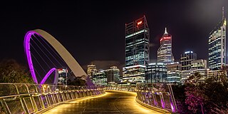
Tourism in Perth, the capital city of Western Australia, is an important part of the Australian state's economy, contributing to the prosperity of businesses in the city, as well as other regions of the state.
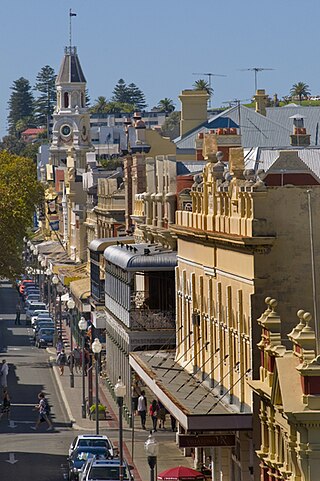
High Street is the main street running through the City of Fremantle, Western Australia. The street passes by historic landmarks, including the Round House, the Fremantle Town Hall, and the Fremantle War Memorial, through the Fremantle West End Heritage area and through two town squares. Trams operated along High Street for 47 years, between 1905 and 1952. Running east–west, High Street continues as Leach Highway, a major arterial road, at Stirling Highway, linking Fremantle with Perth Airport although the stretch of road between Stirling Highway and Carrington Street is known locally—and signed—as High Street.
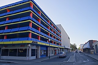
Queen Street is a street in Fremantle, Western Australia that crosses High Street at Kings Square, and is located away from and west of Queens Square. It is a separate street from Queen Victoria Street, which is located 500 metres (0.3 mi) further north. The street is named after Queen Adelaide, consort of William IV.
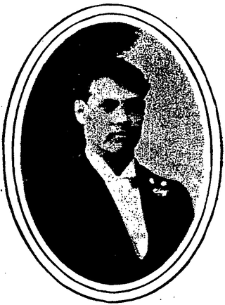
The 1919 Fremantle Wharf riot, also known as the Battle of the Barricades, arose out of a strike by stevedores in Fremantle, Western Australia in 1919. The strike was called by the Waterside Workers' Federation (WWF) over the use of National Waterside Workers Union (NWWU) workers to unload the quarantined ship Dimboola, and escalated into fatal violence when WWF workers and supporters attempted to prevent NWWU members from carrying out the work.
Queens Square, also known as Queen's Square, is a town square in Fremantle, Western Australia. It is located at the intersection of High Street and Parry Street, both of which bisect the square. The square was originally a single space, but was divided into four sections due to the extensions of High and Parry Streets, completed in 1886. Today Queens Square still functions as a public open space for residents of Fremantle.

St John's Anglican Church also known as St John the Evangelist Church, is the historic Anglican parish church of Fremantle, Western Australia. The first Georgian-style church close to the present site was opened in 1843, and then replaced with a larger Gothic building nearby in 1882. The older building was demolished, which allowed Fremantle Town Hall to be built and for the High Street to be extended, giving the Kings Square its current shape.

The National Hotel is on the corner of High and Market Streets Fremantle. Originally built as a shop in 1868, it was occupied by the National Bank in the early 1880s. When the bank relocated in 1886, the building became the National Hotel.

Scots Presbyterian Church is a Presbyterian church located at 90 South Terrace, on the corner of Parry Street, in Fremantle, Western Australia. It was the first Presbyterian Church built in Fremantle and one of only six to decline amalgamation with the Uniting Church.

Wilhemsen House, also known as the Elders Building, Elder Building, Barwil House and the Dalgety & Co. Building, is a heritage building located at 11 Cliff Street on the corner of Phillimore Street in the port city of Fremantle, Western Australia. The building dates from the gold rush boom period in the late nineteenth and early twentieth centuries and is of historic significance.
The City of Fremantle Centenary Building was built by the Fremantle Council for the Centenary of Western Australia in 1929. It provided extra reception and office space for the council, the Federal Electoral Department, Tramway Board, and Water Supply Receiving Department) as well as other tenants, and improved public toilets.


