Kipp, Kansas

Last updated

Kipp, Kansas
CDP
Saline County Kansas Incorporated and Unincorporated areas Kipp Highlighted.svg
Location within Saline County and Kansas
Map of Saline Co, Ks, USA.png
Coordinates: 38°47′02″N97°27′16″W / 38.78389°N 97.45444°W / 38.78389; -97.45444 [1]
Country United States
State Kansas
County Saline
Elevation
[1]
1,207 ft (368 m)
Population
 (2020) [2]
  Total60
Time zone UTC-6 (CST)
  Summer (DST) UTC-5 (CDT)
ZIP code
67401
Area code 785
FIPS code 20-37200 [1]
GNIS ID 476837 [1]

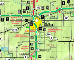
Kipp is a census-designated place (CDP) in Eureka and Solomon townships in Saline County, Kansas, United States. [1] As of the 2020 census, the population was 60. [2] It is located southeast of Salina along Schilling Road between Whitmore Road and Kipp Road, next to an abandoned railroad.

Contents

Kipp is a part of the Salina micropolitan area.

History

A post office was opened in Kipp in 1890, and remained in operation until it was discontinued in 1957. [3]

Geography

Its elevation is 1207 feet (368 m), and it is located at 38°47′2″N97°27′16″W / 38.78389°N 97.45444°W / 38.78389; -97.45444 (38.7838911, -97.4544748). [4] The West Branch of Gypsum Creek flows through the community. [5]

Demographics

Historical population
CensusPop.Note
2020 60
U.S. Decennial Census

The 2020 United States census counted 60 people, 29 households, and 26 families in Kipp. [6] [7] The population density was 74.4 per square mile (28.7/km2). There were 31 housing units at an average density of 38.5 per square mile (14.9/km2). [7] [8] The racial makeup was 90.0% (54) white or European American (86.67% non-Hispanic white), 0.0% (0) black or African-American, 0.0% (0) Native American or Alaska Native, 0.0% (0) Asian, 0.0% (0) Pacific Islander or Native Hawaiian, 0.0% (0) from other races, and 10.0% (6) from two or more races. [9] Hispanic or Latino of any race was 6.67% (4) of the population. [10]

Of the 29 households, 31.0% had children under the age of 18; 82.8% were married couples living together; 13.8% had a female householder with no spouse or partner present. 10.3% of households consisted of individuals and 6.9% had someone living alone who was 65 years of age or older. [7] The percent of those with a bachelor’s degree or higher was estimated to be 0.0% of the population. [11]

25.0% of the population was under the age of 18, 3.3% from 18 to 24, 18.3% from 25 to 44, 28.3% from 45 to 64, and 25.0% who were 65 years of age or older. The median age was 50.3 years. For every 100 females, there were 172.7 males. [7] For every 100 females ages 18 and older, there were 181.2 males. [7]

Education

The community is served by Southeast of Saline USD 306 public school district. The district high school, Southeast of Saline, is located 4 miles west of Gypsum.

Kipp schools were closed through school unification. The Kipp High School mascot was Kipp Orioles. [12] The Kipp Orioles won the Kansas State High School class B baseball championship in 1949. [13]

Related Research Articles

<span class="mw-page-title-main">Saline County, Kansas</span> County in Kansas, United States

Saline County is located in the U.S. state of Kansas. Its county seat and largest city is Salina. As of the 2020 census, the county population was 54,303. The county was named after the Saline River.

<span class="mw-page-title-main">Morganville, Kansas</span> City in Clay County, Kansas

Morganville is a city in Clay County, Kansas, United States. As of the 2020 census, the population of the city was 180.

<span class="mw-page-title-main">Gove City, Kansas</span> City in Gove County, Kansas

Gove City, more commonly known as Gove, is a city in and the county seat of Gove County, Kansas, United States. As of the 2020 census, the population of the city was 80.

<span class="mw-page-title-main">Lyndon, Kansas</span> City in Osage County, Kansas

Lyndon is a city in, and the county seat of Osage County, Kansas, United States. As of the 2020 census, the population of the city was 1,037.

<span class="mw-page-title-main">Overbrook, Kansas</span> City in Osage County, Kansas

Overbrook is a city in Osage County, Kansas, United States. As of the 2020 census, the population of the city was 1,005.

<span class="mw-page-title-main">Downs, Kansas</span> City in Osborne County, Kansas

Downs is a city in Osborne County, Kansas, United States. As of the 2020 census, the population of the city was 800.

<span class="mw-page-title-main">Luray, Kansas</span> City in the United States

Luray is a city in Russell County, Kansas, United States. As of the 2020 census, the population of the city was 166.

<span class="mw-page-title-main">Assaria, Kansas</span> City in Saline County, Kansas

Assaria is a city in Saline County, Kansas, United States. As of the 2020 census, the population of the city was 428.

<span class="mw-page-title-main">Brookville, Kansas</span> City in Saline County, Kansas

Brookville is a city in Saline County, Kansas, United States. As of the 2020 census, the population of the city was 247.

<span class="mw-page-title-main">Gypsum, Kansas</span> City in Saline County, Kansas

Gypsum is a city in Saline County, Kansas, United States. As of the 2020 census, the population of the city was 400.

<span class="mw-page-title-main">New Cambria, Kansas</span> City in Saline County, Kansas

New Cambria is a city in Saline County, Kansas, United States. As of the 2020 census, the population of the city was 106.

<span class="mw-page-title-main">Garden Plain, Kansas</span> City in Sedgwick County, Kansas

Garden Plain is a city in Sedgwick County, Kansas, United States. As of the 2020 census, the population of the city was 948.

<span class="mw-page-title-main">Piqua, Kansas</span> Unincorporated community in Woodson County, Kansas, United States

Piqua is a census-designated place (CDP) in Woodson County, Kansas, United States. As of the 2020 census, the population was 90.

<span class="mw-page-title-main">Mentor, Kansas</span> Unincorporated community in Saline County, Kansas

Mentor is a census-designated place (CDP) in Saline County, Kansas, United States. As of the 2020 census, the population was 101. It is located south of Salina on Mentor Road.

<span class="mw-page-title-main">Codell, Kansas</span> Unincorporated community in Rooks County, Kansas

Codell is a census-designated place (CDP) in Rooks County, Kansas, United States. As of the 2020 census, the population was 49.

<span class="mw-page-title-main">Falun, Kansas</span> Unincorporated community in Saline County, Kansas

Falun is a census-designated place (CDP) in southwestern Saline County, Kansas, United States. As of the 2020 census, the population was 83. It lies southwest of Salina and northwest of Lindsborg at the intersection of Forsse Road and Hedberg Road, about 7.5 miles west of Interstate 135 highway, or about 8 miles west of Assaria. It lies next to an abandoned railroad.

<span class="mw-page-title-main">Salina, Kansas micropolitan area</span> Micropolitan Statistical Area in Kansas, United States

The Salina, Kansas micropolitan area, as defined by the United States Census Bureau, consists of two counties in Kansas, anchored by the city of Salina.

<span class="mw-page-title-main">Bavaria, Kansas</span> Unincorporated community in Saline County, Kansas

Bavaria is a census-designated place (CDP) in Saline County, Kansas, United States. As of the 2020 census, the population was 60. It lies along K-140 and a Union Pacific Railroad line west of Salina. Bavaria is a part of the Salina micropolitan area.

<span class="mw-page-title-main">Bridgeport, Kansas</span> Unincorporated community in Saline County, Kansas

Bridgeport is a census-designated place (CDP) in Smoky View Township, Saline County, Kansas, United States. As of the 2020 census, the population was 64. It is located south of Salina, along K-4 near Interstate 135.

<span class="mw-page-title-main">Conway, Kansas</span> Unincorporated community in McPherson County, Kansas

Conway is an unincorporated community in southwestern Jackson Township, McPherson County, Kansas, United States. It lies along U.S. Route 56 and a Kansas and Oklahoma Railroad line, west of the city of McPherson.

References

  1. 1 2 3 4 5 "Kipp, Kansas", Geographic Names Information System , United States Geological Survey, United States Department of the Interior
  2. 1 2 "Profile of Kipp, Kansas (CDP) in 2020". United States Census Bureau. Archived from the original on November 13, 2021. Retrieved November 13, 2021.
  3. "Kansas Post Offices, 1828-1961". Kansas Historical Society. Archived from the original on October 9, 2013. Retrieved June 23, 2014.
  4. U.S. Geological Survey Geographic Names Information System: Kipp, Kansas
  5. DeLorme. Kansas Atlas & Gazetteer. 4th ed. Yarmouth: DeLorme, 2009, 48. ISBN   0-89933-342-7.
  6. "US Census Bureau, Table P16: HOUSEHOLD TYPE". data.census.gov. Retrieved January 2, 2024.
  7. 1 2 3 4 5 "US Census Bureau, Table DP1: PROFILE OF GENERAL POPULATION AND HOUSING CHARACTERISTICS". data.census.gov. Retrieved January 2, 2024.
  8. Bureau, US Census. "Gazetteer Files". Census.gov. Retrieved December 30, 2023.
  9. "US Census Bureau, Table P1: RACE". data.census.gov. Retrieved January 2, 2024.
  10. "US Census Bureau, Table P2: HISPANIC OR LATINO, AND NOT HISPANIC OR LATINO BY RACE". data.census.gov. Retrieved January 2, 2024.
  11. "US Census Bureau, Table S1501: EDUCATIONAL ATTAINMENT". data.census.gov. Retrieved January 2, 2024.
  12. "The good ole days", The Salina Journal, 1 December 1994, p.17.
  13. "Baseball". KSHSAA. Archived from the original on January 7, 2017. Retrieved January 6, 2017.

Further reading