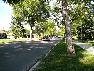
Kirkness, Edmonton

Last updated
Kirkness
Neighbourhood
Edmonton agglomeration-blank.svg
Red pog.svg
Kirkness
Location of Kirkness in Edmonton
Coordinates: 53°36′43″N113°23′20″W / 53.612°N 113.389°W / 53.612; -113.389
CountryFlag of Canada (Pantone).svg  Canada
Province Flag of Alberta.svg  Alberta
City Edmonton
Quadrant [1] NW
Ward [1] Dene
Sector [2] Northeast
Area [3] [4] Clareview
Government
[5]
  Administrative body Edmonton City Council
  Councillor Aaron Paquette
Area
[6]
  Total0.89 km2 (0.34 sq mi)
Elevation
651 m (2,136 ft)
Population
 (2012) [7]
  Total3,740
  Density4,202.2/km2 (10,884/sq mi)
  Change (2009–12)
Increase2.svg4.9%
  Dwellings
1,443

Kirkness is a residential neighbourhood in the Clareview area of north east Edmonton, Alberta, Canada. It is named for James Kirkness who came to the Edmonton area in 1866 as an employee of the Hudson's Bay Company. [8] "A local park is named for James A. Christianson (1889-1953), a prominent citizen who sponsored the Oil Kings hockey club." [8]

Contents

According to the 2001 federal census, residential development in the neighbourhood began during the 1970s when one out of every eight (12.0%) of residences were built. Most residential development, however, occurred during the 1980s when seven out of ten (70.3%) of residences were built. Another one is six (15.8%) were built during the 1990s. There has been some additional residential construction since 2000. [9]

The most common type of residence in Kirkness is the single-family dwelling. According to the 2005 municipal census, these accounted for just over half (55%) of all residences in the neighbourhood. Another one in four (28%) are rented apartments in low-rise buildings with fewer than five stories. One in ten (9%) are duplexes [10] and one in twelve (8%) are row houses. Three out of every five (63%) of residences are owner-occupied while two in five (37%) are rented. [11]

The population of Kirkeness is somewhat mobile. According to the 2005 municipal census, one in eight residents (12.2%) of all residents had moved within the previous twelve months. Another one in four residents (23.1%) had moved within the previous one to three years. Only two residents in five (43.3%) had lived at the same address for five or more years. [12]

The neighbourhood is bounded on the west by the Canadian National Railway right of way, on the east by Victoria Trail, on the south by 144 Avenue and on the north by 153 Avenue. Just to the west of the railway right of way is Manning Drive which provides access to destinations to the north east of Edmonton.

Demographics

In the City of Edmonton's 2012 municipal census, Kirkness had a population of 3,740 living in 1,443 dwellings, [7] a 4.9% change from its 2009 population of 3,565. [13] With a land area of 0.89 km2 (0.34 sq mi), [6] it had a population density of 4,202.2 people/km2 in 2012. [6] [7]

Surrounding neighbourhoods

Related Research Articles

<span class="mw-page-title-main">West Jasper Place, Edmonton</span> Neighbourhood in Edmonton, Alberta, Canada

West Jasper Place is a residential neighbourhood in west Edmonton, Alberta, Canada. Originally part of the Town of Jasper Place, West Jasper Place became a part of Edmonton when Edmonton and Jasper Place amalgamated on August 17, 1964.

<span class="mw-page-title-main">Holyrood, Edmonton</span> Neighbourhood in Edmonton, Alberta, Canada

Holyrood is a residential neighbourhood in the Bonnie Doon area of south east Edmonton, Alberta, Canada. The name, Holyrood, is an anglicisation of the Scots haly ruid.

Richfield is a residential neighbourhood in the Millbourne area of Mill Woods, part of south east Edmonton, Alberta, Canada.

Montrose is a residential neighbourhood in north east Edmonton, Alberta, Canada.

Hazeldean is a residential neighbourhood in south east Edmonton, Alberta, Canada. The neighbourhood overlooks the Mill Creek Ravine.

Skyrattler is a residential neighbourhood in south west Edmonton, Alberta, Canada. The neighbourhood is named after Chief Skyrattler of the Winterburn band.

<span class="mw-page-title-main">Belmead, Edmonton</span> Neighbourhood in Edmonton, Alberta, Canada

Belmead is a residential neighbourhood in west Edmonton, Alberta, Canada. Residents in Belmead live just to the west of West Edmonton Mall, the largest shopping centre in Canada. A portion of the neighbourhood, from 188 Street to 190 Street, is called Park West.

Kildare is a mixed residential/commercial neighbourhood in northeast Edmonton, Alberta, Canada. It is named after Kildare in Ireland.

Casselman is a residential neighbourhood located in north east Edmonton, Alberta, Canada. It is named after a lawyer who practiced in Edmonton during the early part of the 20th century.

Dovercourt is a residential neighbourhood in north west Edmonton, Alberta, Canada. While the area was originally annexed by the City of Edmonton in 1913, residential development did not occur until after the end of World War II.

Empire Park is a residential neighbourhood in southwest Edmonton, Alberta, Canada. A major shopping centre, Southgate Centre, is located at the west end of the Neighbourhood.

Sifton Park is a residential neighbourhood in the Clareview area of north east Edmonton, Alberta, Canada. The neighbourhood was named for Arthur Sifton, who served as the second premier of Alberta from 1910 until 1917.

King Edward Park is a residential neighbourhood on south east Edmonton, Alberta, Canada. The neighbourhood was originally annexed by Edmonton in 1912.

Lauderdale is a residential neighbourhood in north west Edmonton, Alberta, Canada. It is named for "James Lauder who farmed and owned land near the neighbourhood before the turn of the 20th century".

<span class="mw-page-title-main">Prince Charles, Edmonton</span> Neighbourhood in Edmonton, Alberta, Canada

Prince Charles is a residential neighbourhood in north west Edmonton, Alberta. The area was named in honour of Charles III, then known as Prince Charles.

Canon Ridge is a residential neighbourhood in the Hermitage area of north east Edmonton, Alberta, Canada that was mostly built up in the 1950s.

Homesteader is a residential neighbourhood in the Hermitage area of north east Edmonton, Alberta, Canada.

Killarney is a residential neighbourhood located in north east Edmonton, Alberta, Canada. While the area became part of Edmonton in 1913, residential development did not occur until the 1950s and 1960s.

Kilkenny is a residential neighbourhood in north east Edmonton, Alberta, Canada. Most of the development in the neighbourhood occurred during the 1960s and 1970s. It was named after Kilkenny in Ireland.

Rideau Park is a residential neighbourhood in southwest Edmonton, Alberta, Canada. The name Rideau means curtain in the French Language.

References

  1. 1 2 "City of Edmonton Wards & Standard Neighbourhoods" (PDF). City of Edmonton. Archived from the original (PDF) on May 3, 2014. Retrieved February 13, 2013.
  2. "Edmonton Developing and Planned Neighbourhoods, 2011" (PDF). City of Edmonton. Archived from the original (PDF) on September 4, 2013. Retrieved February 13, 2013.
  3. "The Way We Grow: Municipal Development Plan Bylaw 15100" (PDF). City of Edmonton. 2010-05-26. Archived from the original (PDF) on May 2, 2015. Retrieved February 13, 2013.
  4. "City of Edmonton Plans in Effect" (PDF). City of Edmonton. November 2011. Archived from the original (PDF) on October 17, 2013. Retrieved February 13, 2013.
  5. "City Councillors". City of Edmonton. Retrieved February 13, 2013.
  6. 1 2 3 "Neighbourhoods (data plus kml file)". City of Edmonton. Retrieved February 22, 2013.
  7. 1 2 3 "Municipal Census Results – Edmonton 2012 Census". City of Edmonton. Retrieved February 22, 2013.
  8. 1 2 Neighbourhood description in the City of Edmonton map utility.
  9. "Neighbourhood info" (PDF). censusdocs.edmonton.ca.
  10. Duplexes include triplexes and fourplexes.
  11. "2005 Municipal census" (PDF). censusdocs.edmonton.ca.
  12. "Info" (PDF). censusdocs.edmonton.ca.
  13. "2009 Municipal Census Results". City of Edmonton. Retrieved February 22, 2013.