Kirkstead

Last updated

Kirkstead
Pastoral Scene - geograph.org.uk - 549489.jpg
The remains of Kirkstead Abbey
Lincolnshire UK location map.svg
Red pog.svg
Kirkstead
Location within Lincolnshire
OS grid reference TF186617
Civil parish
District
Shire county
Region
Country England
Sovereign state United Kingdom
Post town Woodhall Spa
Postcode district LN10
Dialling code 01526
Police Lincolnshire
Fire Lincolnshire
Ambulance East Midlands
List of places
UK
England
Lincolnshire
53°09′05″N0°13′06″W / 53.1515°N 0.2183°W / 53.1515; -0.2183

Kirkstead is a village and former civil parish now in the parish of Woodhall Spa, in the East Lindsey district, in Lincolnshire, England, on the River Witham. [1] [2] In 1961 the parish had a population of 85. [3] It was merged with the civil parish of Woodhall Spa in 1987.[ citation needed ]

Contents

History

Kirkstead has its origins in a Cistercian monastery, Kirkstead Abbey (the name Kirkstead means "the site of a church") founded in 1139 by Hugh Brito, lord of Tattershall and originally colonised by an abbot and twelve monks from Fountains Abbey in Yorkshire. It was around this abbey that the little settlement of Kirkstead grew. The abbey remained in existence until 1537, when it was dissolved and Richard Harrison (the last Abbot) and three of his monks were executed by King Henry VIII following their implication (probably unjustly) in the Lincolnshire Rising of the previous year.

The abbey and manor of Kirkstead passed to the Duke of Suffolk, Henry VIII's brother-in-law, and later to the Clintons, Earls of Lincoln, who built a large country house. By 1791 that too had gone, and all that remains today is a dramatic crag of masonry – a fragment of the south transept wall of the abbey church and the earthworks of the vast complex of buildings that once surrounded it.

The church of St Leonard's Without, thus named as it was outside the gates of the abbey, stands in a field by the side of the ruins of the abbey. Built between 1230 and 1240 it is an excellent example of the Early English style. Measuring only 42 feet (12.8 m) by 19 feet (5.8 m) it is up to "Cathedral standards" and may well have been built as a chantry chapel in memory of Robert de Tattershall who died in 1212.

After many centuries use as a church, it closed in 1877, when a Presbyterian congregation was evicted. From 1883 "The Society for the Protection of Ancient Buildings" fought to save it from total decay. Eventually during 1913 and 1914 it was restored by the architect Weir.

Kirkstead remained an isolated hamlet, but the area by the River Witham, 'Kirkstead Wharfs', developed as a locally important trading point on the canal system for goods being imported and exported in the local area, including coal.

With the opening in 1848 of the Lincoln to Boston line of the London and York Railway, a station was built here which was the nearest station to the increasingly fashionable spa town of Woodhall Spa, 1.2 mi (2 km) away. The resulting carriage trade, carrying the gentry to and from the spa, lasted until 1855 when a branch line opened from Kirkstead Station, (which then became known as Woodhall Junction) to Woodhall Spa and Horncastle. Woodhall Spa and Horncastle stations were closed to passengers in 1954. Woodhall Junction closed with the closure of its railway line in 1970.

The arrival of the railways greatly decreased the isolation of Kirkstead and the surrounding area. Kirkstead Wharfs was absorbed by the encroaching civil parish of Woodhall Spa in 1894. The remainder was incorporated into the parish in 1987, so that Kirkstead is now the western part of Woodhall Spa between the village centre and the River Witham.

Kirkstead Bridge (December 2005) Kirkstead Bridge - geograph.org.uk - 95376.jpg
Kirkstead Bridge (December 2005)

The Kirkstead Bridge is a concrete arch bridge spanning the River Witham at Kirkstead in Woodhall Spa. Finished and opened in 1968, it carries the B1191 as it runs from Horncastle to the A15 road just north of Dunsby St Andrew. The bridge replaced an existing swing bridge alongside it. That had replaced a ferry that operated until the early 20th century.

See also

Related Research Articles

<span class="mw-page-title-main">Horncastle</span> Town in Lincolnshire, England

Horncastle is a market town and civil parish in the East Lindsey district in Lincolnshire, England. It is 17 miles (27 km) east of Lincoln. Its population was 6,815 at the 2011 census and estimated at 7,123 in 2019. A section of the ancient Roman walls remains.

<span class="mw-page-title-main">Tattershall</span> Village and civil parish in the East Lindsey district of Lincolnshire, England

Tattershall is a village and civil parish in the East Lindsey district of Lincolnshire, England. It is situated on the A153 Horncastle to Sleaford road, 1 mile (1.6 km) east from the point where that road crosses the River Witham at Tattershall Bridge. At its eastern end, Tattershall adjoins the town of Coningsby, with the two being separated by the River Bain and is 1 mile (1.6 km) south-east from the hamlet Tattershall Thorpe.

<span class="mw-page-title-main">River Bain</span> River in Lincolnshire, England

The River Bain is a river in Lincolnshire, England, and a tributary of the River Witham.

<span class="mw-page-title-main">Coningsby</span> Town and civil parish in the East Lindsey district in Lincolnshire, England

Coningsby is a town and civil parish in the East Lindsey district in Lincolnshire, England, it is situated on the A153 road, adjoining Tattershall on its western side, 13 miles (21 km) north west of Boston and 8 miles (13 km) south west from Horncastle.

The Horncastle Canal was a broad canal which ran 11 miles (18 km) from the River Witham to Horncastle in Lincolnshire, England, through twelve locks largely following the course of the River Bain. The canal opened in 1802, and was abandoned for navigation in 1889.

<span class="mw-page-title-main">Bardney</span> Village and civil parish in the West Lindsey district of Lincolnshire, England

Bardney is a village and civil parish in the West Lindsey district of Lincolnshire, England. The population of the civil parish was 1,643 at the 2001 census increasing to 1,848 at the 2011 census. The village sits on the east bank of the River Witham and 9 miles (14 km) east of Lincoln.

<span class="mw-page-title-main">Timberland, Lincolnshire</span> Village in the North Kesteven district of Lincolnshire, England

Timberland is a village in the North Kesteven district of Lincolnshire, England. The population of the civil parish at the 2011 census was 578. It is situated 9 miles (14 km) north-east from Sleaford, and on the Timberland Fen. Its closest neighbouring village is Martin, less than 1 mile (1.6 km) to the north.
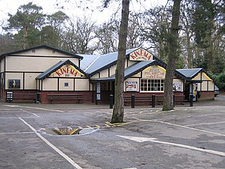
<span class="mw-page-title-main">Woodhall Spa</span> Former spa town and civil parish in Lincolnshire, England

Woodhall Spa is a former spa town and civil parish in the East Lindsey district of Lincolnshire, England, on the southern edge of the Lincolnshire Wolds, 6 miles (10 km) south-west of Horncastle, 23 miles (37 km) west of Skegness, 15 miles (24 km) east-south-east of Lincoln and 17 miles (27 km) north-west of Boston. It is noted for its mineral springs, historic cinema and its Second World War association with the RAF 617 Squadron, commonly referred to as 'The Dambusters'.

Kirkstead Bridge is a concrete bridge in central Lincolnshire over the River Witham on the B1191.

<span class="mw-page-title-main">Kirkstead Abbey</span>

Kirkstead Abbey is a former Cistercian monastery in Kirkstead, Lincolnshire, England.

<span class="mw-page-title-main">St Leonard's Without</span> Church

The church of St Leonard's Without is a small chapel built between 1230 and 1240 in the parish of Kirkstead, Lincolnshire, close to Woodhall Spa.

<span class="mw-page-title-main">Woodhall Junction railway station</span> Former railway station in Lincolnshire, England

Woodhall Junction railway station is a former station in Woodhall, Lincolnshire. It served as a junction where several different lines met, none of which are still open.

<span class="mw-page-title-main">Woodhall Spa railway station</span> Former railway station in Lincolnshire, England

Woodhall Spa railway station was a station in Woodhall Spa, Lincolnshire on a small branch line running north from Woodhall Junction to Horncastle. Both the station and the line are now closed.

<span class="mw-page-title-main">Lincolnshire loop line</span> Former railway line in England

The Lincolnshire loop line was a railway built by the Great Northern Railway, that linked Peterborough to Gainsborough via Spalding, Boston and Lincoln. It ran through the counties of Lincolnshire and Northamptonshire

The Horncastle and Kirkstead Junction Railway was a seven mile long single track branch railway line in Lincolnshire, England, that ran from Horncastle to Woodhall Junction on the Great Northern Railway (GNR) line between Boston and Lincoln. There was one intermediate station, Woodhall Spa.

<span class="mw-page-title-main">Dogdyke</span> Hamlet in the North Kesteven district of Lincolnshire, England

Dogdyke is a hamlet in the North Kesteven district of Lincolnshire, England. It is situated approximately 2 miles (3 km) south from Tattershall, and at the confluence of the Rivers Bain and Witham, and close to where the River Slea joins the Witham.

<span class="mw-page-title-main">Stixwould</span> Village in Lincolnshire, England

Stixwould is a small village in the civil parish of Stixwould and Woodhall, in the East Lindsey district of Lincolnshire, England.

<span class="mw-page-title-main">Wildmore</span> Human settlement in England

Wildmore is a civil parish in the East Lindsey district of Lincolnshire, England. It is situated approximately 9 miles (14 km) north-west from the town of Boston and 11 miles (18 km) south from Horncastle.
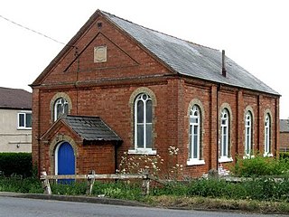
<span class="mw-page-title-main">Martin Dales</span> Hamlet in Lincolnshire, England

Martin Dales is a hamlet in the civil parish of Martin in North Kesteven, Lincolnshire, England. It is located to the east of Martin and west of Woodhall Spa.

References

  1. Ordnance Survey: Landranger map sheet 122 Skegness & Horncastle (Map). Ordnance Survey. 2013. ISBN   9780319229392.
  2. "A Vision of Britain Through Time: Kirkstead". www.visionofbritain.co.uk. GB Historical GIS/University of Portsmouth. Retrieved 18 March 2016.
  3. "Population statistics Kirkstead AP/CP through time". A Vision of Britain through Time . Retrieved 5 September 2023.

Commons-logo.svg Media related to Kirkstead at Wikimedia Commons