Kiro, Kansas | |
|---|---|
 | |
 Kiro  Kiro | |
| Coordinates: 39°05′49″N95°47′52″W / 39.09694°N 95.79778°W [1] | |
| Country | United States |
| State | Kansas |
| County | Shawnee |
| Elevation | 902 ft (275 m) |
| Time zone | UTC-6 (CST) |
| • Summer (DST) | UTC-5 (CDT) |
| Area code | 785 |
| FIPS code | 20-37250 |
| GNIS ID | 478659 [1] |
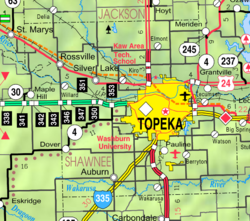
Kiro is an unincorporated community in Shawnee County, Kansas, United States. [1]
