Kodibail

Last updated

Kodibail
Locality(Uppala)
India Kerala location map.svg
Red pog.svg
Kodibail
Location in Kerala, India
India location map.svg
Red pog.svg
Kodibail
Kodibail (India)
Coordinates: 12°40′0″N74°55′0″E / 12.66667°N 74.91667°E / 12.66667; 74.91667 Coordinates: 12°40′0″N74°55′0″E / 12.66667°N 74.91667°E / 12.66667; 74.91667
CountryFlag of India.svg  India
State Kerala
District Kasaragod
Talukas Kasaragod
Languages
  Official Malayalam, English
Time zone UTC+5:30 (IST)
PIN
671322
Vehicle registration KL-14

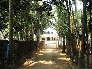
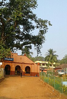
Kodibail is a locality of Uppala in Kasaragod district in the state of Kerala, India. [1] It is in the central region of Uppala.

Uppala Place in Kerala, India

Uppala is a major town in Kasaragod district, Kerala, India. It is a satellite town developing 22 km north to Kasaragod city. Uppala is the one of the fastest growing urban settlements along the National Highway 66. It is well known as a trade hub in the district.

Kasaragod district Place in Kerala, India

Kasaragod District is one of the 14 districts in the southern Indian state of Kerala. Kasaragod became part of Kannur district following the reorganisation of states due to predominance of Malayalam speakers. Kasaragod was declared as a district on 24 May 1984.

Kerala State in southern India

Kerala, locally known as Keralam, is a state on the southwestern, Malabar Coast of India. It was formed on 1 November 1956, following passage of the States Reorganisation Act, by combining Malayalam-speaking regions. Spread over 38,863 km2 (15,005 sq mi), Kerala is the twenty-second largest Indian state by area. It is bordered by Karnataka to the north and northeast, Tamil Nadu to the east and south, and the Lakshadweep Sea and Arabian Sea to the west. With 33,387,677 inhabitants as per the 2011 Census, Kerala is the thirteenth-largest Indian state by population. It is divided into 14 districts with the capital being Thiruvananthapuram. Malayalam is the most widely spoken language and is also the official language of the state.

Contents

Transportation

Local roads have access to National Highway No.66 which connects to Mangalore in the north and Calicut in the south. The nearest railway station is Manjeshwar on Mangalore-Palakkad line. There is an airport at Mangalore.

Mangalore Corporation City in Karnataka, India

Mangalore, officially known as Mangaluru, is the chief port city of the Indian state of Karnataka. It is located about 352 km (219 mi) west of the state capital, Bangalore, between the Arabian Sea and the Western Ghats mountain range. It is the second major city in Karnataka state in all aspects after the capital city Bangalore. It is the only city in Karnataka to have all modes of transport — Air, Road, Rail and Sea along with 5 other major cities in India. It is also known as the Gateway of Karnataka. It is the largest city in the Tulu Nadu region of Karnataka. Mangalore is the second best business destination in Karnataka after Bangalore & 13th best in India. The population of the urban agglomeration was 623,841, according to the provisional results of the 2011 national census of India.

Palakkad City in Kerala

Palakkadpronunciation , also known as Palghat, is a city and municipality in the state of Kerala in southern India, spread over an area of 26.60 km2 and is the administrative headquarters of the Palakkad District. The city is situated about 350 kilometres (217 mi) north of state capital Thiruvananthapuram and 54 kilometers south west of Coimbatore, and 66 km north east of Thrissur on the Salem-Kanyakumari National Highway NH 47.

Languages

This locality is an essentially multi-lingual region. The people speak Malayalam, Tulu, Urdu, Beary bashe and Konkani. Migrant workers also speak Hindi and Tamil languages.

Malayalam language spoken in Kerala and Lakshadweep of India

Malayalam is a Dravidian language spoken in the Indian state of Kerala and the union territories of Lakshadweep and Puducherry (Mahé) by the Malayali people, and it is one of 22 scheduled languages of India. Malayalam has official language status in the state of Kerala and in the union territories of Lakshadweep and Puducherry (Mahé) and is spoken by 38 million people worldwide. Malayalam is also spoken by linguistic minorities in the neighbouring states; with significant number of speakers in the Nilgiris, Kanyakumari, and Coimbatore districts of Tamil Nadu, and Kodagu and Dakshina Kannada districts of Karnataka. Due to Malayali expatriates in the Persian Gulf, the language is also widely spoken in Gulf countries.

Tulu language Dravidian language, coastal karnataka language, People from Coastal karnataka. Tulunadu language

Tulu is a Dravidian language spoken mainly in the south west part of the Indian state of Karnataka and also in the Kasaragod district of Kerala. The Tulu speaking region is often referred to as Tulu Nadu. The native speakers of Tulu are referred to as Tuluva or Tulu people.

Urdu national language and lingua franca of Pakistan; standardized register of Hindustani

Urdu —or, more precisely, Modern Standard Urdu—is a Persianised standard register of the Hindustani language. It is the official national language and lingua franca of Pakistan. In India, it is one of the 22 official languages recognized in the Constitution of India, having official status in the six states of Jammu and Kashmir, Telangana, Uttar Pradesh, Bihar, Jharkhand and West Bengal, as well as the national capital territory of Delhi. It is a registered regional language of Nepal.

Administration

This village is part of Manjeswaram assembly constituency which is again part of Kasaragod (Lok Sabha constituency)

Kasaragod is a Lok Sabha constituency in Kerala.

Related Research Articles

Bayar, Kasaragod Village in Kerala, India

Bayar is a village in Kasaragod district in the state of Kerala, India. Bayar is 12 km far from the Uppala town.

Mangalpady Panchayath in Kerala, India

Mangalpady is a Panchayath in Kasaragod district, Kerala. Uppala is the major town in this panchayat.

Paivalike Village in Kerala, India

Paivalike is a village in Kasaragod district in the state of Kerala, India. Paivalike is 8 km far from the Uppala town and 38 km far from Mangalore city. A union of Pyvalicanz formed in UAE named as United Pyvalicanz.

Vorkady Gram Panchayath in Kerala, India

Vorkady is a Gram Panchayat in Kasaragod district in the state of Kerala, India.

Bekoor Locality in Kerala, India

Bekoor is a locality of Uppala town in Kasaragod district in the state of Kerala, India. This locality is located in eastern Uppala, in Uppala-Bayar road, which connects Uppala with Paivalike, Bayar, and leads to Kanyana, Vittal and Puttur in dakshina Kannada district, Karnataka. It is around 3 km from Kaikamba junction and 1 km from Sonkal.

Heroor village in Kerala, India

Heroor is a village in Kasaragod district in the state of Kerala, India.

Katukukke is a village in Kasaragod district in the state of Kerala, India.

Kayyar village in Kerala, India

Kayyar is a village in Kasaragod district in the state of Kerala, India.

Koliyoor village in Kerala, India

Koliyoor is a village in Kasaragod district in the state of Kerala, India.

Kubanoor locality in Kerala, India

Kubanoor is a locality of Uppala in Kasaragod district in the state of Kerala, India.

Meenja Village in Kerala, India

Meenja is a grama Panchayat in manjeshwar taluk Kasaragod district in the state of Kerala, India who's capital is Miyapadav

Mulinja locality in Kerala, India

Mulinja is a locality in Uppala, Kasaragod district, Kerala, India. It is a locality considered under Uppala town.

Talikala is a village in Kasaragod district in the state of Kerala, India.

Sajankila village in Kerala, India

Sajankila is a small village in Bayar Village in the Kasaragod district, state of Kerala, India.

Kondevoor is a small village in Uppala, Kasaragod district, Kerala state, India.

Hidayath Nagar is a small town in Uppala, a town in Kasaragod district, Kerala. It is located about 1 kilometre (0.62 mi) north of the main junction in Uppala.

Uppala Gate Town in Karnataka, India

Uppala Gate is a small town in Uppala, Kasaragod district, Kerala. It is located about 1 kilometre (0.62 mi) north from the Uppala town.

Sonkal is a small local residential location in Uppala, in Kasaragod district, Kerala.

Perla, Kasaragod Town in Kerala, India

Perla is an administrative capital of Enmakaje Panchayath, which is in Kasaragod District, Kerala, India.

References

  1. "Census of India : List of villages by Alphabetical : Kerala". Registrar General & Census Commissioner, India. Retrieved 2008-12-10.