Related Research Articles

The Kootenay River or Kootenai River is a major river of the Northwest Plateau in southeastern British Columbia, Canada, and northern Montana and Idaho in the United States. It is one of the uppermost major tributaries of the Columbia River, the largest North American river that empties into the Pacific Ocean. The Kootenay River runs 781 kilometres (485 mi) from its headwaters in the Kootenay Ranges of the Canadian Rockies, flowing from British Columbia's East Kootenay region into northwestern Montana, then west into the northernmost Idaho Panhandle and returning to British Columbia in the West Kootenay region, where it joins the Columbia at Castlegar.
The Selkirk Mountains are a mountain range spanning the northern portion of the Idaho Panhandle, eastern Washington, and southeastern British Columbia which are part of a larger grouping of mountains, the Columbia Mountains. They begin at Mica Peak and Krell Hill near Spokane and extend approximately 320 km north from the border to Kinbasket Lake, at the now-deserted location of the onetime fur company post, Boat Encampment. The range is bounded on its west, northeast and at its northern extremity by the Columbia River, or the reservoir lakes now filling most of that river's course. From the Columbia's confluence with the Beaver River, they are bounded on their east by the Purcell Trench, which contains the Beaver River, Duncan River, Duncan Lake, Kootenay Lake and the Kootenay River. The Selkirks are distinct from, and geologically older than, the Rocky Mountains. The neighboring Monashee and Purcell Mountains, and sometimes including the Cariboo Mountains to the northwest, are also part of the larger grouping of mountains known as the Columbia Mountains. A scenic highway loop, the International Selkirk Loop, encircles the southern portions of the mountain range.

Kootenay Lake is a lake located in British Columbia, Canada. It is part of the Kootenay River. The lake has been raised by the Corra Linn Dam and has a dike system at the southern end, which, along with industry in the 1950s–70s, has changed the ecosystem in and around the water. The Kootenay Lake ferry is a year-round toll-free ferry that crosses between Kootenay Bay and Balfour. The lake is a popular summer tourist destination.
Kokanee is a North American lager-style beer produced at the Columbia Brewery in Creston, British Columbia. Columbia Brewery began brewing Kokanee lager in 1959 and was purchased by the Labatt Brewing Company in 1974.

The Columbia Mountains are a group of mountain ranges along the Upper Columbia River in British Columbia, Montana, Idaho and Washington. The mountain range covers 135,952 km². The range is bounded by the Rocky Mountain Trench on the east, and the Kootenai River on the south; their western boundary is the edge of the Interior Plateau. Seventy-five percent of the range is located in Canada and the remaining twenty-five percent in the United States; American geographic classifications place the Columbia Mountains as part of the Rocky Mountains complex, but this designation does not apply in Canada. Mount Sir Sandford is the highest mountain in the range, reaching 3,519 metres (11,545 ft).

Kokanee Glacier Provincial Park is one of the oldest provincial parks in British Columbia, established in 1922. The park has an area of 320.35 km2 (123.69 sq mi) and is located in the Selkirk Mountains in the West Kootenays region of BC. The park has three glaciers that feed over 30 alpine lakes which are the headwaters of many creeks.
Kokanee is a word from the Okanagan language referring to land-locked lake populations of sockeye salmon. It may also refer to:

Syringa Park is a provincial park on the east shore of Lower Arrow Lake in the West Kootenay region of southeastern British Columbia. At the foot of the Norns Range, Tulip Creek passes through the centre, and Syringa Creek is closer to the southeastern boundary. The park is about 19 kilometres (12 mi) west of Castlegar via Broadwater Rd.
The Lower Similkameen Indian Band or Lower Smelqmix, is a First Nations band government in the Canadian province of British Columbia. Their office was in the village of Keremeos in the Similkameen region, until 2015 when they moved into their own $7million multi-purpose facility south of Cawston. They are a member of the Okanagan Nation Alliance.
Columbia Country refers to the upper basin of the Columbia River in the Canadian province of British Columbia. It includes a smaller region known as the Columbia Valley, near the river's headwaters at Columbia Lake in the Rocky Mountain Trench, as well as the Big Bend of that river, now mostly inundated by Kinbasket Lake and Revelstoke Lake.
The Whatshan River is a tributary of the Columbia River in the West Kootenay region of southeastern British Columbia. The river's drainage basin is approximately 390 square kilometres (150 sq mi) in area.

Fimbulheimen is a mountain range in Queen Maud Land, Antarctica. It stretches from Jutulstraumen by 1° west of Carsten Borchgrevink Ice at 18° east, about 200 km from the ice edge. Fimbulheimen is thus between Maudheim Plateau and Sør-Rondane.
Greater Oxdrift is a local services board in Kenora District in northwestern Ontario, Canada. It provides services to the geographic townships of Aubrey, Britton, Brownbridge, Eton, Rugby, Van Horne, Wainwright, and Zealand and was created in 2009.
The Nelson Range is a subrange of the Selkirk Mountains in the West Kootenay region of British Columbia, Canada. It is located south of the west arm of Kootenay Lake between the Salmo (W) and Kootenay Rivers (E) and also to the west of the south arm of Kootenay Lake. The range gets its name from the City of Nelson, which is on the south bank of the West Arm of Kootenay Lake and at the foot of the range's northwestern slopes.
Grays Peak is a mountain in southeast British Columbia, Canada. It is located in Kokanee Glacier Provincial Park in the Kootenays, and is best known for being the mountain pictured on the label of Kokanee beer.

Quartz Creek is a creek in Selkirk Mountains in the West Kootenay region of the Regional District of Central Kootenay in British Columbia, Canada. This short creek flows into the Salmo River in Ymir, British Columbia. The source of the creek is just to the west of the Ymir townsite a few kilometres up Round Mountain. Quartz creek was mined for gold in the 1860s. The creek is the source of drinking water in the town of Ymir. The Regional District of Central Kootenay added a filtration system in the early 2010s for the community.

Ymir Mountain is a 2,398-metre (7,867 ft) summit in the West Kootenay region of southeastern British Columbia, Canada. The nearest higher neighbour is Wood Peak, about 31 kilometres (19 mi) to the southeast.
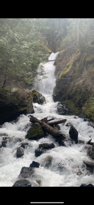
Stewart Creek is a small creek in the Regional District of Central Kootenay in the West Kootenay region of British Columbia, Canada. The creek is a tributary of the Salmo River and has its source in the Selkirk Mountains close to the town of Ymir. The name was adopted in 1930. Its source is the peaks of Round Mountain, the same source as that of Quartz Creek and is approximately 2 km north of Ymir. There is a rest area featuring a small waterfall with a picnic area on Highway 6 at Stewart Creek.

Barrett Creek is a creek in the Selkirk Mountains in the West Kootenay region of the Regional District of Central Kootenay in British Columbia, Canada. The creek flows east from Barrett Lake to the Salmo River in the community of Porto Rico a few kilometres north of Ymir. Porto Rico was the site of mines staked in 1896, and some early maps may refer to Barrett creek as Porto Rico creek.

Barrett Lake is a lake in the Selkirk Mountains in the West Kootenay region of the Regional District of Central Kootenay in British Columbia, Canada. The lake is the source of Barrett Creek, a tributary of the Salmo River. The lake is surrounded by a series of mountain peaks including Dominion Mountain, Empire Peak, Commonwealth Mountain and others. There is an emergency cabin maintained by Recreation Sites and Trails BC.
References
- ↑ "Kokanee Range". BC Geographical Names .
- ↑ Bivouac.com, Canadian Mountain Encyclopedia, Grays Peak. Retrieved 2010.07.24
49°50′00″N117°00′00″W / 49.83333°N 117.00000°W
| | This article about a location in the Interior of British Columbia, Canada is a stub. You can help Wikipedia by expanding it. |