Kori Creek

Last updated
Kori Creek
Bombay Prov north 1909.jpg
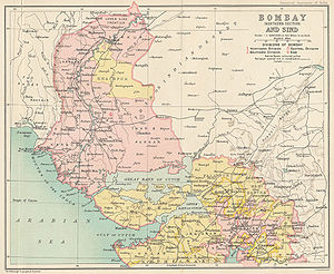
Location of Kori Creek in British Colonial era map
Physical characteristics
Mouth  
  location
Indian Ocean
  coordinates
23°35′N68°22′E / 23.583°N 68.367°E / 23.583; 68.367
Basin features
River system Indus river delta
Kori Creek Sir-Creek-map.svg
Kori Creek
This map shows the creek in the Rann of Kutch of Gujarat. Bombay Prov north 1909.jpg
This map shows the creek in the Rann of Kutch of Gujarat.

The Kori Creek is a tidal creek in the Kutch region of the Indian state of Gujarat. It lies just to the west of the Great Rann of Kutch area of India. This region belonging to India is a part of the Indus River Delta, which lies across Gujarat state in India and Sindh in Pakistan.

Contents

The Sir Creek, laying around 33 km northwest of Kori Creek, is a disputed area between India and Pakistan.

Geography

On the border of India and Pakistan in Gujarat at the mouth of the Indus River, the Kori Creek is one of the six main creeks on the Indian side. All other five are to the west of it, namely Sir Creek – the westernmost creek, Vian Wari Creek (Vianbari and Viyanbari), Pir Sanai, Pabevari, and Padala 16 km west. [1] [2] All of these creeks are within undisputed territory of India, except for the westernmost creek, namely the Sir Creek, which is claimed by both India and Pakistan. Ever shifting creeks exit Indian territory, enter Pakistan, reenter India and vice versa, thus creating a hard-to-patrol snake- and scorpion-infested marshy wetland border with no physical barrier or fencing. The Indian military's Border Security Force (BSF) patrols the Kori Creek and Sir Creek up to the midstream using floating border posts, amphibious vehicles, and foot travel by the Creek Crocodile Commandos. The coastal area of the Sir Creek is manned by the Indian Coast Guard, and the larger open sea beyond is patrolled by the Indian Navy. [2]

See also

Related Research Articles

<span class="mw-page-title-main">Geography of India</span> Geographical features of India

India is situated north of the equator between 8°4' north to 37°6' north latitude and 68°7' east to 97°25' east longitude. It is the seventh-largest country in the world, with a total area of 3,287,263 square kilometres (1,269,219 sq mi). India measures 3,214 km (1,997 mi) from north to south and 2,933 km (1,822 mi) from east to west. It has a land frontier of 15,200 km (9,445 mi) and a coastline of 7,516.6 km (4,671 mi).

<span class="mw-page-title-main">Great Rann of Kutch</span> Salt marsh in Gujarat, India and Sindh, Pakistan; the greater part of the Rann of Kutch

The Great Rann of Kutch is a salt marsh in the Thar Desert in the Kutch District of Gujarat, India. It is about 7500 km2 in area and is reputed to be one of the largest salt deserts in the world. This area has been inhabited by the Kutchi people.

<span class="mw-page-title-main">Kutch district</span> District in Gujarat, India

Kutch district, officially spelled Kachchh, is a district of Gujarat state in western India, with its headquarters (capital) at Bhuj. Covering an area of 45,674 km2, it is the largest district of India. The area of Kutch is larger than the entire area of other Indian states like Haryana (44,212 km2) and Kerala (38,863 km2). The population of Kutch is about 2,092,371. It has 10 talukas, 939 villages and 6 municipalities. The Kutch district is home to the Kutchi people who speak the Kutchi language.

<span class="mw-page-title-main">Gulf of Kutch</span> Inlet of the Arabian Sea on the west coast of India

The Gulf of Kutch is located between the peninsula regions of Kutch and Saurashtra, bounded in the state of Gujarat that borders Pakistan. It opens towards the Arabian Sea facing the Gulf of Oman.

<span class="mw-page-title-main">Sutlej</span> River in Asia

The Satluj River is the longest of the five rivers that flow through the historic crossroads region of Punjab in northern India and Pakistan. The Sutlej River is also known as Satadru. It is the easternmost tributary of the Indus River. The Bhakra Dam is built around the river Sutlej to provide irrigation and other facilities to the states of Punjab, Rajasthan and Haryana.

<span class="mw-page-title-main">1999 Pakistan Breguet 1150 Atlantic shootdown</span> Aviation accident

The Atlantique incident occurred on 10 August 1999, when a Breguet Atlantic maritime patrol aircraft of the Pakistan Naval Air Arm was shot down by a MiG-21 fighter of the Indian Air Force over the Rann of Kutch, on the border between India and Pakistan. Sixteen Pakistani personnel including the pilots were killed as a result. The episode took place just a month after the Kargil War ended, aggravating already tense relations between the two countries.

<span class="mw-page-title-main">Lakhpat</span> Town in Gujarat, India

Lakhpat is a town in Kachchh district in the Indian state of Gujarat located at the mouth of the Kori Creek. The town is enclosed by 7km-long, 18th century fort walls.

<span class="mw-page-title-main">Western India</span> Group of Western Indian states

Western India is a loosely defined region of India consisting of western states of Republic of India. The Ministry of Home Affairs in its Western Zonal Council Administrative division includes the states of Goa, Gujarat, and Maharashtra along with the Union territory of Dadra and Nagar Haveli and Daman and Diu, while the Ministry of Culture and some historians also include the state of Rajasthan. The Geological Survey of India includes Maharashtra but excludes Rajasthan whereas Ministry of Minority Affairs includes Karnataka but excludes Rajasthan.

<span class="mw-page-title-main">Indus Waters Treaty</span> Water-distribution treaty between India and Pakistan

The Indus Water Treaty (IWT) is a water-distribution treaty between India and Pakistan, arranged and negotiated by the World Bank, to use the water available in the Indus River and its tributaries. It was signed in Karachi on 19 September 1960 by then Indian Prime Minister Jawaharlal Nehru and then Pakistani president Ayub Khan.

<span class="mw-page-title-main">Saltoro Mountains</span> Subrange of the Karakoram located on the southwestern side of the Siachen Glacier in Kashmir

The Saltoro Mountains form a subrange within the Karakoram Range and are situated in the southeastern part of the Karakoram. They lie on the southwest side of the Siachen Glacier, which is one of the two longest glaciers in the world outside the polar regions. The name "Saltoro" is also associated with the Saltoro Valley, located west of this range and descending on the Pakistani side of the Saltoro Range, which generally follows the Actual Ground Position Line (AGPL).

<span class="mw-page-title-main">India–Pakistan border</span> International border

The India–Pakistan, Indo–Pakistani or Pakistani-Indian border is the international boundary that separates the nations of the Republic of India and the Islamic Republic of Pakistan. At its northern end is the Line of Control, which separates Indian-administered Kashmir from Pakistani-administered Kashmir; and at its southern end is Sir Creek, a tidal estuary in the Rann of Kutch between the Indian state of Gujarat and the Pakistani province of Sindh.

<span class="mw-page-title-main">Sir Creek</span> Tidal estuary on the Indus River in India and Pakistan

Sir Creek, originally Ban Ganga, is a 96 km tidal estuary in the uninhabited marshlands of the Indus River Delta on the border between India and Pakistan. The creek flows into the Arabian Sea and separates Gujarat state in India from Sindh province in Pakistan. The long-standing India-Pakistan Sir Creek border dispute stems from the demarcation "from the mouth of Sir Creek to the top of Sir Creek, and from the top of Sir Creek eastward to a point on the line designated on the Western Terminus". From this point onward, the boundary is unambiguously fixed as defined by the Tribunal Award of 1968.

<span class="mw-page-title-main">Geography of Gujarat</span> Geography of the Indian state of Gujarat

Gujarat is a state in Western India. It has the India's Longest Coastline of 1214 km and It also has the one of the Largest Salt Desert in the World with the Area of 7500 Sq. km.

Chir Batti, Chhir Batti or Cheer batti is a ghost light reported in the Banni grasslands, a seasonal marshy wetlands and adjoining desert of the marshy salt flats of the Rann of Kutch near the India–Pakistan border in Kutch district, Gujarat, India. Local villagers refer to the light as Chir Batti in the Kutchhi-Sindhi language, with Chir meaning ghost and Batti meaning light.

Banni Grasslands Reserve or Banni grasslands form a belt of arid grassland ecosystem on the outer southern edge of the desert of the marshy salt flats of Rann of Kutch in Kutch District, Gujarat State, India. They are known for rich wildlife and biodiversity and are spread across an area of 3,847 square kilometres. They are currently legally protected under the status as a protected or reserve forest in India. Though declared a protected forest more than half a century ago Gujarat state's forest department has recently proposed a special plan to restore and manage this ecosystem in the most efficient way. Wildlife Institute of India (WII) has identified this grassland reserve as one of the last remaining habitats of the cheetah in India and a possible reintroduction site for the species.

<span class="mw-page-title-main">Rann of Kutch</span> Large area of salt desert in India and Pakistan

The Rann of Kutch is a large area of salt marshes that span the border between India and Pakistan. It is located mostly in the Kutch district of the Indian state of Gujarat, with a minor portion extending into the Sindh province of Pakistan. It is divided into the Great Rann and Little Rann.

The Kutch Desert Wildlife Sanctuary is situated in the Great Rann of Kutch, Kutch district, Gujarat, India. It was declared a sanctuary in February 1986. It is the largest Wildlife Sanctuary in India regarding its size.

<span class="mw-page-title-main">1819 Rann of Kutch earthquake</span> Earthquake and tsunami in Gujarat, India

The 1819 Rann of Kutch earthquake occurred at about 18:45 to 18:50 local time on 16 June 1819. It had an estimated magnitude ranging from 7.7 to 8.2 on the moment magnitude scale and a maximum perceived intensity of XI (Extreme) on the Mercalli intensity scale. It triggered a tsunami and caused at least 1,543 deaths. The earthquake caused an area of subsidence that formed the Sindri Lake and a local zone of uplift to the north about 80 km (50 mi) long, 6 km (3.7 mi) wide and 6 m (20 ft) high that dammed the Koree / Kori / Puran / Nara river. This natural dam was known as the Allah Bund.

Shakoor Lake is a lake, comprising 300 km2, located on the border between the Indian state of Gujarat and the Sindh province on the southern edge of Pakistan. About 90 km2 of the lake lies within Pakistan, whilst the majority of the lake, i.e. 210 km2, is in India. The Indian built Indo-Pak Border Road runs across the Shakoor Lake and it is joined by the Indian GJ SH 45 State Highway just east of the lake, at the Kanjarkot Fort.

<span class="mw-page-title-main">Operation Desert Hawk</span> Pakistani Military Operation In The Indo-Pakistani War Of 1965

Operation Desert Hawk was the codename of a military operation planned and executed by the Pakistan Army in the Rann of Kutch area, the disputed area which was under Indian control from the long-standing status quo. The boundary of Rann of Kutch was one of the few un-demarcated boundaries pending since the 1947 partition of India.

References

  1. Shaurya Karanbir Gurung (29 March 2015). "21 Months on, BSF Still Bereft of Hi-Tech Tools to Fight Nature". The Tribune. Retrieved 25 June 2022.
  2. 1 2 Shantanu Nandan Sharma (13 July 2018). "Away from the LoC, how BSF Has Secured the Natural Border Between Gujarat and Pakistan". The Economic Times. Retrieved 25 June 2022.