Vyazniki is a town and the administrative center of Vyaznikovsky District in Vladimir Oblast, Russia. Population: 36,203 (2021 Census); 41,248 (2010 Census); 40,398 (2002 Census); 45,438 (1989 Soviet census).

Sudogda is a town and the administrative center of Sudogodsky District in Vladimir Oblast, Russia, located on the left bank of the river Sudogda 40 kilometers (25 mi) southeast of Vladimir, the administrative center of the oblast. Population: 10,408 (2021 Census); 11,848 (2010 Census); 13,328 (2002 Census); 14,191 (1989 Soviet census).

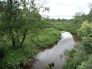
Kolchugino is a town and the administrative center of Kolchuginsky District in Vladimir Oblast, Russia, located on the Peksha River some 74 kilometers (46 mi) northwest of Vladimir, the administrative center of the oblast. Population: 39,410 (2021 Census); 45,776 (2010 Census); 47,059 (2002 Census); 45,601 (1989 Soviet census).

Sobinka is a town and the administrative center of Sobinsky District in Vladimir Oblast, Russia, located on the right bank of the Klyazma River, 37 kilometers (23 mi) southwest of Vladimir, the administrative center of the oblast. Population: 17,444 (2021 Census); 19,482 (2010 Census); 21,054 (2002 Census); 23,720 (1989 Soviet census).

Strunino is a town in Alexandrovsky District of Vladimir Oblast, Russia, located 131 kilometers (81 mi) northwest of Vladimir, the administrative center of the oblast. Population: 11,774 (2021 Census); 14,369 (2010 Census); 16,056 (2002 Census); 18,658 (1989 Soviet census).

Petushki is a town and the administrative center of Petushinsky District in Vladimir Oblast, Russia, located on the left bank of the Klyazma River on the Moscow–Nizhny Novgorod railway and motorway, 67 kilometers (42 mi) west of Vladimir, the administrative center of the oblast. Population: 13,317 (2021 Census); 15,148 (2010 Census); 16,482 (2002 Census); 20,144 (1989 Soviet census).

Pokrov is a town in Petushinsky District of Vladimir Oblast, Russia, located 5 kilometers (3.1 mi) to the north of the left bank of the Klyazma River, 82 kilometers (51 mi) west of Vladimir, the administrative center of the oblast, and 100 kilometers (62 mi) east of Moscow. Population: 17,747 (2021 Census); 17,756 (2010 Census); 15,920 (2002 Census); 15,988 (1989 Soviet census); 2,925 (1897).

Karabanovo is a town in Alexandrovsky District of Vladimir Oblast, Russia, located on the left bank of the Seraya River, 110 kilometers (68 mi) west of Vladimir, the administrative center of the oblast. Population: 13,150 (2021 Census); 14,868 (2010 Census); 16,015 (2002 Census); 17,456 (1989 Soviet census).

Gorokhovetsky District is an administrative and municipal district (raion), one of the sixteen in Vladimir Oblast, Russia. It is located in the east of the oblast. The area of the district is 1,487 square kilometers (574 sq mi). Its administrative center is the town of Gorokhovets. Population: 20,870 (2021 Census); 22,923 (2010 Census); 25,832 ; 30,156 (1989 Soviet census). The population of Gorokhovets accounts for 60.7% of the district's total population.

Kameshkovsky District is an administrative and municipal district (raion), one of the sixteen in Vladimir Oblast, Russia. It is located in the north of the oblast. The area of the district is 1,090 square kilometers (420 sq mi). Its administrative center is the town of Kameshkovo. Population: 30,862 (2021 Census); 30,466 (2010 Census); 37,961 ; 42,298 (1989 Soviet census). The population of Kameshkovo accounts for 39.0% of the district's total population.

Kirzhachsky District is an administrative and municipal district (raion), one of the sixteen in Vladimir Oblast, Russia. It is located in the west of the oblast. The area of the district is 1,135 square kilometers (438 sq mi). Its administrative center is the town of Kirzhach. Population: 38,768 (2021 Census); 42,159 (2010 Census); 45,188 ; 49,846 (1989 Soviet census). The population of Kirzhach accounts for 70.5% of the district's total population.

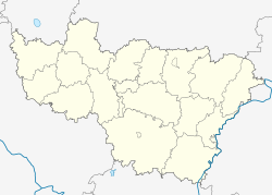
Kolchuginsky District is an administrative and municipal district (raion), one of the sixteen in Vladimir Oblast, Russia. It is located in the west of the oblast. The area of the district is 1,148 square kilometers (443 sq mi). Its administrative center is the town of Kolchugino. Population: 49,656 (2021 Census); 56,351 (2010 Census); 11,405 ; 16,312 (1989 Soviet census). The population of Kolchugino accounts for 79.4% of the district's total population.
Petushinsky District is an administrative and municipal district (raion), one of the sixteen in Vladimir Oblast, Russia. It is located in the southwest of the oblast. The area of the district is 1,692 square kilometers (653 sq mi). Its administrative center is the town of Petushki. Population: 59,680 (2021 Census); 68,062 (2010 Census); 69,364 ; 78,498 (1989 Soviet census). The population of Petushki accounts for 22.3% of the district's total population.

Sobinsky District is an administrative and municipal district (raion), one of the sixteen in Vladimir Oblast, Russia. It is located in the center and the south of the oblast. The area of the district is 1,523.8 square kilometers (588.3 sq mi). Its administrative center is the town of Sobinka. Population: 50,883 (2021 Census); 58,801 (2010 Census); 24,864 ; 25,549 (1989 Soviet census). The population of Sobinka accounts for 34.3% of the district's total population.

Suzdalsky District is an administrative and municipal district (raion), one of the sixteen in Vladimir Oblast, Russia. It is located in the north of the oblast. The area of the district is 1,479 square kilometers (571 sq mi). Its administrative center is the town of Suzdal. Population: 46,084 (2021 Census); 44,114 (2010 Census); 39,736 ; 39,670 (1989 Soviet census). The population of Suzdal accounts for 20.2% of the district's total population.

Balakirevo is an urban-type settlement in Alexandrovsky District of Vladimir Oblast, Russia. Population: 9,474 (2021 Census); 10,076 (2010 Census); 9,141 (2002 Census); 9,470 (1989 Soviet census).
Nikologory is an urban-type settlement in Vyaznikovsky District of Vladimir Oblast, Russia. Population: 4,950 (2021 Census); 5,486 (2010 Census); 6,390 (2002 Census); 6,782 (1989 Soviet census).
Volginsky is an urban-type settlement in Petushinsky District of Vladimir Oblast, Russia. Population: 5,494 (2021 Census); 6,089 (2010 Census); 6,295 (2002 Census); 6,104 (1989 Soviet census).
Gorodishchi is an urban-type settlement in Petushinsky District of Vladimir Oblast, Russia. Population: 4,290 (2021 Census); 5,628 (2010 Census); 5,942 (2002 Census); 6,149 (1989 Soviet census).
Stavrovo is an urban-type settlement in Sobinsky District of Vladimir Oblast, Russia. Population: 6,932 (2021 Census); 7,800 (2010 Census); 8,005 (2002 Census); 7,985 (1989 Soviet census).