Murom

Last updated • 3 min readFrom Wikipedia, The Free Encyclopedia
Murom
Муром
Murom. Transfiguration monastery. Transfiguration Cathedral and Saint Basil Church P5231223 2350.jpg
Murom Transfiguration monastery
Flag of Murom (Vladimirskaya oblast).png
Coat of Arms of Murom (Vladimir oblast) (1781).png
Location of Murom
Murom
Russia administrative location map.svg
Red pog.svg
Murom
Location of Murom
Outline Map of Vladimir Oblast.svg
Red pog.svg
Murom
Murom (Vladimir Oblast)
Coordinates: 55°34′N42°02′E / 55.567°N 42.033°E / 55.567; 42.033
Country Russia
Federal subject Vladimir Oblast [2]
First mentioned862
Government
  Head [3] Yevgeny Rychkov [3]
Elevation
115 m (377 ft)
Population
  Total116,075
  Rank 140th in 2010
  Subordinated to City of Murom [2]
   Capital of Muromsky District, [5] City of Murom [2]
  Urban okrug Murom Urban Okrug [6]
   Capital ofMurom Urban Okrug, [6] Muromsky Municipal District [7]
Time zone UTC+3 (MSK   OOjs UI icon edit-ltr-progressive.svg [8] )
Postal code(s) [9]
602250
Dialing code(s) +7 49234
OKTMO ID17735000001
Website www.murom.info

Murom (Russian : Муром, IPA: [ˈmurəm] ) is a historical city in Vladimir Oblast, Russia, which sprawls along the west bank of the Oka River. It borders Nizhny Novgorod Oblast and is situated 137 kilometres (85 mi) from the administrative center Vladimir. Its population as of the 2021 Census was 107,497.

Contents

History

In the 9th century AD, the city marked the easternmost settlement of the East Slavs in the land of the Finnic Muromians. The Primary Chronicle mentions it as early as AD 862. [10] It is, thus, one of the oldest cities in Russia. Circa 900 AD, it was an important trading post from Volga Bulgaria to the Baltic Sea.

Between AD 1010 and AD 1393, it was the capital of a separate principality, whose rulers included Saint Gleb, assassinated in AD 1015 and canonized in AD 1071, Saint Prince Konstantin the Blessed, and Saints Peter and Fevronia of Murom, subjects of an opera by Rimsky-Korsakov. It was believed to be the home town of the most celebrated East Slavic epic hero, Ilya Muromets. The town has a statue which shows Ilya holding the hilt of his sword in the left hand and a cross in the right.

On June 30, 1961, Murom was the site of a spontaneous protest and riot against the police and Soviet authorities, following the death in police custody of a senior factory foreman named Kostikov. [11]

Administrative and municipal status

Within the framework of administrative divisions, Murom serves as the administrative center of Muromsky District, [5] even though it is not a part of it. [1] As an administrative division, it is incorporated separately as the Cit] of Murom — an administrative unit with the status equal to that of the districts. [2] As a municipal division, the territory of the City of Murom together with nine rural localities in Muromsky District are incorporated as Murom Urban Okrug. [1] [6]

Economy

Murom has since 1941 and the Great Patriotic War against the Nazis played host to the JSC Murom instrument making plant (MIMP) which produces the means of initiation and ignition of ammunition, as well as various pyrotechnic devices. It is a subsidiary of Rostec State Corporation. [12] The MIMP was sanctioned on 23.06.2023 in the EU's 11th package of sanctions in response to Russia's invasion of Ukraine. [13]

Sights

Murom still retains many marks of antiquity. The Savior monastery, one of the most ancient in Russia, was first chronicled in 1096, when Oleg of Chernigov besieged it and killed Vladimir Monomakh's son Izyaslav, who is buried there. In 1552, the monastery was visited by Ivan the Terrible who commissioned a stone cathedral, which was followed by other churches.

The Trinity convent, where the relics of Sts. Peter and Fevronia are displayed, features a fine cathedral (1642–1643), Kazan church (1652), a bell-tower (1652), a wooden church of St. Sergius, and stone walls. It is rivaled by the Annunciation Monastery, founded in the reign of Ivan the Terrible to house the relics of local princes and containing a cathedral from 1664. Two last-mentioned cathedrals, being probably the works of the same masters, have much in common with the Resurrection Church (1658) in the downtown. Quite different is the tent-like church of Sts. Cosmas and Damian, built in 1565 on the bank of the Oka to commemorate the Russian conquest of Kazan.

International relations

Murom is twinned with:

Notable people

Among notable natives are the father of color photography, Sergey Prokudin-Gorsky (1863), the painter Ivan Kulikov [14] (1875) and the father of television, Vladimir Zworykin (1888) and Russian physicist Igor Irodov. Saints Peter and Fevronia.[ clarification needed ]

Related Research Articles

<span class="mw-page-title-main">Kovrov</span> City in Vladimir Oblast, Russia

Kovrov is a city in Vladimir Oblast, Russia, located on the right bank of the Klyazma River, a tributary of the Oka. Kovrov's population as of the 2021 Census was 132,417, down from 145,214 recorded in the 2010 Census, and further down from 155,499 recorded in the 2002 Census and 159,942 recorded in the 1989 Census. In terms of population, it is the second-largest city in Vladimir Oblast after Vladimir. In 1977, Kovrov's population had been estimated at 140,000.

<span class="mw-page-title-main">Gus-Khrustalny (town)</span> Town in Vladimir Oblast, Russia

Gus-Khrustalny is a town in Vladimir Oblast, Russia, located on the Gus River 63 kilometers (39 mi) south of Vladimir, the administrative center of the oblast. Population: 51,552 (2021 Census); 60,784 (2010 Census); 67,121 (2002 Census); 76,360 (1989 Soviet census); 65,000 (1970); 40,000 (1939); 17,900 (1926).

<span class="mw-page-title-main">Kovrovsky District</span> District in Vladimir Oblast, Russia

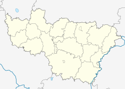
Kovrovsky District is an administrative and municipal district (raion), one of the sixteen in Vladimir Oblast, Russia. It is located in the north of the oblast. The area of the district is 1,817 square kilometers (702 sq mi). Its administrative center is the city of Kovrov. Population: 30,174 (2021 Census); 31,477 (2010 Census); 31,148 ; 30,044 (1989 Soviet census).

<span class="mw-page-title-main">Yuryev-Polsky District</span> District in Vladimir Oblast, Russia

Yuryev-Polsky District is an administrative and municipal district (raion), one of the sixteen in Vladimir Oblast, Russia. It is located in the northwest of the oblast. The area of the district is 1,910 square kilometers (740 sq mi). Its administrative center is the town of Yuryev-Polsky. Population: 31,961 (2021 Census); 36,747 (2010 Census); 39,023 ; 42,219 (1989 Soviet census). The population of the administrative center accounts for 54.1% of the district's total population.

<span class="mw-page-title-main">Alexandrovsky District, Vladimir Oblast</span> District in Vladimir Oblast, Russia

Alexandrovsky District is an administrative and municipal district (raion), one of the sixteen in Vladimir Oblast, Russia. It is located in the west of the oblast. The area of the district is 1,834 square kilometers (708 sq mi). Its administrative center is the town of Alexandrov. Population: 105,927 (2021 Census); 113,900 (2010 Census); 55,207 ; 26,258 (1989 Soviet census). The population of Alexandrov accounts for 53.9% of the total district's population.

<span class="mw-page-title-main">Gorokhovetsky District</span> District in Vladimir Oblast, Russia

Gorokhovetsky District is an administrative and municipal district (raion), one of the sixteen in Vladimir Oblast, Russia. It is located in the east of the oblast. The area of the district is 1,487 square kilometers (574 sq mi). Its administrative center is the town of Gorokhovets. Population: 20,870 (2021 Census); 22,923 (2010 Census); 25,832 ; 30,156 (1989 Soviet census). The population of Gorokhovets accounts for 60.7% of the district's total population.

<span class="mw-page-title-main">Gus-Khrustalny District</span> District in Vladimir Oblast, Russia

Gus-Khrustalny District is an administrative and municipal district (raion), one of the sixteen in Vladimir Oblast, Russia. It is located in the south of the oblast. The area of the district is 4,370 square kilometers (1,690 sq mi). Its administrative center is the town of Gus-Khrustalny. Population: 40,609 (2021 Census); 44,883 (2010 Census); 50,813 ; 58,748 (1989 Soviet census).

<span class="mw-page-title-main">Kameshkovsky District</span> District in Vladimir Oblast, Russia

Kameshkovsky District is an administrative and municipal district (raion), one of the sixteen in Vladimir Oblast, Russia. It is located in the north of the oblast. The area of the district is 1,090 square kilometers (420 sq mi). Its administrative center is the town of Kameshkovo. Population: 30,862 (2021 Census); 30,466 (2010 Census); 37,961 ; 42,298 (1989 Soviet census). The population of Kameshkovo accounts for 39.0% of the district's total population.

<span class="mw-page-title-main">Kolchuginsky District</span> District in Vladimir Oblast, Russia

Kolchuginsky District is an administrative and municipal district (raion), one of the sixteen in Vladimir Oblast, Russia. It is located in the west of the oblast. The area of the district is 1,148 square kilometers (443 sq mi). Its administrative center is the town of Kolchugino. Population: 49,656 (2021 Census); 56,351 (2010 Census); 11,405 ; 16,312 (1989 Soviet census). The population of Kolchugino accounts for 79.4% of the district's total population.

<span class="mw-page-title-main">Melenkovsky District</span> District in Vladimir Oblast, Russia

Melenkovsky District is an administrative and municipal district (raion), one of the sixteen in Vladimir Oblast, Russia. It is located in the southeast of the oblast. The area of the district is 2,221 square kilometers (858 sq mi). Its administrative center is the town of Melenki. Population: 32,701 (2021 Census); 36,464 (2010 Census); 41,125 ; 49,712 (1989 Soviet census). The population of Melenki accounts for 41.0% of the district's total population.

<span class="mw-page-title-main">Muromsky District</span> District in Vladimir Oblast, Russia

Muromsky District is an administrative and municipal district (raion), one of the sixteen in Vladimir Oblast, Russia. It is located in the east of the oblast. The area of the district is 1,050 square kilometers (410 sq mi). Its administrative center is the city of Murom. Population: 15,013 (2021 Census); 24,991 (2010 Census); 26,382 ; 29,975 (1989 Soviet census).

<span class="mw-page-title-main">Selivanovsky District</span> District in Vladimir Oblast, Russia

Selivanovsky District is an administrative and municipal district (raion), one of the sixteen in Vladimir Oblast, Russia. It is located in the east of the oblast. The area of the district is 1,388 square kilometers (536 sq mi). Its administrative center is the urban locality of Krasnaya Gorbatka. Population: 17,201 (2021 Census); 18,610 (2010 Census); 21,330 ; 24,767 (1989 Soviet census). The population of Krasnaya Gorbatka accounts for 46.5% of the district's total population.

<span class="mw-page-title-main">Sudogodsky District</span> District in Vladimir Oblast, Russia

Sudogodsky District is an administrative and municipal district (raion), one of the sixteen in Vladimir Oblast, Russia. It is located in the center of the oblast. The area of the district is 1,616 square kilometers (624 sq mi). Its administrative center is the town of Sudogda. Population: 35,529 (2021 Census); 41,177 (2010 Census); 44,429 ; 45,946 (1989 Soviet census). The population of Sudogda accounts for 29.3% of the district's total population.

<span class="mw-page-title-main">Vyaznikovsky District</span> District in Vladimir Oblast, Russia

Vyaznikovsky District is an administrative and municipal district (raion), one of the sixteen in Vladimir Oblast, Russia. It is located in the northeast of the oblast. The area of the district is 2,252 square kilometers (870 sq mi). Its administrative center is the town of Vyazniki. Population: 71,015 (2021 Census); 80,987 (2010 Census); 50,692 ; 60,262 (1989 Soviet census). The population of Vyazniki accounts for 51.0% of the district's total population.

<span class="mw-page-title-main">Murom Urban Okrug</span> District in Russia

Murom Urban Okrug is a municipal formation in Vladimir Oblast, Russia, one of the five urban okrugs in the oblast. Its territory covers the territories of two administrative divisions of Vladimir Oblast—the whole of the City of Murom and nine rural localities in Muromsky District.

Krasnaya Gorbatka is an urban-type settlement and the administrative center of Selivanovsky District, Vladimir Oblast, Russia. Population: 7,998 (2021 Census); 8,885 (2010 Census); 9,441 (2002 Census); 10,493 (1989 Soviet census).

<span class="mw-page-title-main">Balakirevo</span> Urban locality in Vladimir Oblast, Russia

Balakirevo is an urban-type settlement in Alexandrovsky District of Vladimir Oblast, Russia. Population: 9,474 (2021 Census); 10,076 (2010 Census); 9,141 (2002 Census); 9,470 (1989 Soviet census).

Nikologory is an urban-type settlement in Vyaznikovsky District of Vladimir Oblast, Russia. Population: 4,950 (2021 Census); 5,486 (2010 Census); 6,390 (2002 Census); 6,782 (1989 Soviet census).

Melekhovo is an urban-type settlement in Kovrovsky District of Vladimir Oblast, Russia. Population: 6,560 (2021 Census); 7,039 (2010 Census); 7,084 (2002 Census); 6,180 (1989 Soviet census). It is home to the IK-6 maximum security prison.

Stavrovo is an urban-type settlement in Sobinsky District of Vladimir Oblast, Russia. Population: 6,932 (2021 Census); 7,800 (2010 Census); 8,005 (2002 Census); 7,985 (1989 Soviet census).

References

Notes

  1. 1 2 3 Resolution #433
  2. 1 2 3 4 Law #130-OZ
  3. 1 2 "Yevgeny Rychkov, Head of the Urban Okrug". www.murom.info, Official website of Murom Urban Okrug. Archived March 23, 2011, at the Wayback Machine (in Russian)
  4. Russian Federal State Statistics Service (2011). Всероссийская перепись населения 2010 года. Том 1 [2010 All-Russian Population Census, vol. 1]. Всероссийская перепись населения 2010 года [2010 All-Russia Population Census] (in Russian). Federal State Statistics Service.
  5. 1 2 Государственный комитет Российской Федерации по статистике. Комитет Российской Федерации по стандартизации, метрологии и сертификации. №ОК 019-95 1 января 1997 г. «Общероссийский классификатор объектов административно-территориального деления. Код 17 244», в ред. изменения №278/2015 от 1 января 2016 г.. (State Statistics Committee of the Russian Federation. Committee of the Russian Federation on Standardization, Metrology, and Certification. #OK 019-95 January 1, 1997 Russian Classification of Objects of Administrative Division (OKATO). Code 17 244 , as amended by the Amendment #278/2015 of January 1, 2016. ).
  6. 1 2 3 Law #53-OZ
  7. Law #58-OZ
  8. "Об исчислении времени". Официальный интернет-портал правовой информации (in Russian). June 3, 2011. Retrieved January 19, 2019.
  9. Почта России. Информационно-вычислительный центр ОАСУ РПО. (Russian Post). Поиск объектов почтовой связи (Postal Objects Search) (in Russian)
  10. Hazzard Cross; Samuel and Sherbowitz-Wetzor; Olgerd P. (1953). The Russian Primary Chronicle: Laurentian Text (PDF). Medieval Academy of America, Cambridge, MA. pp. 59–60.
  11. Kozlov, Vladimir A.; McClarnand MacKinnon, Elaine (2002). Mass uprisings in the USSR: protest and rebellion in the post-Stalin years. M.E. Sharpe. ISBN   9780765606686 via books.google.com.
  12. "JSC "MUROM INSTRUMENT MAKING PLANT"". RS Trade. Retrieved July 9, 2023.
  13. "EU blacklists 71 individuals, 33 companies as part of new anti-Russian sanctions package". tass.com. Retrieved November 1, 2024.
  14. "Brief biography and appreciation". www.museum.nnov.ru. Archived 2013-01-10 at archive.today @ the Museum of Nizhny Novgorod State University

Sources