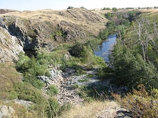
| Kotrtas Qotyrtas | |
|---|---|
| Village | |
| Coordinates: 48°21′0″N58°49′0″E / 48.35000°N 58.81667°E Coordinates: 48°21′0″N58°49′0″E / 48.35000°N 58.81667°E | |
| Country | Kazakhstan |
| Region | Aktobe Region |
| Time zone | Central Asia Time (UTC+5) |
Kotrtas or Qotyrtas is a village in the Aktobe Region of western Kazakhstan. [1]

Aktobe Region is a region of Kazakhstan. The Aktobe regional capital is the city of Aktobe, with a population of more than 340,000. The region itself has a population 678,900. The name "Aktobe" comes from Kazakh "Ақ" (white) and "төбе" (hill); supposedly, Aktobe's initial settlers were able to see white mountains far to the north.

Kazakhstan, officially the Republic of Kazakhstan, is the world's largest landlocked country, and the ninth largest in the world, with an area of 2,724,900 square kilometres (1,052,100 sq mi). It is a transcontinental country largely located in Asia; the most western parts are in Europe. Kazakhstan is the dominant nation of Central Asia economically, generating 60% of the region's GDP, primarily through its oil and gas industry. It also has vast mineral resources.

