Altyndy

Last updated

Coordinates: 48°56′43″N58°41′10″E / 48.94528°N 58.68611°E / 48.94528; 58.68611

Geographic coordinate system Coordinate system

A geographic coordinate system is a coordinate system that enables every location on Earth to be specified by a set of numbers, letters or symbols. The coordinates are often chosen such that one of the numbers represents a vertical position and two or three of the numbers represent a horizontal position; alternatively, a geographic position may be expressed in a combined three-dimensional Cartesian vector. A common choice of coordinates is latitude, longitude and elevation. To specify a location on a plane requires a map projection.

Altyndy
Алтынды
Алтынды
التىندى
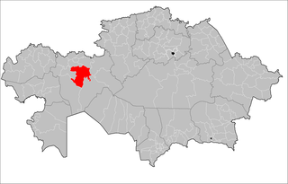
Kazakhstan adm location map.svg
Red pog.svg
Altyndy
Coordinates: 48°56′43″N58°41′10″E / 48.94528°N 58.68611°E / 48.94528; 58.68611
CountryFlag of Kazakhstan.svg  Kazakhstan
Region Aktobe
Elevation 402 m (1,319 ft)
Time zone West Kazakhstan Time (UTC+5)
  Summer (DST) West Kazakhstan Time (UTC+5)

Altyndy [1] (Russian : Алтынды, Altyndy, Kazakh : Алтынды, Altındı, التىندى) is a town in Aktobe Region, west Kazakhstan. It lies at an altitude of 402 m (1,319 ft). [1]

Russian language East Slavic language

Russian is an East Slavic language, which is official in the Russian Federation, Belarus, Kazakhstan and Kyrgyzstan, as well as being widely used throughout Eastern Europe, the Baltic states, the Caucasus and Central Asia. It was the de facto language of the Soviet Union until its dissolution on 25 December 1991. Although, nowadays, nearly three decades after the breakup of the Soviet Union, Russian is used in official capacity or in public life in all the post-Soviet nation-states, as well as in Israel and Mongolia, the rise of state-specific varieties of this language tends to be strongly denied in Russia, in line with the Russian World ideology.

Kazakh language Turkic language

Kazakh or Kazak belongs to the Kipchak branch of the Turkic languages. It is closely related to Nogai, Kyrgyz, and Karakalpak. Kazakh is the official language of the Republic of Kazakhstan and a significant minority language in the Ili Kazakh Autonomous Prefecture in Xinjiang, China and in the Bayan-Ölgii Province of Mongolia. Kazakh is also spoken by many ethnic Kazakhs through the former Soviet Union, Afghanistan, Iran, Turkey, and Germany.
Aktobe Region Region in Kazakhstan

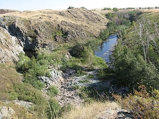
Aktobe Region is a region of Kazakhstan. The Aktobe regional capital is the city of Aktobe, with a population of more than 340,000. The region itself has a population 678,900. The name "Aktobe" comes from Kazakh "Ақ" (white) and "төбе" (hill); supposedly, Aktobe's initial settlers were able to see white mountains far to the north.

Related Research Articles

Jurva former municipality of Finland, now part of Kurikka

Jurva is a former municipality of Finland. It was consolidated to Kurikka on 1 January 2009.

Marley is a hamlet in the civil parish of Harrietsham that, in turn, forms part of the district of Maidstone in the English county of Kent.

Chirag Gala

Chirag Gala, also spelled Çiraq Qala or Çirax Qala, which means lamp castle in Azerbaijani is a ruined ancient fortress overlooking the Caspian coastal plains north of Baku in Azerbaijan. It is located on the top of a mountain, in the Guba Forest. It was constructed by the Sassanid Persians in the 5th century, it was used as a defense for the khanate of Quba in the 18th century.

Kargaly District District in Aktobe Region, Kazakhstan

Kargaly is a district of Aktobe Region in Kazakhstan. The administrative center of the district is the settlement of Badamsha. Population: 16,741 ; 16,781 ; 19,172.

Mugalzhar District District in Aktobe Region, Kazakhstan

Mugalzhar is a district of Aktobe Region in Kazakhstan. The administrative center of the district is the town of Kandyagash. Two more towns, Embi and Zhem, belong to the district. Population: 64,553 ; 62,115 ; 63,812.

Kurmangazy District District in Atyrau Region, Kazakhstan

Kurmangazy District is a district of Atyrau Region in Kazakhstan. The administrative center of the district is the selo of Ganyushkino. Population: 57,138 ; 55,502 ; 55,579.

Abay District, East Kazakhstan District in East Kazakhstan Region, Kazakhstan

Abay is a district of East Kazakhstan Region in eastern Kazakhstan. The administrative center of the district is the selo of Karauyl. Population: 15,228 ; 15,258 ; 17,885.

Rondos District is one of seven districts of the province Lauricocha in Peru.

Yuxarı Mollu Place in Qubadli

Yuxarı Mollu is a village in the Qubadli Rayon of Azerbaijan.

Muruqoba Place in Khachmaz, Azerbaijan

Muruqoba is a village in the Khachmaz Rayon of Azerbaijan. The village forms part of the municipality of Ləcət.

Kolonia Zawada Village in Łódź, Poland

Kolonia Zawada is a village in the administrative district of Gmina Tomaszów Mazowiecki, within Tomaszów Mazowiecki County, Łódź Voivodeship, in central Poland. It lies approximately 5 kilometres (3 mi) west of Tomaszów Mazowiecki and 45 km (28 mi) south-east of the regional capital Łódź.

Łazy Biegonickie Village in Lesser Poland, Poland

Łazy Biegonickie is a village in the administrative district of Gmina Stary Sącz, within Nowy Sącz County, Lesser Poland Voivodeship, in southern Poland. It lies approximately 4 kilometres (2 mi) east of Stary Sącz, 7 km (4 mi) south of Nowy Sącz, and 77 km (48 mi) south-east of the regional capital Kraków.

Siekierno Village in Świętokrzyskie, Poland

Siekierno is a village in the administrative district of Gmina Bodzentyn, within Kielce County, Świętokrzyskie Voivodeship, in south-central Poland. It lies approximately 5 kilometres (3 mi) north of Bodzentyn and 26 km (16 mi) north-east of the regional capital Kielce.

Gruda, Bartoszyce County Village in Warmian-Masurian, Poland

Gruda is a village in the administrative district of Gmina Bartoszyce, within Bartoszyce County, Warmian-Masurian Voivodeship, in northern Poland, close to the border with the Kaliningrad Oblast of Russia. It lies approximately 11 kilometres (7 mi) east of Bartoszyce and 57 km (35 mi) north-east of the regional capital Olsztyn.

Hunjiang District District in Jilin, Peoples Republic of China

Hunjiang District is a district of the city of Baishan, Jilin, People's Republic of China. It was known as Bādàojiāng District (八道江区) until 22 February 2010, when the State Council of the People's Republic of China approved the name change.

Metsaääre, Pärnu County is a village in Surju Parish, Pärnu County in southwestern Estonia.

The Canton of Saint-Pol-de-Léon is a French canton, located in the arrondissement of Morlaix, in the Finistère département. Since the French canton reorganisation which came into effect in March 2015, the communes of the canton of Saint-Pol-de-Léon are:

Taschagil Place in Atyrau, Kazakhstan

Taschagil is a town in Atyrau Region, west Kazakhstan. It lies at an altitude of 16 m (52 ft).

Birshoghyr Place in Aktobe, Kazakhstan

Birshoghyr, known as Berchogur during the Soviet era, is a town in Aktobe Region, west Kazakhstan. It lies at an altitude of 396 m (1,299 ft).

Bestamak Place in Aktobe, Kazakhstan

Bestamak is a town in Aktobe Region, west Kazakhstan. It lies at an altitude of 246 m (807 ft).

References

  1. 1 2 "Altyndy, Kazakhstan - P PPL 863528". GeoNames . Retrieved September 26, 2016.