Alpyspay

Last updated

Coordinates: 50°13′50″N56°12′32″E / 50.23056°N 56.20889°E / 50.23056; 56.20889

Geographic coordinate system Coordinate system

A geographic coordinate system is a coordinate system that enables every location on Earth to be specified by a set of numbers, letters or symbols. The coordinates are often chosen such that one of the numbers represents a vertical position and two or three of the numbers represent a horizontal position; alternatively, a geographic position may be expressed in a combined three-dimensional Cartesian vector. A common choice of coordinates is latitude, longitude and elevation. To specify a location on a plane requires a map projection.

Alpyspay
Алпыспай
Kazakhstan adm location map.svg
Red pog.svg
Alpyspay
Coordinates: 49°39′26″N57°20′22″E / 49.65722°N 57.33944°E / 49.65722; 57.33944
CountryFlag of Kazakhstan.svg  Kazakhstan
Region Aktobe
Elevation 181 m (594 ft)
Time zone West Kazakhstan Time (UTC+5)
  Summer (DST) West Kazakhstan Time (UTC+5)

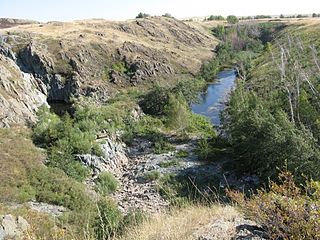
Alpyspay [1] (Russian : Алпыспай, Alpyspay) is a town in Aktobe Region, west Kazakhstan. It lies at an altitude of 181 m (594 ft). [1]

Russian language East Slavic language

Russian is an East Slavic language, which is official in the Russian Federation, Belarus, Kazakhstan and Kyrgyzstan, as well as being widely used throughout Eastern Europe, the Baltic states, the Caucasus and Central Asia. It was the de facto language of the Soviet Union until its dissolution on 25 December 1991. Although, nowadays, nearly three decades after the breakup of the Soviet Union, Russian is used in official capacity or in public life in all the post-Soviet nation-states, as well as in Israel and Mongolia, the rise of state-specific varieties of this language tends to be strongly denied in Russia, in line with the Russian World ideology.

Aktobe Region Region in Kazakhstan

Aktobe Region is a region of Kazakhstan. The Aktobe regional capital is the city of Aktobe, with a population of more than 340,000. The region itself has a population 678,900. The name "Aktobe" comes from Kazakh "Ақ" (white) and "төбе" (hill); supposedly, Aktobe's initial settlers were able to see white mountains far to the north.

Kazakhstan transcontinental republic in Asia and Europe

Kazakhstan, officially the Republic of Kazakhstan, is the world's largest landlocked country, and the ninth largest in the world, with an area of 2,724,900 square kilometres (1,052,100 sq mi). It is a transcontinental country largely located in Asia; the most western parts are located in Europe. Kazakhstan is the dominant nation of Central Asia economically, generating 60% of the region's GDP, primarily through its oil/gas industry. It also has vast mineral resources.

Related Research Articles

Lakeland, Tennessee City in Tennessee, United States

Lakeland is a city in Shelby County, Tennessee, and a suburb of Memphis. The population was 12,430 at the 2010 census.

Cəlilabad City & Municipality in Azerbaijan

Cəlilabad is a city in and the capital of the Jalilabad Rayon of Azerbaijan. The city is named after Jalil Mammadguluzadeh.

Vicat company

Vicat SA is a French company manufacturing cement, aggregates and ready-mix concrete in four continents.

Grzegorz, Kuyavian-Pomeranian Voivodeship Village in Kuyavian-Pomeranian, Poland

Grzegorz is a village in the administrative district of Gmina Chełmża, within Toruń County, Kuyavian-Pomeranian Voivodeship, in north-central Poland. It lies approximately 7 kilometres (4 mi) north-east of Chełmża and 23 km (14 mi) north of Toruń.

Dokudów Drugi Village in Lublin, Poland

Dokudów Drugi is a village in the administrative district of Gmina Biała Podlaska, within Biała Podlaska County, Lublin Voivodeship, in eastern Poland.

Wólka Bielecka is a village in the administrative district of Gmina Milejów, within Łęczna County, Lublin Voivodeship, in eastern Poland.

Ilkowice, Miechów County Village in Lesser Poland, Poland

Ilkowice is a village in the administrative district of Gmina Słaboszów, within Miechów County, Lesser Poland Voivodeship, in southern Poland. It lies approximately 4 kilometres (2 mi) west of Słaboszów, 15 km (9 mi) east of Miechów, and 42 km (26 mi) north-east of the regional capital Kraków.

Lipsko-Kosobudy Village in Lublin, Poland

Lipsko-Kosobudy is a village in the administrative district of Gmina Zamość, within Zamość County, Lublin Voivodeship, in eastern Poland. It lies approximately 8 kilometres (5 mi) south of Zamość and 81 km (50 mi) south-east of the regional capital Lublin.

Kłyż Village in Lesser Poland, Poland

Kłyż is a village in the administrative district of Gmina Żabno, within Tarnów County, Lesser Poland Voivodeship, in southern Poland. It lies approximately 9 kilometres (6 mi) north of Żabno, 23 km (14 mi) north-west of Tarnów, and 67 km (42 mi) east of the regional capital Kraków.

Potok Mały Village in Świętokrzyskie, Poland

Potok Mały is a village in the administrative district of Gmina Jędrzejów, within Jędrzejów County, Świętokrzyskie Voivodeship, in south-central Poland. It lies approximately 7 kilometres (4 mi) south-west of Jędrzejów and 43 km (27 mi) south-west of the regional capital Kielce.

Plechówka is a village in the administrative district of Gmina Kazimierza Wielka, within Kazimierza County, Świętokrzyskie Voivodeship, in south-central Poland.

Marcinków, Silesian Voivodeship Village in Silesian, Poland

Marcinków is a village in the administrative district of Gmina Siewierz, within Będzin County, Silesian Voivodeship, in southern Poland. It lies approximately 6 kilometres (4 mi) south of Siewierz, 13 km (8 mi) north-east of Będzin, and 25 km (16 mi) north-east of the regional capital Katowice.

Jarnołtów, Opole Voivodeship Village in Opole, Poland

Jarnołtów is a village in the administrative district of Gmina Otmuchów, within Nysa County, Opole Voivodeship, in south-western Poland, close to the Czech border. It lies approximately 12 kilometres (7 mi) south of Otmuchów, 14 km (9 mi) south-west of Nysa, and 60 km (37 mi) south-west of the regional capital Opole.

Skwierzynka Village in West Pomeranian, Poland

Skwierzynka is a village in the administrative district of Gmina Sianów, within Koszalin County, West Pomeranian Voivodeship, in north-western Poland. It lies approximately 7 kilometres (4 mi) west of Sianów, 6 km (4 mi) north of Koszalin, and 140 km (87 mi) north-east of the regional capital Szczecin.

Tuřany (Kladno District) Municipality and village in Central Bohemian Region, Czech Republic

Tuřany is a village and municipality in Kladno District in the Central Bohemian Region of the Czech Republic.

Neroberg mountain

Neroberg is a hill in Wiesbaden in Hesse, Germany.

Miloševići, Višegrad Village in Republika Srpska, Bosnia and Herzegovina

Miloševići is a village in the municipality of Višegrad, Bosnia and Herzegovina.

Donji Drežanj Village in Republika Srpska, Bosnia and Herzegovina

Donji Drežanj is a village in the municipality of Nevesinje, Republika Srpska, Bosnia and Herzegovina.

Žeimiai Manor

Žeimiai Manor is a former residential manor in Žeimiai, Jonava district. Currently it is under reconstruction.

Simmons is an unincorporated community in Texas County, in the U.S. state of Missouri. The community is located at the intersection of US Route 63 and Missouri Route Z about seven miles south of Houston. The Big Piney River flows past the east side of the community.

References

  1. 1 2 "Alpyspay, Kazakhstan - P PPL 610650". GeoNames . Retrieved September 25, 2016.