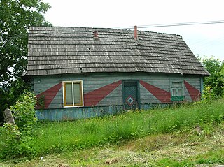
Bogoslovka, Kazakhstan

Last updated

Coordinates: 50°06′03″N56°49′26″E / 50.10083°N 56.82389°E / 50.10083; 56.82389

Geographic coordinate system Coordinate system

A geographic coordinate system is a coordinate system that enables every location on Earth to be specified by a set of numbers, letters or symbols. The coordinates are often chosen such that one of the numbers represents a vertical position and two or three of the numbers represent a horizontal position; alternatively, a geographic position may be expressed in a combined three-dimensional Cartesian vector. A common choice of coordinates is latitude, longitude and elevation. To specify a location on a plane requires a map projection.

Bogoslovka
Богословка
Kazakhstan adm location map.svg
Red pog.svg
Bogoslovka
Coordinates: 50°06′03″N56°49′26″E / 50.10083°N 56.82389°E / 50.10083; 56.82389
CountryFlag of Kazakhstan.svg  Kazakhstan
Region Aktobe
Elevation 336 m (1,102 ft)
Time zone West Kazakhstan Time (UTC+5)
  Summer (DST) West Kazakhstan Time (UTC+5)

Bogoslovka (also known as Bogoslavskoye [1] (Russian : Богословка, Bogoslovka)) is a town in Aktobe Region, west Kazakhstan. It lies at an altitude of 336 m (1,102 ft). [1]

Russian language East Slavic language

Russian is an East Slavic language, which is official in the Russian Federation, Belarus, Kazakhstan and Kyrgyzstan, as well as being widely used throughout Eastern Europe, the Baltic states, the Caucasus and Central Asia. It was the de facto language of the Soviet Union until its dissolution on 25 December 1991. Although, nowadays, nearly three decades after the breakup of the Soviet Union, Russian is used in official capacity or in public life in all the post-Soviet nation-states, as well as in Israel and Mongolia, the rise of state-specific varieties of this language tends to be strongly denied in Russia, in line with the Russian World ideology.
Aktobe Region Region in Kazakhstan

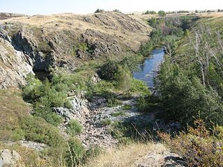
Aktobe Region is a region of Kazakhstan. The Aktobe regional capital is the city of Aktobe, with a population of more than 340,000. The region itself has a population 678,900. The name "Aktobe" comes from Kazakh "Ақ" (white) and "төбе" (hill); supposedly, Aktobe's initial settlers were able to see white mountains far to the north.

Kazakhstan transcontinental republic in Asia and Europe

Kazakhstan, officially the Republic of Kazakhstan, is the world's largest landlocked country, and the ninth largest in the world, with an area of 2,724,900 square kilometres (1,052,100 sq mi). It is a transcontinental country largely located in Asia; the most western parts are located in Europe. Kazakhstan is the dominant nation of Central Asia economically, generating 60% of the region's GDP, primarily through its oil/gas industry. It also has vast mineral resources.

Related Research Articles

Bukovina nad Labem Village in Pardubice District of Pardubice region

Bukovina nad Labem is a village in the Pardubice Region of the Czech Republic. It has approximately 220 inhabitants.

Mojków Village in Lower Silesian, Poland

Mojków is a village in the administrative district of Gmina Strzelin, within Strzelin County, Lower Silesian Voivodeship, in south-western Poland. Prior to 1945 it was in Germany.

Martuk District District in Akmola Region, Kazakhstan

Martuk is a district of Aktobe Region in Kazakhstan. The administrative center of the district is the selo of Martuk. Population: 29,647 ; 29,843 ; 31,084.

Sulechów, Lesser Poland Voivodeship Village in Lesser Poland, Poland

Sulechów is a village in the administrative district of Gmina Kocmyrzów-Luborzyca, within Kraków County, Lesser Poland Voivodeship, in southern Poland. It lies approximately 14 km (9 mi) north-east of the regional capital Kraków. The village is located in the historical region Galicia.

Staw Ujazdowski-Kolonia is a village in the administrative district of Gmina Nielisz, within Zamość County, Lublin Voivodeship, in eastern Poland.

Paprocice Village in Świętokrzyskie, Poland

Paprocice is a village in the administrative district of Gmina Nowa Słupia, within Kielce County, Świętokrzyskie Voivodeship, in south-central Poland. It lies approximately 5 kilometres (3 mi) south of Nowa Słupia and 33 km (21 mi) east of the regional capital Kielce.

Lipowa, Świętokrzyskie Voivodeship Village in Świętokrzyskie, Poland

Lipowa is a village in the administrative district of Gmina Opatów, within Opatów County, Świętokrzyskie Voivodeship, in south-central Poland. It lies approximately 3 kilometres (2 mi) north-east of Opatów and 59 km (37 mi) east of the regional capital Kielce.

Zaskale, Świętokrzyskie Voivodeship Village in Świętokrzyskie, Poland

Zaskale is a village in the administrative district of Gmina Łączna, within Skarżysko County, Świętokrzyskie Voivodeship, in south-central Poland. It lies approximately 3 kilometres (2 mi) south-east of Łączna, 17 km (11 mi) south-west of Skarżysko-Kamienna, and 19 km (12 mi) north-east of the regional capital Kielce.

Karminiec Village in Greater Poland, Poland

Karminiec is a village in the administrative district of Gmina Dobrzyca, within Pleszew County, Greater Poland Voivodeship, in west-central Poland. It lies approximately 6 kilometres (4 mi) south-east of Dobrzyca, 12 km (7 mi) south-west of Pleszew, and 81 km (50 mi) south-east of the regional capital Poznań.

Markotów Mały is a village in the administrative district of Gmina Wołczyn, within Kluczbork County, Opole Voivodeship, in south-western Poland.

Kopalina, Krapkowice County Settlement in Opole, Poland

Kopalina, German: Kopaline is a settlement in the administrative district of Gmina Strzeleczki, within Krapkowice County, Opole Voivodeship, in south-western Poland. It lies approximately 5 kilometres (3 mi) north-west of Strzeleczki, 11 km (7 mi) west of Krapkowice, and 21 km (13 mi) south of the regional capital Opole.

Wielki Klincz Village in Pomeranian, Poland

Wielki Klincz is a village in the administrative district of Gmina Kościerzyna, within Kościerzyna County, Pomeranian Voivodeship, in northern Poland. It lies approximately 6 kilometres (4 mi) east of Kościerzyna and 48 km (30 mi) south-west of the regional capital Gdańsk.

Sąglewo Village in Warmian-Masurian, Poland

Sąglewo is a village in the administrative district of Gmina Miłakowo, within Ostróda County, Warmian-Masurian Voivodeship, in northern Poland. It lies approximately 8 kilometres (5 mi) south of Miłakowo, 28 km (17 mi) north of Ostróda, and 32 km (20 mi) north-west of the regional capital Olsztyn.

Gārsene parish is an administrative unit of the Aknīste Municipality, Latvia. It was formerly in the Jēkabpils District.

Collins Crossing is an unincorporated community in Caroline County, in the U.S. state of Virginia.

Rõude is a village in Lääne-Nigula Parish, Lääne County, in western Estonia.

Columbia Lake Ecological Reserve is a nature reserve on Columbia Lake in the East Kootenay region of British Columbia, Canada, located on the east side of Columbia Lake just north of the village of Canal Flats.

Alpyspay Place in Aktobe, Kazakhstan

Alpyspay is a town in Aktobe Region, west Kazakhstan. It lies at an altitude of 181 m (594 ft).

Baturasay Place in Aktobe, Kazakhstan

Baturasay is a town in Aktobe Region, west Kazakhstan. It has an altitude of 220 m (720 ft).

Chernovodsk Place in Aktobe, Kazakhstan

Chernovodsk is a town in Aktobe Region, west Kazakhstan. It lies at an altitude of 318 m (1,043 ft).

References

  1. 1 2 "Bogoslovka, Kazakhstan - P PPL 610254". GeoNames . Retrieved October 5, 2016.