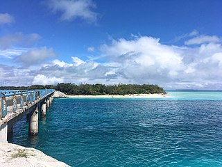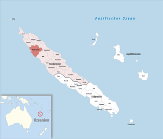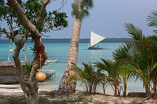
New Caledonia is a sui generis collectivity of overseas France in the southwest Pacific Ocean, south of Vanuatu, about 1,210 km (750 mi) east of Australia, and 17,000 km (11,000 mi) from Metropolitan France. The archipelago, part of the Melanesia subregion, includes the main island of Grande Terre, the Loyalty Islands, the Chesterfield Islands, the Belep archipelago, the Isle of Pines, and a few remote islets. The Chesterfield Islands are in the Coral Sea. French people, especially locals, call Grande Terre le Caillou, a nickname also used more generally for the entire New Caledonia. Pro-independence Kanak parties use the name (la) Kanaky to refer to New Caledonia, a term coined in the 1980s from the ethnic name of the indigenous Melanesian Kanak people who make up 41% of New Caledonia's population. New Caledonia is one of the European Union's Overseas Countries and Territories (OCTs), but it is not part of the European Union.

The geography of New Caledonia (Nouvelle-Calédonie), an overseas collectivity of France located in the subregion of Melanesia, makes the continental island group unique in the southwest Pacific. Among other things, the island chain has played a role in preserving unique biological lineages from the Mesozoic. It served as a waystation in the expansion of the predecessors of the Polynesians, the Lapita culture. Under the Free French it was a vital naval base for Allied Forces during the War in the Pacific.

Nouméa is the capital and largest city of the French special collectivity of New Caledonia and is also the largest francophone city in Oceania. It is situated on a peninsula in the south of New Caledonia's main island, Grande Terre, and is home to the majority of the island's European, Polynesian, Indonesian, and Vietnamese populations, as well as many Melanesians, Ni-Vanuatu and Kanaks who work in one of the South Pacific's most industrialised cities. The city lies on a protected deepwater harbour that serves as the chief port for New Caledonia.

Ouvéa or Uvea is a commune in the Loyalty Islands Province of New Caledonia, an overseas territory of France in the Pacific Ocean. The settlement of Fayaoué, on Ouvéa Island, is the administrative centre of the commune.

Lifou is a commune of France in the Loyalty Islands Province of New Caledonia, Pacific Ocean.

Punaʻauia is a commune in the suburbs of Papeʻete in French Polynesia, an overseas territory of France in the Pacific Ocean. Punaʻauia is located on the island of Tahiti, in the administrative subdivision of the Windward Islands, themselves part of the Society Islands. In the late 1890s, the French painter Paul Gauguin lived in Punaʻauia. Here he painted his masterpiece Where Do We Come From? What Are We? Where Are We Going?. The commune borders Faʻaʻā on the north and Pāʻea on the south.

Belep is a commune in the North Province of New Caledonia, an overseas territory of France in the Pacific Ocean. It has almost 900 people living on 70 km2.

Houaïlou is a commune in the North Province of New Caledonia, an overseas territory of France in the Pacific Ocean.

Kaala-Gomen is a commune in the North Province of New Caledonia, an overseas territory of France in the Pacific Ocean. It is situated on RT1 and is approximately 18 km south of Koumac, 50 km north of Voh, and 365 km from Nouméa.

Koné is a commune in the North Province of New Caledonia, a special collectivity of France in the Pacific Ocean. Koné is the provincial seat of the North Province.

La Foa is a commune in the South Province of New Caledonia, an overseas territory of France in the Pacific Ocean.

Païta is a commune in the suburbs of Nouméa in the South Province of New Caledonia, an overseas territory of France in the Pacific Ocean. New Caledonia's international airport, La Tontouta International Airport, is located there.

Poindimié is a commune in the North Province of New Caledonia, an overseas territory of France in the Pacific Ocean. The Poindimié Islands, a group of seven tiny islets where seabirds and sea turtles nest, lies off the coast of the commune.

Poya is a commune in New Caledonia, an overseas territory of France in the Pacific Ocean. The largest part of the commune lies in the North Province of New Caledonia, and a smaller part of the commune lies in the South Province, an odd situation resulting from the creation of New Caledonia's provinces in 1989. At the 2019 census, 2,592 of the 2,802 inhabitants of Poya lived on the North Province's side of the commune, while only 210 inhabitants lived on the South Province's side.

Touho is a commune in the North Province of New Caledonia, an overseas territory of France in the Pacific Ocean. Touho lies on the east coast of the main island and is served by a road and an airfield.

Yaté is a commune in the South Province of New Caledonia, an overseas territory of France in the Pacific Ocean. The Yaté Dam and Blue River Provincial Park are located within the commune.

Boulouparis is a commune in the South Province of New Caledonia, an overseas territory of France in the Pacific Ocean.

L'Île-des-Pins is a commune in the South Province of New Caledonia, an overseas territory of France in the Pacific Ocean. L'Île-des-Pins is made up of the Isle of Pines, the smaller Kôtomo Island, and several islets around these two, as well as the distant island of Walpole, which is located almost 150 kilometres to the east. The Isle of Pines and adjacent islands are located to the south of New Caledonia's mainland. At 16,830 km from Paris, L'Île-des-Pins is further from the French capital than any other commune of France. The settlement of Vao, on the Isle of Pines, is the administrative centre of the commune of L'Île-des-Pins.

Maré Island or Nengone is the second-largest of the Loyalty Islands, in the archipelago of New Caledonia, an overseas territory of France in the Pacific Ocean. The island is part of the commune (municipality) of Maré, in the Loyalty Islands Province of New Caledonia.

Solbach is a commune in the Bas-Rhin department in Grand Est in north-eastern France.


