Kruševica (Vlasotince)

Last updated
Kruševica
Крушевица
Village
Serbia adm location map.svg
Red pog.svg
Kruševica
Coordinates: 42°59′46″N22°10′40″E / 42.99611°N 22.17778°E / 42.99611; 22.17778
CountryFlag of Serbia.svg  Serbia
District Jablanica District
Municipality Vlasotince
Population (2002)
  Total 567
Time zone CET (UTC+1)
  Summer (DST) CEST (UTC+2)

Kruševica is a village in the municipality of Vlasotince, Serbia. According to the 2002 census, the village has a population of 567 people. [1]

Village Small clustered human settlement smaller than a town

A village is a clustered human settlement or community, larger than a hamlet but smaller than a town, with a population ranging from a few hundred to a few thousand. Though villages are often located in rural areas, the term urban village is also applied to certain urban neighborhoods. Villages are normally permanent, with fixed dwellings; however, transient villages can occur. Further, the dwellings of a village are fairly close to one another, not scattered broadly over the landscape, as a dispersed settlement.

Vlasotince Town and municipality in Southern and Eastern Serbia, Serbia

Vlasotince is a town and municipality located in Jablanica District of southern Serbia. As of 2011, the municipality has 29,669 inhabitants, while the town itself has a population of 15,830 inhabitants.

Serbia Republic in Southeastern Europe

Serbia, officially the Republic of Serbia, is a country situated at the crossroads of Central and Southeast Europe in the southern Pannonian Plain and the central Balkans. The sovereign state borders Hungary to the north, Romania to the northeast, Bulgaria to the southeast, North Macedonia to the south, Croatia and Bosnia and Herzegovina to the west, and Montenegro to the southwest. The country claims a border with Albania through the disputed territory of Kosovo. Serbia's population is about seven million. Its capital, Belgrade, ranks among the oldest and largest citiеs in southeastern Europe.

Related Research Articles

Browning Pond lake in United States of America

Browning Pond is located in Oakham and Spencer, Massachusetts. This 89-acre (360,000 m2) great pond forms the headwaters of the Seven Mile River. It is part of the Chicopee River Watershed.

Józefowo, Gmina Włocławek Village in Kuyavian-Pomeranian, Poland

Józefowo is a village in the administrative district of Gmina Włocławek, within Włocławek County, Kuyavian-Pomeranian Voivodeship, in north-central Poland. It lies approximately 9 kilometres (6 mi) east of Włocławek and 59 km (37 mi) south-east of Toruń.

Aydinlar, Shabran Place in Davachi, Azerbaijan

Aydinlar is a village in the Shabran District of Azerbaijan.

Xallanlı Place in Kalbajar

Xallanlı is a village in the Kalbajar Rayon of Azerbaijan.

Qarababa, Zangilan Place in Zangilan, Azerbaijan

Qarababa is a village in the Zangilan Rayon of Azerbaijan.

Wola-Dąbrowa Village in Łódź, Poland

Wola-Dąbrowa is a village in the administrative district of Gmina Wartkowice, within Poddębice County, Łódź Voivodeship, in central Poland. It lies approximately 5 kilometres (3 mi) east of Wartkowice, 14 km (9 mi) north-east of Poddębice, and 36 km (22 mi) north-west of the regional capital Łódź.

Bonów is a village in the administrative district of Gmina Trawniki, within Świdnik County, Lublin Voivodeship, in eastern Poland.

Piaski, Lesser Poland Voivodeship Village in Lesser Poland, Poland

Piaski is a village in the administrative district of Gmina Żabno, within Tarnów County, Lesser Poland Voivodeship, in southern Poland. It lies approximately 6 kilometres (4 mi) north of Żabno, 19 km (12 mi) north-west of Tarnów, and 68 km (42 mi) east of the regional capital Kraków.

Góry Zborowskie Village in Greater Poland, Poland

Góry Zborowskie is a village in the administrative district of Gmina Żelazków, within Kalisz County, Greater Poland Voivodeship, in west-central Poland. It lies approximately 12 kilometres (7 mi) north-east of Kalisz and 107 km (66 mi) south-east of the regional capital Poznań.

Głucha Puszcza is a village in the administrative district of Gmina Orchowo, within Słupca County, Greater Poland Voivodeship, in west-central Poland.

Lipnica, Pomeranian Voivodeship Village in Pomeranian, Poland

Lipnica is a village in Gmina Lipnica, Bytów County, Pomeranian Voivodeship, in northern Poland. It lies approximately 20 kilometres (12 mi) south-west of Bytów and 90 km (56 mi) south-west of Gdańsk.

Dębina, Kościerzyna County Settlement in Pomeranian, Poland

Dębina is a settlement in the administrative district of Gmina Dziemiany, within Kościerzyna County, Pomeranian Voivodeship, in northern Poland. It lies approximately 3 kilometres (2 mi) south-east of Dziemiany, 18 km (11 mi) south-west of Kościerzyna, and 68 km (42 mi) south-west of the regional capital Gdańsk.

Wielbark, Pomeranian Voivodeship Village in Pomeranian, Poland

Wielbark is a village in the administrative district of Gmina Malbork, within Malbork County, Pomeranian Voivodeship, in northern Poland. It lies approximately 5 kilometres (3 mi) south-west of Malbork, and is 48 km (30 mi) south-east of the regional capital Gdańsk. The village has a population of 103.

Spurgle is a village in the administrative district of Gmina Bartoszyce, within Bartoszyce County, Warmian-Masurian Voivodeship, in northern Poland, close to the border with the Kaliningrad Oblast of Russia.

Łazdoje Village in Warmian-Masurian, Poland

Łazdoje is a village in the administrative district of Gmina Kętrzyn, within Kętrzyn County, Warmian-Masurian Voivodeship, in northern Poland. It lies approximately 12 kilometres (7 mi) south-west of Kętrzyn and 58 km (36 mi) north-east of the regional capital Olsztyn.

Puyan, Changhua Rural township

Puyan Township is a rural township in Changhua County, Taiwan.

Mrštane Village in Jablanica District, Serbia

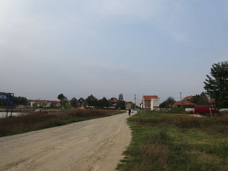
Mrštane is a village in the municipality of Leskovac, Serbia. According to the 2002 census, the village has a population of 1431 people.

Šumata Trnica Village in Pčinja District, Serbia

Šumata Trnica is a village in the municipality of Trgovište, in southeastern Serbia. According to the 2002 census, the village has a population of 50 people.

Žulj Village in Republika Srpska, Bosnia and Herzegovina

Žulj is a village in the municipality of Sokolac, Bosnia and Herzegovina. In 1991 it had a population of 75 people.

Halkapınar, Konya District in Turkey

Halkapınar is a town and district of Konya Province in the Central Anatolia region of Turkey. According to 2000 census, population of the district is 6,255 of which 2,021 live in the town of Halkapınar.

References

  1. Popis stanovništva, domaćinstava i Stanova 2002. Knjiga 1: Nacionalna ili etnička pripadnost po naseljima. Republika Srbija, Republički zavod za statistiku Beograd 2003. ISBN   86-84433-00-9

Coordinates: 42°59′46″N22°10′40″E / 42.99611°N 22.17778°E / 42.99611; 22.17778

Geographic coordinate system Coordinate system

A geographic coordinate system is a coordinate system that enables every location on Earth to be specified by a set of numbers, letters or symbols. The coordinates are often chosen such that one of the numbers represents a vertical position and two or three of the numbers represent a horizontal position; alternatively, a geographic position may be expressed in a combined three-dimensional Cartesian vector. A common choice of coordinates is latitude, longitude and elevation. To specify a location on a plane requires a map projection.