
South Kalimantan is a province of Indonesia. It is the second most populous province on the island of Kalimantan, the Indonesian territory of the island of Borneo after West Kalimantan. The provincial capital was Banjarmasin until 15 February 2022 when it was legally moved 35 kms southeast to Banjarbaru. The population of South Kalimantan was recorded at just over 3.625 million people at the 2010 Census, and at 4.07 million at the 2020 Census. The official estimate as at mid 2023 was 4,221,929. One of the five Indonesian provinces in Kalimantan, it is bordered by the Makassar Strait in the east, Central Kalimantan in the west and north, the Java Sea in the south, and East Kalimantan in the northeast. The province also includes the island of Pulau Laut, located off the eastern coast of Kalimantan, as well as other smaller offshore islands. The province is divided into 11 regencies and 2 cities. South Kalimantan is the traditional homeland of the Banjar people, although some parts of East Kalimantan and Central Kalimantan are also included in this criterion. Nevertheless, South Kalimantan, especially the former capital city Banjarmasin has always been the cultural capital of Banjarese culture. Many Banjarese have migrated to other parts of Indonesia, as well as neighbouring countries such as Singapore and Malaysia. In addition, other ethnic groups also inhabit the province, such as several groups of the Dayaks, who mostly live in the interior part of the province, as well as the Javanese, who mostly migrated from Java due to the Transmigration program which dated from the Dutch colonial era. It is one of the provinces in Indonesia that has a larger population than Mongolia.

Banjarmasin is a largest city in South Kalimantan, Indonesia. It was the capital of the province until 15 February 2022. The city is located on a delta island near the junction of the Barito and Martapura rivers. Historically the centre of the Banjarese culture, and the capital of the Sultanate of Banjar, it is the biggest city in South Kalimantan and one of the main cities of Kalimantan. The city covers an area of 98.46 km2 (38.02 sq mi) and had a population of 625,481 as of the 2010 Census and 657,663 as of the 2020 Census; the official estimate as of mid 2023 was 675,915. It is the third most populous city on the island of Borneo.

Kapuas Hulu Regency is a regency in West Kalimantan province of Indonesia. Located around the upper drainage area of the Kapuas River, it has a total land area of 31,318.25 square kilometres or around 21.3% of West Kalimantan province's area. The regency seat is located in town of Putussibau, where most of its economic and government activities take place. Kapuas Hulu Regency is one of the few Indonesian regencies having a land border with another country. It is also the largest regency in the province by land area. Due to its relatively large area, it is sparsely populated compared to neighbouring regencies around it. The regency had a population of 222,160 at the 2010 Census and 252,609 according to the 2020 Census; the official estimate as at mid 2023 was 262,404.

Purwokerto is a large but non-autonomous town on the island of Java, Indonesia. It is the coordinating centre of local government and the largest city in southwestern Central Java. Currently, Purwokerto is the capital of Banyumas Regency, Central Java province. The population of the four districts which comprise the town at the 2010 census was 233,951 and 229,271 at the 2020 census; the official estimate as of mid-2023 was 233,865. The City is considered to be the most comfortable city in Indonesia, as it is the favourite place for pensioners to live after they have finished working.

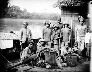
The Banjar or Banjarese are an Austronesian ethnic group native to the Banjar regions in the southeastern Kalimantan regions of Indonesia. Nowadays, Banjarese diaspora can be found in neighbouring Banjar regions as well; including Kotabaru Regency, the southeastern regions of Central Kalimantan, southernmost regions of East Kalimantan, and some provinces of Indonesia in general. The Banjarese diaspora community also can be found in neighbouring countries of Indonesia, such as Brunei, Malaysia, and Singapore.
Kumai is a port in Central Kalimantan province in Indonesia, on the island of Borneo. It lies on the Kumai River.

South Hulu Sungai Regency is one of the regencies (kabupaten) in South Kalimantan province, Indonesia. It had an area of 1,804.94 km2, and a population of 212,485 at the 2010 Census and 228,006 at the 2020 Census; the official estimate as at mid 2023 was 237.319. The capital of the regency is the town of Kandangan, which is famous for its culinary ketupat Kandangan.

Sampit is a large town located in East Kotawaringin Regency, Central Kalimantan. Previously a timber port town, it has grown to be a medium-sized community with a population of 166,773 according to Statistics Indonesia in 2019, with the economy having since divested from timber products. However, the town is not an autonomous city and not an administrative division by despite having a sizeable population and urban built-up. It consists of 11 urban villages (kelurahan) from Baamang District, Seranau District, and Mentawa Baru Ketapang District. The total area of the town is 751.45 square kilometres.
Bakumpai or Baraki are indigenous people of Borneo and are considered as a sub-ethnic group of the Dayak Ngaju people group with Islamic background. The Bakumpai people first occupy along the Barito riverbanks in South Kalimantan and Central Kalimantan, from Marabahan to Puruk Cahu, Murung Raya Regency. The Bakumpai people first appeared as a newly recognized people group in census 2000 and were made up of 7.51% of Central Kalimantan population, which before this the Bakumpai people were considered as part of the Dayak people in a 1930 census.

Seruyan Regency is one of the thirteen regencies which comprise the Central Kalimantan Province on the island of Kalimantan (Borneo), Indonesia. It was created on 10 April 2002 from what were previously the western districts of East Kotawaringin Regency. The town of Kuala Pembuang in Seruyan Hilir District is the capital of Seruyan Regency. The population of the Regency was 139,931 at the 2010 Census and 162,906 at the 2020 census; the official estimate was at mid 2023 was 171,304.

Tana Tidung Regency is a regency within the Indonesian province of North Kalimantan. It is Indonesia's least populous regency, with 25,584 inhabitants recorded in the 2020 census; the official estimate as at mid 2023 was 27,470. Its regency seat is the town of Tideng Pale, in Sesayap District, where 11,227 of the regency's population lived in mid 2023.

Malinau Kota is a district and the regency seat of Malinau Regency in North Kalimantan province. The town is the economic center of the regency, largest town in the regency, and serves as a gateway for interior towns and villages around the Heart of Borneo especially neighbouring Krayan region in Nunukan Regency. It had a population of 27,736 in mid 2022.
Tembilahan is a town and district of Indragiri Hilir Regency, in the Riau province of Indonesia. It is also the capital of the regency. Tembilahan District has an area of 162.14 km2, consisting of 8 villages. Tembilahan's population at the 2020 Census was 77,862, rising to 82,291 according to the official estimates for mid 2023.
This is a list of emblems or coat of arms used in Indonesia. Indonesia is divided into 38 provinces, and each province is divided into regencies (kabupaten) and cities (kota). There are 416 regencies and 98 cities. Each province, regency, and city has its own emblem.

Kuala Kapuas is the regency seat of Kapuas Regency and also one of the major towns in Central Kalimantan. This town is at a distance of 137 km northeast of Palangka Raya city, the capital of Central Kalimantan Province. The area of this town is mainly situated within six urban villages (kelurahan) and two rural districts (desa) in the district of Selat i.e. the kelurahan of Selat Barat, Selat Dalam, Selat Tengah, Selat Hulu, Selat Hilir and Selat Utara, and the desa of Pulau Telo, and Pulau Telo Baru. The total population of Kuala Kapuas as of 2019 was approximately 55,573 people
Banjarmasin metropolitan area officially Banjarbakula; or native name Wilayah metropolitan Banjarmasin is a metropolitan area located in Indonesia. This area includes Banjarmasin city and its surrounding areas such as Banjarbaru city, and Banjar Regency. This region of South Kalimantan province, officially the biggest city in Southern Kalimantan island on Barito River to Java Sea. It has an area of 5,072.11 km2, and at the 2023 estimate had a population of 1,526,061
The Seruyan Bridge is a bridge that crosses the Seruyan River, connecting Kuala Pembuang and Persil Raya to Pematang Panjang. The bridge is located in Seruyan Regency, Indonesia. The bridge, which is 590 meters long and 9 meters wide, connects Pematang Panjang village with the city of Kuala Pembuang, which is the capital of Seruyan Regency.


