
Barabinsk is a town in Novosibirsk Oblast, Russia, located in the Baraba steppe on the Trans-Siberian Railway between Omsk and Novosibirsk. Population: 30,394 (2010 Census); 32,501 (2002 Census); 36,501 (1989 Soviet census).

Kuybyshev is a town in Novosibirsk Oblast, Russia, located on the Om River, 315 kilometers (196 mi) west of Novosibirsk, the administrative center of the oblast. Population: 45,299 (2010 Census); 48,848 (2002 Census); 51,171 (1989 Soviet census); 40,000 (1970).

Kargat is a town and the administrative center of Kargatsky District in Novosibirsk Oblast, Russia, located on the river Kargat. Population: 10,042 (2010 Census); 11,184 (2002 Census); 12,561 (1989 Soviet census); 12,600 (1979); 12,700 (1959).
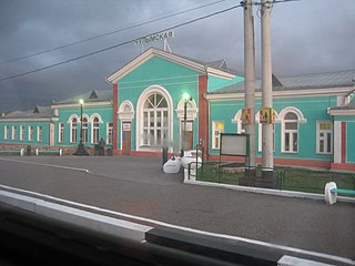
Chulym is a town and the administrative center of Chulymsky District in Novosibirsk Oblast, Russia, located on the Chulym River 131 kilometers (81 mi) from Novosibirsk, the administrative center of the oblast. Population: 11,568 (2010 Census); 12,275 (2002 Census); 13,703 (1989 Soviet census). It was previously known as Chulymskoye.

Karasuk is a town and the administrative center of Karasuksky District in Novosibirsk Oblast, Russia, located on the Karasuk River 678 kilometers (421 mi) west of Novosibirsk, the administrative center of the oblast. Population: 28,586 (2010 Census); 28,734 (2002 Census); 29,401 (1989 Soviet census).

Kupino is a town and the administrative center of Kupinsky District in Novosibirsk Oblast, Russia, located 581 kilometers (361 mi) west of Novosibirsk, the administrative center of the oblast. Population: 14,893 (2010 Census); 16,878 (2002 Census); 19,518 (1989 Soviet census).
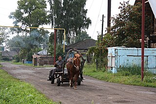
Bolotninsky District is an administrative and municipal district (raion), one of the thirty in Novosibirsk Oblast, Russia. It is located in the northeast of the oblast. The area of the district is 3,400 square kilometers (1,300 sq mi). Its administrative center is the town of Bolotnoye. Population: 29,365 ; 32,348 (2002 Census); 36,236 (1989 Soviet census). The population of Bolotnoye accounts for 56.4% of the district's total population.

Chanovsky District is an administrative and municipal district (raion), one of the thirty in Novosibirsk Oblast, Russia. It is located in the west of the oblast. The area of the district is 5,515 square kilometers (2,129 sq mi). Its administrative center is the urban locality of Chany. Population: 25,523 ; 29,391 (2002 Census); 34,199 (1989 Soviet census). The population of Chany accounts for 33.2% of the district's total population.

Chistoozyorny District is an administrative and municipal district (raion), one of the thirty in Novosibirsk Oblast, Russia. It is located in the southwest of the oblast. The area of the district is 5,690 square kilometers (2,200 sq mi). Its administrative center is the urban locality of Chistoozyornoye. Population: 19,603 ; 22,444 (2002 Census); 24,126 (1989 Soviet census). The population of Chistoozyornoye accounts for 32.8% of the district's total population.
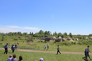
Kolyvansky District is an administrative and municipal district (raion), one of the thirty in Novosibirsk Oblast, Russia. It is located in the northeast of the oblast. The area of the district is 10,573 square kilometers (4,082 sq mi). Its administrative center is the urban locality of Kolyvan. Population: 24,049 ; 25,737 (2002 Census); 28,292 (1989 Soviet census). The population of Kolyvan accounts for 49.2% of the district's total population.

Krasnozyorsky District is an administrative and municipal district (raion), one of the thirty in Novosibirsk Oblast, Russia. It is located in the south of the oblast. The area of the district is 5,330 square kilometers (2,060 sq mi). Its administrative center is the urban locality of Krasnozyorskoye. Population: 32,491 ; 38,836 (2002 Census); 40,312 (1989 Soviet census). The population of Krasnozyorskoye accounts for 29.3% of the district's total population.
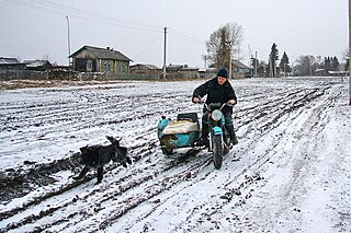
Kyshtovsky District is an administrative and municipal district (raion), one of the thirty in Novosibirsk Oblast, Russia. It is located in the northwest of the oblast. The area of the district is 11,101 square kilometers (4,286 sq mi). Its administrative center is the rural locality of Kyshtovka. Population: 12,399 ; 16,427 (2002 Census); 19,081 (1989 Soviet census). The population of Kyshtovka accounts for 42.6% of the district's total population.

Moshkovsky District is an administrative and municipal district (raion), one of the thirty in Novosibirsk Oblast, Russia. It is located in the northeast of the oblast. The area of the district is 2,591 square kilometers (1,000 sq mi). Its administrative center is the urban locality of Moshkovo. Population: 39,192 ; 41,281 (2002 Census); 41,879 (1989 Soviet census). The population of Moshkovo accounts for 26.1% of the district's total population.

Suzunsky District is an administrative and municipal district (raion), one of the thirty in Novosibirsk Oblast, Russia. It is located in the southeast of the oblast. The area of the district is 4,746 square kilometers (1,832 sq mi). Its administrative center is the urban locality of Suzun. Population: 32,592 ; 34,917 (2002 Census); 35,677 (1989 Soviet census). The population of Suzun accounts for 47.1% of the district's total population.

Tatarsky District is an administrative and municipal district (raion), one of the thirty in Novosibirsk Oblast, Russia. It is located in the west of the oblast. The area of the district is 4,870 square kilometers (1,880 sq mi). Its administrative center is the town of Tatarsk. Population: 15,875 ; 19,297 (2002 Census); 20,718 (1989 Soviet census).

Ubinsky District is an administrative and municipal district (raion), one of the thirty in Novosibirsk Oblast, Russia. It is located in the center of the oblast. The area of the district is 13,760 square kilometers (5,310 sq mi). Its administrative center is the rural locality of Ubinskoye. Population: 16,297 ; 19,300 (2002 Census); 21,107 (1989 Soviet census). The population of Ubinskoye accounts for 35.8% of the district's total population. The district's name comes from Lake Ubinskoye, which is mostly located inside the district.
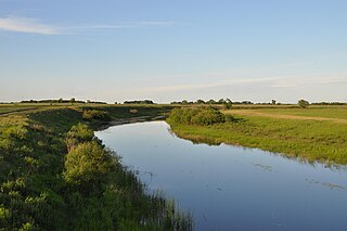
Zdvinsky District is an administrative and municipal district (raion), one of the thirty in Novosibirsk Oblast, Russia. It is located in the southwestern central part of the oblast. The area of the district is 4,943 square kilometers (1,909 sq mi). Its administrative center is the rural locality of Zdvinsk. Population: 16,636 ; 18,770 (2002 Census); 21,035 (1989 Soviet census). The population of Zdvinsk accounts for 33.7% of the district's total population.

Ob is a town in Novosibirsk Oblast, Russia, located 17 kilometers (11 mi) west of Novosibirsk, the administrative center of the oblast. Population: 25,382 (2010 Census); 24,473 (2002 Census); 25,014 (1989 Soviet census).

Kyshtovka is a rural locality and the administrative center of Kyshtovsky District, Novosibirsk Oblast, Russia. Population: 5,282 (2010 Census); 5,798 (2002 Census); 6,000 (1989 Soviet census).
Khorosheye is a rural locality. It is part of the Khoroshinsky village council of Karasuksky District, Novosibirsk Oblast, Russia.


