Kuybyshev is a town in Novosibirsk Oblast, Russia, located on the Om River, 315 kilometers (196 mi) west of Novosibirsk, the administrative center of the oblast. Population: 45,299 (2010 Census); 48,848 (2002 Census); 51,171 (1989 Soviet census); 40,000 (1970).

Kargat is a town and the administrative center of Kargatsky District in Novosibirsk Oblast, Russia, located on the river Kargat. Population: 10,042 (2010 Census); 11,184 (2002 Census); 12,561 (1989 Soviet census); 12,600 (1979); 12,700 (1959).

Cherepanovo is a town and the administrative center of Cherepanovsky District in Novosibirsk Oblast, Russia, located 109 kilometers (68 mi) southeast of Novosibirsk, the administrative center of the oblast. Population: 19,803 (2010 Census); 20,496 (2002 Census); 22,116 (1989 Soviet census).
Chulym is a town and the administrative center of Chulymsky District in Novosibirsk Oblast, Russia, located on the Chulym River 131 kilometers (81 mi) from Novosibirsk, the administrative center of the oblast. Population: 11,568 (2010 Census); 12,275 (2002 Census); 13,703 (1989 Soviet census). It was previously known as Chulymskoye.

Karasuk is a town and the administrative center of Karasuksky District in Novosibirsk Oblast, Russia, located on the Karasuk River 678 kilometers (421 mi) west of Novosibirsk, the administrative center of the oblast. Population: 28,586 (2010 Census); 28,734 (2002 Census); 29,401 (1989 Soviet census).

Barabinsky District is an administrative and municipal district (raion), one of the thirty in Novosibirsk Oblast, Russia. Its administrative center is the town of Barabinsk. Population: 14,169 ; 17,126 (2002 Census); 18,279 (1989 Soviet census).
Chulymsky District is an administrative and municipal district (raion), one of the thirty in Novosibirsk Oblast, Russia. It is located in the center of the oblast. The area of the district is 8,500 square kilometers (3,300 sq mi). Its administrative center is the town of Chulym. Population: 23,909 ; 26,763 (2002 Census); 31,854 (1989 Soviet census). The population of Chulym accounts for 48.4% of the district's total population.

Dovolensky District is an administrative and municipal district (raion), one of the thirty in Novosibirsk Oblast, Russia. It is located in the south of the oblast. The area of the district is 4,400 square kilometers (1,700 sq mi). Its administrative center is the rural locality of Dovolnoye. Population: 17,405 ; 20,664 (2002 Census); 22,506 (1989 Soviet census).
Karasuksky District is an administrative and municipal district (raion), one of the thirty in Novosibirsk Oblast, Russia. It is located in the southwest of the oblast. The area of the district is 4,321 square kilometers (1,668 sq mi). Its administrative center is the town of Karasuk. Population: 46,262 ; 48,548 (2002 Census); 50,374 (1989 Soviet census). The population of Karasuk accounts for 61.8% of the district's total population.
Kochkovsky District is an administrative and municipal district (raion), one of the thirty in Novosibirsk Oblast, Russia. It is located in the south of the oblast. The area of the district is 2,518 square kilometers (972 sq mi). Its administrative center is the rural locality of Kochki. Population: 14,863 ; 16,301 (2002 Census); 16,745 (1989 Soviet census). The population of Kochki accounts for 27.3% of the district's total population.
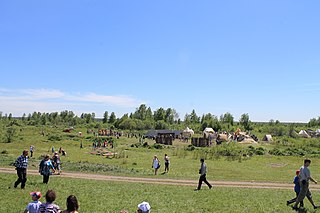
Kolyvansky District is an administrative and municipal district (raion), one of the thirty in Novosibirsk Oblast, Russia. It is located in the northeast of the oblast. The area of the district is 10,573 square kilometers (4,082 sq mi). Its administrative center is the urban locality of Kolyvan. Population: 24,049 ; 25,737 (2002 Census); 28,292 (1989 Soviet census). The population of Kolyvan accounts for 49.2% of the district's total population.

Krasnozyorsky District is an administrative and municipal district (raion), one of the thirty in Novosibirsk Oblast, Russia. It is located in the south of the oblast. The area of the district is 5,330 square kilometers (2,060 sq mi). Its administrative center is the urban locality of Krasnozyorskoye. Population: 32,491 ; 38,836 (2002 Census); 40,312 (1989 Soviet census). The population of Krasnozyorskoye accounts for 29.3% of the district's total population.

Novosibirsky District is an administrative and municipal district (raion), one of the thirty in Novosibirsk Oblast, Russia. It is located in the east of the oblast. The area of the district is 2,900 square kilometers (1,100 sq mi). Its administrative center is the city of Novosibirsk. Population: 127,891 ; 113,047 (2002 Census); 130,300 (1989 Soviet census).

Ordynsky District is an administrative and municipal district (raion), one of the thirty in Novosibirsk Oblast, Russia. It is located in the southeast of the oblast. The area of the district is 4,748 square kilometers (1,833 sq mi). Its administrative center is the urban locality of Ordynskoye. Population: 36,708 ; 39,209 (2002 Census); 38,231 (1989 Soviet census). The population of Ordynskoye accounts for 27.9% of the district's total population.

Suzunsky District is an administrative and municipal district (raion), one of the thirty in Novosibirsk Oblast, Russia. It is located in the southeast of the oblast. The area of the district is 4,746 square kilometers (1,832 sq mi). Its administrative center is the urban locality of Suzun. Population: 32,592 ; 34,917 (2002 Census); 35,677 (1989 Soviet census). The population of Suzun accounts for 47.1% of the district's total population.

Tatarsky District is an administrative and municipal district (raion), one of the thirty in Novosibirsk Oblast, Russia. It is located in the west of the oblast. The area of the district is 4,870 square kilometers (1,880 sq mi). Its administrative center is the town of Tatarsk. Population: 15,875 ; 19,297 (2002 Census); 20,718 (1989 Soviet census).
Toguchinsky District is an administrative and municipal district (raion), one of the thirty in Novosibirsk Oblast, Russia. It is located in the east of the oblast. The area of the district is 3,925 square kilometers (1,515 sq mi). Its administrative center is the town of Toguchin. Population: 60,303 ; 65,515 (2002 Census); 66,912 (1989 Soviet census). The population of Toguchin accounts for 36.3% of the district's total population.

Vengerovsky District is an administrative and municipal district (raion), one of the thirty in Novosibirsk Oblast, Russia. It is located in the west of the oblast. The area of the district is 6,382.71 square kilometers (2,464.38 sq mi). Its administrative center is the rural locality of Vengerovo. As of the 2010 Census, the total population of the district was 20,446, with the population of Vengerovo accounting for 34.4% of that number.

Tatarsk is a town in Novosibirsk Oblast, Russia, located 457 kilometers (284 mi) west of Novosibirsk, the administrative center of the oblast. Population: 24,217 (2010 Census); 26,051 (2002 Census); 30,355 (1989 Soviet census); 31,000 (1974).
Ubinskoye is a rural locality and the administrative center of Ubinsky District, Novosibirsk Oblast, Russia. Population: 5,841 (2010 Census); 5,958 (2002 Census); 6,586 (1989 Soviet census).