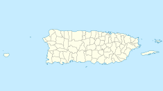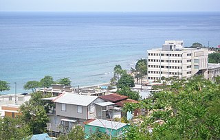
Aguadilla, founded in 1775 by Luis de Córdova, is a city and municipality located in the northwestern tip of Puerto Rico, bordered by the Atlantic Ocean to the north and west, north of Aguada, and Moca and west of Isabela. Aguadilla is spread over 15 barrios and Aguadilla Pueblo. It is a principal city of Aguadilla-Isabela-San Sebastián Metropolitan Statistical Area.

Isabela is a town and municipality of Puerto Rico located in the north-western region of the island, north of San Sebastián; west of Quebradillas; and east of Aguadilla and Moca. It is named in honor of Isabella I of Castile. Isabela is spread over 13 barrios and Isabela Pueblo, which is the downtown area and administrative center. It is a principal part of the Aguadilla-Isabela-San Sebastián Metropolitan Statistical Area.

Luquillo is a town and municipality of Puerto Rico located in the northeast coast, northwest of Fajardo; and east of Rio Grande. Luquillo is spread over 5 barrios and Luquillo Pueblo. It lends its name to the Sierra de Luquillo, where El Yunque National Forest is located. It is part of the Fajardo Metropolitan Statistical Area.

Manatí is a city and municipality of Puerto Rico on the northern coast, north of Morovis and Ciales; east of Florida and Barceloneta; and west of Vega Baja. Manatí is spread over 8 barrios and Manatí barrio-pueblo. It is part of the San Juan-Caguas-Guaynabo Metropolitan Statistical Area.
Quebradillas is a town and municipality of the island of Puerto Rico located in the north-western shore bordering the Atlantic Ocean, north of San Sebastián; east of Isabela; and west of Camuy. Quebradillas is spread over seven barrios and Quebradillas Pueblo. It is part of the San Juan-Caguas-Guaynabo Metropolitan Statistical Area.

Plaza Las Delicias is the main plaza in the city of Ponce, Puerto Rico. The square is notable for its fountains and for the various monuments it contains. The historic Parque de Bombas and Ponce Cathedral buildings are located within the plaza, which actually consists of two squares: Plaza Muñoz Rivera on the north end, and Plaza Degetau on the southern end. The square is the center of the Ponce Historic Zone, and it is flanked by the historic Ponce City Hall to the south, the early 19th-century Teatro Fox Delicias to the north, the NRHP-listed Banco Crédito y Ahorro Ponceño and Banco de Ponce buildings to the east, and the Armstrong-Poventud Residence to the west. The square dates back to the early Spanish settlement in Ponce of 1670. It is the main tourist attraction of the city, receiving about a quarter of a million visitors per year.
Puerto Rico Highway 2 (PR-2) is a road in Puerto Rico that connects the cities of San Juan and Ponce. At 156 miles (230 km) long, it is Puerto Rico's longest singled-signed highway.

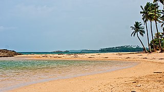
Crash Boat Beach or Crashboat Beach on the northwestern coast of Puerto Rico is situated in the municipality of Aguadilla.

Bayahíbe is a town in the Dominican Republic, located about 10 miles (16 km) east of La Romana on the shore of the Caribbean Sea. Founded as a fishing village in 1874 by Juan Brito and his family, who came from Puerto Rico, the town is now a tourist destination.

Marine Street Beach is a public beach located in the community of La Jolla in San Diego, California, on the Pacific Ocean. It sits at the western terminus of Marine Street, with Children's Pool Beach to the north and Windansea Beach to the south. The surf has been described as rough and not suitable for children. However, the rough surf has made the beach popular with surfers and bodyboarders. Nearby kelp beds host marine life making the area a popular dive spot.

Parque Urbano Dora Colón Clavell is a passive park in Ponce, Puerto Rico. The park is named after the mother of ex-governor of Puerto Rico and Ponce native, Rafael Hernández Colón. It opened on 9 December 1995. The park was designed by Ponce architect Juan Dalmau Sambolín.

Flamenco Beach is a public beach on the Caribbean island of Culebra. It is known for its shallow turquoise waters, white sand, swimming areas, and diving sites. It stretches for a mile around a sheltered, horseshoe-shaped bay. Playa Flamenco is a popular beach destination for both Culebra and Puerto Rico. In March 2014, Flamenco beach was ranked 3rd best beach in the world with a TripAdvisor Travelers' Choice Award. In August 2016, it was announced that Flamenco Beach had regained its Blue Flag Beach international distinction.

The Complejo Recreativo y Cultural La Guancha is a recreational complex in barrio Playa in Ponce, Puerto Rico, with family recreational and cultural facilities that opened on 23 June 1998. The highlight of the complex is the Paseo Tablado La Guancha, which is flanked by a beach, an observation tower, an amphitheater, and 24 open-air kiosks. It was developed during the administration of Mayor Rafael Cordero Santiago. In October 2017, after Hurricane Maria, it closed to the public to undergo repairs but, as of January 2020, when the area suffered severe damage due to the 2020 Puerto Rico earthquakes, no repairs had been made and, as of 17 June 2020, it remained closed. By late 2020 arrangements were made for the merchants that operated from waterfront kiosks to reopen their businesses out of provisional facilities at a temporary location away from the waterfront while reconstruction of the waterfront area takes place.
Jobos Beach or Playa Jobos is a beach facing the Atlantic Ocean located on the PR-466 street of Isabela in the northwest of Puerto Rico. While popular, the beach is dangerous and signs warning tourists of dangerous currents were installed in early 2021.

Buyé Beach is a beach in southwestern Puerto Rico, in the municipality of Cabo Rojo. The beach is popular with locals due to its soft, light beige-colored sand, its calm waters, and its relaxed and secluded, yet family-friendly, atmosphere. It is located next to the small Buyé Resort which offers parking, food kiosks and restrooms for visitors to the beach.
Mar Bella Beach, colloquially known as Puerto Nuevo Beach, is a beach in the municipality of Vega Baja in the north coast of Puerto Rico. The beach is often referred to as Puerto Nuevo Beach because it is located in the Puerto Nuevo barrio of Vega Baja; it is also referred to as the Balneario de Vega Baja or Balneario de Puerto Nuevo. The beach is located approximately 45 minutes west of San Juan, making it popular with both locals and visitors.

Caracas Beach, also known as Red Beach in English, is a beach on the southern coast of Vieques in the barrio of Puerto Ferro. The beach is famous for its white sand, its clear blue waters, tidal pools and shallow cove perfect for snorkeling. It used to be considered remote but it is now easily reachable through a paved road. The beach has also been developed for visitors with picnic areas, bathrooms and a large parking area. It is located in and managed by the Vieques National Wildlife Refuge and there is also a trail that leads to a nearby hill that offers beautiful views of the beach and cove.
Esperanza Beach is a popular beach on the southern coast of Vieques in La Esperanza, Puerto Real. In comparison to other beaches in the island which are located far away from populated areas, this beach is located close to La Esperanza and it hosts a number of hotels, restaurants, food kiosks and stores. Esperanza Pier, located on the western part of the beach, is considered a landmark of Vieques. It is a very popular weekend destination for locals and visitors alike. The beach is located between Sun Bay Beach and Black Sand Beach and both can be reached by foot from La Esperanza.