Vichada Department is a department of the Republic of Colombia in South America. Vichada is located in the eastern plains of Colombia, in the Orinoquía Region within the Orinoco river basin bordering the Bolivarian Republic of Venezuela to the north and east. To the north the department also borders with Arauca Department, to the northwest with Casanare Department, to the west with Meta Department, to the southwest narrowly bordering with Guaviare Department and to the south with Guainía Department. The department is the second largest in Colombia and scarcely populated in comparison to other departments.

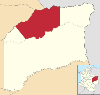
Puerto Carreño, translation English: Puerto Carreno, lit. 'Port Carreno' is the departmental capital city, and a municipality combined of the department of Vichada in the Llanos of Colombia located on the Orinoco River. Puerto Carreño is best-known as a tourist gateway to hundreds of adventure, ecological and sustainable tourism destinations, it is well-known for peacock bass fishing on the Vita River, Indigenous artisans from the Orinoquia, as a river port trade center, and as a frontier settlement that has become the capital of the second largest department (province) in Colombia.

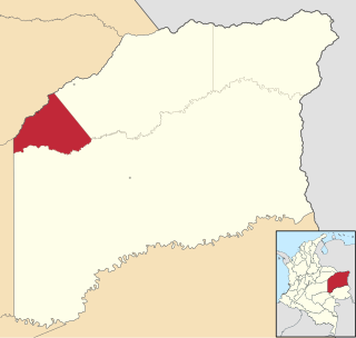
Cumaribo is a town and municipality located in the Department of Vichada, Republic of Colombia. Cumaribo was founded by Jose Nicolino Mattar in 1959.

La Primavera is a town and municipality located in the Department of Vichada, Colombia.

Santa Rosalía is a town and municipality located in the Department of Vichada, Colombia.
La Chorrera Airport is an airport serving the town of La Chorrera in the Amazonas Department of Colombia.
La Pedrera Airport is an airport serving the Caquetá River town of La Pedrera in the Amazonas Department of southern Colombia.
La Macarena Airport, also known as El Refugio Airport, is an airport serving the Guayabero River town of La Macarena in the Meta Department of Colombia.
Germán Olano Airport is an airport serving Puerto Carreño, the capital of Vichada Department in Colombia. It is also known as Puerto Carreño Airport. The airport is 1.5 kilometres (0.93 mi) west of and parallels the Orinoco River, locally Colombia's border with Venezuela.

Jorge Enrique González Torres Airport is an airport serving San José del Guaviare, the capital of the Guaviare Department of Colombia. The runway is just north of the town and parallels the Guaviare River.
Colonel Luis Arturo Rodríguez Meneses Air Base is a Colombian military base assigned to the Colombian Aerospace Force Eastern Air Group. The base is located in Marandúa, near Santa Rita, in the Vichada department of Colombia. It is named in honor of Colonel Luis Arturo Rodríguez Meneses.
Uribe Airport is an airport serving the town of La Uribe, in the Meta Department of Colombia. The runway and town are on the northern bank of the small Duda River, a tributary of the Guayabero River. High terrain exists north and west.
Santa Rosalía Airport is an airport serving the village of Santa Rosalía in the Vichada Department of Colombia.
Las Gaviotas Airport is an airport serving the agricultural village of Las Gaviotas, in the Vichada Department of Colombia.
La Jagua Airport is an airport serving the town of Garzón, in the Huila Department of Colombia. The airport is 8 kilometres (5.0 mi) southwest of the town, near the village of La Jagua.
Calenturitas Airport is an airport serving the Calenturitas coal mine and the town of La Loma in the Cesar Department of Colombia. The runway is adjacent to the surface mine, 10 kilometres (6.2 mi) northeast of La Loma.
Cumaribo Airport is an airport serving the town of Cumaribo in the Vichada Department of Colombia. The runway is 1 kilometre (0.62 mi) east of the town.
Buenavista Airport is an airport serving the towns of Fonseca and Distracción in the La Guajira Department of Colombia. The runway is 1.5 kilometres (0.93 mi) southwest of Distracción.
Elborrego Airport is an airport serving the La Loma coal mine and the town of La Loma in the Cesar Department of Colombia. The runway is adjacent to the mine and midway between La Loma and La Jagua de Ibirico.


