Santiago de Cali, or Cali, is the capital of the Valle del Cauca department, and the most populous city in southwest Colombia, with 2,280,522 residents estimate by DANE in 2023. The city spans 560.3 km2 (216.3 sq mi) with 120.9 km2 (46.7 sq mi) of urban area, making Cali the second-largest city in the country by area and the third most populous after Bogotá and Medellín. As the only major Colombian city with access to the Pacific Coast, Cali is the main urban and economic center in the south of the country, and has one of Colombia's fastest-growing economies. The city was founded on 25 July 1536 by the Spanish explorer Sebastián de Belalcázar.

Valle del Cauca, or Cauca Valley, is a department in western Colombia abutting the Pacific Ocean. Its capital is Santiago de Cali. Other cities such as Buenaventura, Buga, Cartago, Palmira and Tuluá have great economical, political, social and cultural influence on the department's life. Valle del Cauca has the largest number of independent towns with over 100,000 inhabitants in the country, counting six within its borders. Buenaventura has the largest and busiest seaport in Colombia, moving about 8,500,000 tons of merchandise annually.

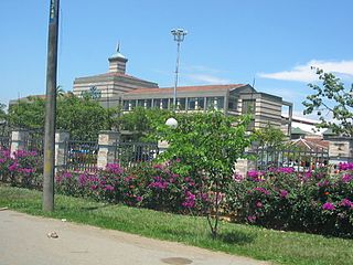
Popayán is the capital of the Colombian department of Cauca. It is located in the Pubenza Valley in southwestern Colombia between the Western Mountain Range and Central Mountain Range. The municipality has a population of 318,059, an area of 483 km2, is located 1760 meters above sea level, and has an average temperature of 18 °C.
Montenegro is a municipality in the western part of the department of Quindío, Colombia. It is located 10 km west of the departmental capital Armenia. In 2023 it had an estimated population of 38,240.

Pereira is the capital city of the Colombian department of Risaralda. It's located in the foothills of the Andes in a coffee-producing area of Colombia officially known as the "Coffee Axis". Pereira, alongside the rest of the Coffee Axis, form part of UNESCO World Heritage Site known as the "Coffee Cultural Landscape of Colombia". It's the most populated city in the Coffee Axis. Pereira is also part of the Central West Metropolitan Area, which has 735.769 residents and is composed of Pereira and the neighboring cities of Dosquebradas and La Virginia. It's considered the most important city in the "Coffee Axis" from a geopolitical and economic standpoint.
Liborina is a municipality in Colombia, located in the Western subregion of the Antioquia Department. It borders the municipalities of Sabanalarga, San Andrés de Cuerquia, and San José de la Montaña to the north; San José de la Montaña and Belmira to the east; Santa Fe de Antioquia and Olaya to the south; and Buriticá to the west. Its town center is 80 kilometers via Sopetrán and 77 kilometers via Santa Fe de Antioquia from Medellín, the capital of Antioquia. The municipality covers an area of 217 square kilometers and is connected by road to the municipalities of Sabanalarga, San José de la Montaña, Belmira, Olaya, and Buriticá.
Filandia is a town and municipality in the northern part of the department of Quindío, Colombia. It's located on the west side of Cordillera Central of the Andes mountain range running through central Colombia, 26 km north of the departmental capital Armenia. In 2023 the estimated population of Filandia was 12,596 inhabitants.

Piamonte is a town and municipality in the Cauca Department, Colombia.

Buenaventura is a coastal seaport city located in the Pacific Region of the department of Valle del Cauca, Colombia. Buenaventura is the main port of Colombia in the Pacific Ocean.

San José del Palmar is a municipality and town in the Chocó Department, Colombia in the central part of the country, 240 km west of the capital Bogotá. San José del Palmar is 1,288 meters above sea level and the population is about 4,800.

Pácora is a town and municipality in the Colombian Department of Caldas. It is located in northern Caldas-Department, on the slopes of the Andes Central Mountains of the Republic of Colombia. With an average annual temperature of 18 °C, the town is bordered to the northeast with Aguadas, Caldas, to the south with Salamina, Caldas and La Merced, and to the west separated by the Cauca River, Marmato-Caldas and Caramanta-Antioquia department. The villages in Pácora are San Bartolomé, Castilla, Las Coles, Los Morros, San Lorenzo and Buenos Aires.

López de Micay is a town and municipality in the Cauca Department, Colombia. It is located on the Pacific Coast of the Cauca Department in the Naya Region on the foothills of the Colombian Western Cordillera. It is located 84 km from the departmental capital, Popayán.

San Sebastián is a town and municipality in the Cauca Department, Colombia at a distance of 165 km by road from the city of Popayán, capital city of the department of Cauca. The town was founded in 1562 by Pedro Antonio Gómez.

Timbiqui is a town and municipality in the Cauca Department, Colombia. It is located on the Pacific Coast of Colombia on the estuary of the Timbiqui River. An earthquake affected its inhabitants on the first of October, 2012.

El Cerrito is a town and municipality located in the Department of Valle del Cauca, Colombia. This is one of the 42 municipalities of the department.
Jamundí is a town and municipality in the Department of Valle del Cauca, Colombia.

Yotoco is a town and municipality located in the Department of Valle del Cauca, Colombia.
San Andrés is a town and municipality in Antioquia Department, Colombia. It is part of the sub-region of Northern Antioquia.

Aragon is one of the five official townships of Santa Rosa de Osos, Antioquia, Colombia. Located north of the municipality. The urban area and centrality of the township is approximately 32 kilometers from the city of Santa Rosa de Osos. It is characterized for being one of the highest towns that Antioquia has, for this and other conditions it is also one of the urban sites with the coldest climate in the department, in February 2012 temperatures of -3.2 °C were reported and in part of the rural area the temperature can drop even further.
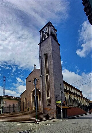
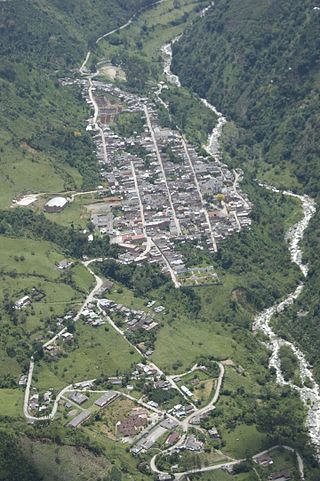
San Juan de Villalobos is a corregiment in the south of the department of Cauca in the region known as Media Bota Caucana, municipality of Santa Rosa. The town was settled in 1937 along National Route 45 at a distance of 8 km from the border between the departments of Huila and Cauca. This town is an obligatory passage between Pitalito and Mocoa and has gained relevance after the construction of National Route 45.