The Arctic Archipelago, also known as the Canadian Arctic Archipelago, is an archipelago lying to the north of the Canadian continental mainland, excluding Greenland and Iceland.

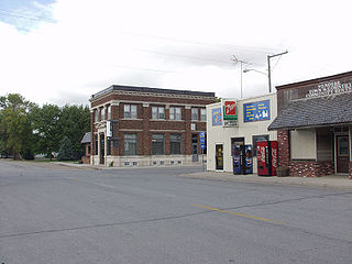
Wendell is a city in Grant County, Minnesota, United States. The population was 167 at the 2010 census.

USS Block Island (CVE-21/AVG-21/ACV-21) was a Bogue-class escort carrier for the United States Navy during World War II. She was the first of two escort carriers named after Block Island Sound off Rhode Island and was the only American carrier sunk in the Atlantic during the war.

The St. Marys River is a 22.3-mile-long (35.9 km) river in southern Maryland in the United States. It rises in southern St. Mary's County, and flows to the southeast through Great Mills, widening into a tidal estuary near St. Mary's City, approximately 2 miles (3 km) wide at its mouth on the north bank of the Potomac River, near the Chesapeake Bay to the east.

The VQ is a family of V6 automobile petrol engines developed by Nissan and produced in displacements varying from 2.0 L to 4.0 L. Designed to replace the VG series, the all-aluminium 4-valve per cylinder DOHC design debuted with Nissan's EGI/ECCS sequential multi-point fuel injection (MPFI) system. Changes from the VG engine include switching to a timing chain from a timing belt, and relocating the water pump from the outside of the engine to inside the timing cover where the pump is driven by the timing chain. Later versions featured various improvements, such as variable valve timing, and NEO-Di designated VQ engines replace MPFI with direct fuel injection.

Charlotte is the largest parish of Saint Vincent and the Grenadines, situated on the eastern coast of the island of Saint Vincent. With an area of 149 km², its size is comparable to that of the British Virgin Islands. It’s the country‘s largest parish by area and the second most populous one. The parish has the longest coastline of all the parishes and is also larger than the three smallest parishes combined. The parish possesses a very rough and rugged topography with very little flat land occurring towards the coast. as a result of these features, parts of the north of the parish cannot be accessed by a main road. Up until the building of a bridge over the Rabacca Dry River access to the north side of the river was not possible when rain caused the river to swell and make the path impassable.

Saint Andrew is an administrative parish of Saint Vincent and the Grenadines, on the island of Saint Vincent. Its capital is Layou.

Andalucía is a town and municipality located in the north of the Department of Valle del Cauca, in Colombia.
German submarine U-217 was a Type VIID mine-laying U-boat of Nazi Germany's Kriegsmarine during World War II.

Ginebra is a town and municipality located in the Department of Valle del Cauca, Colombia.

Rebolledo de la Torre is a municipality and town located in the province of Burgos, Castile and León, Spain. According to the 2004 census (INE), the municipality has a population of 167 inhabitants.
Tansablogo is a village in the Salogo Department of Ganzourgou Province in central Burkina Faso. The village has a population of 800.

Bluie was the United States military code name for Greenland during World War II. It is remembered by the numbered sequence of base locations identified by the 1941 United States Coast Guard South Greenland Survey Expedition, and subsequently used in radio communications by airmen unfamiliar with pronunciation of the Greenlandic Inuit and Danish names of those locations. These were typically spoken BLUIE (direction) (number), with direction being east or west along the Greenland coast from Cape Farewell.

The Cabarita River, originally the Cabaritta, is a river in Jamaica. The Mayfield River is a tributary.
The Plantain Garden River is a river in the parish of St Thomas on the island of Jamaica. It is the only major river in Jamaica that does not flow in a northerly or southerly direction.

Grão-Pará is a municipality in the state of Santa Catarina in the South region of Brazil.
Kogali is a village in the southern state of Karnataka, India. This village is located in Hagaribommanahalli Tehsil of Bellary district in Karnataka, India. It is situated 22 km away from sub-district headquarter Hagari bommanahalli and 122 km away from district headquarter Bellary.
British Corporal was a 6,972 GRT tanker that was built in 1922 by Palmers Shipbuilding and Iron Company, Jarrow, Northumberland, United Kingdom. She was built for the British Tanker Company.
This page is based on this
Wikipedia article Text is available under the
CC BY-SA 4.0 license; additional terms may apply.
Images, videos and audio are available under their respective licenses.


