
Cartago is a city in southwestern Colombia, about 187 miles (301 km) west of Bogotá. It is in the extreme northern portion of the Valle del Cauca. It is located very close to the city of Pereira, Risaralda about a 20-minute drive. It is the sixth largest city in Valle after Cali, Palmira, Buenaventura, Tuluá and Jamundí. Per the 2018 Colombian census, Cartago's population was 142,902.

Santiago de Cali, or Cali, is the capital of the Valle del Cauca department, and the most populous city in southwest Colombia, with 2,280,522 residents estimate by DANE in 2023. The city spans 560.3 km2 (216.3 sq mi) with 120.9 km2 (46.7 sq mi) of urban area, making Cali the second-largest city in the country by area and the third most populous after Bogotá and Medellín. As the only major Colombian city with access to the Pacific Coast, Cali is the main urban and economic center in the south of the country, and has one of Colombia's fastest-growing economies. The city was founded on 25 July 1536 by the Spanish explorer Sebastián de Belalcázar.
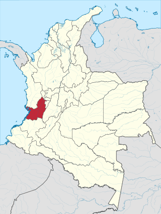
Valle del Cauca, or Cauca Valley, is a department in western Colombia abutting the Pacific Ocean. Its capital is Santiago de Cali. Other cities such as Buenaventura, Buga, Cartago, Palmira and Tuluá have great economical, political, social and cultural influence on the department's life. Valle del Cauca has the largest number of independent towns with over 100,000 inhabitants in the country, counting six within its borders. Buenaventura has the largest and busiest seaport in Colombia, moving about 8,500,000 tons of merchandise annually.

Palmira is a city and municipality in southwestern Colombia in the Valle del Cauca Department, located about 27 kilometres (17 mi) east from Cali, the department's capital and main city in the South of Colombia. Palmira is the second largest city in the Valle del Cauca, behind Cali.
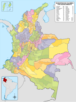
The municipalities of Colombia are decentralized subdivisions of the Republic of Colombia. Municipalities make up most of the departments of Colombia with 1,122 municipalities (municipios). Each one of them is led by a mayor (alcalde) elected by popular vote and represents the maximum executive government official at a municipality level under the mandate of the governor of their department which is a representative of all municipalities in the department; municipalities are grouped to form departments.

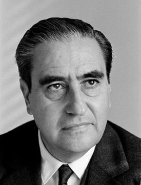
Jorge Isaacs Ferrer was a Colombian writer, politician and soldier. His only novel, María, became one of the most notable works of the Romantic movement in Spanish-language literature.

María is a novel written by Colombian writer Jorge Isaacs between 1864 and 1867. It is a costumbrist novel representative of the Spanish Romantic movement. It may be considered a precursor of the criollist novels of the 1920s and 1930s in Latin America.

Manuel María Mallarino Ibargüen was the 8th Vice President of New Granada, and as such served as Acting President from 1855 to 1857.

The University of Valle, also called Univalle, is a public, departmental, coeducational, research university based primarily in the city of Cali, Valle del Cauca, Colombia. It is the largest higher education institution by student population in the southwest of the country, and the third in Colombia, with more than 30,000 students. The university was established by ordinance No. 12 of 1945, by the Departmental Assembly as the Industrial University of Valle del Cauca, under the leadership of Tulio Ramírez Rojas and Severo Reyes Gamboa.
Joaquín Vallejo Arbeláez was a Colombian civil engineer, businessman and writer who served as 12th Permanent Representative of Colombia to the United Nations, and held various ministries during the Military Junta and the National Front in Colombia. As Colombian Minister of Foment in 1957 during the administration of General Gabriel París Gordillo, he helped design and implement the mechanism that would eventually become known as the Vallejo Plan, a business plan that would allow Colombian companies to import raw materials, specialized equipment, and industrial machinery with duty-free exemptions or lowered tariffs, if those materials and/or equipment would go towards producing marketable exporting goods, as an incentive to industrialize the national economy and open up to international markets.

Yotoco is a town and municipality located in the Department of Valle del Cauca, Colombia.

Cauca State was one of the states of Colombia, which existed from 1857 until 1886.
Jesús María Espinosa Fernández (1908–1995) was a Colombian painter. He was born in the town of Belalcázar, in the Department of Cauca, Colombia on August 10, 1908.
The 50,000 Colombian peso note is the second highest denomination of Colombian currency. Designed by Óscar Muñoz, the front of the notes feature Jorge Isaacs and the heroine of his novel María, and the back of the notes feature an Albizia saman tree, two palm trees, an image of Isaacs' house El Paraiso, and an excerpt from María. In June 2013, the Bank of the Republic of Colombia estimated that 602,500,000 notes of the 50,000 denomination were in circulation.
The Paraíso Fault or Palmira-Buga Fault is a thrust fault with minor dextral lateral movement in the department of Valle del Cauca in southwestern Colombia. The fault is part of the megaregional Romeral Fault System and has a total length of 35.3 kilometres (21.9 mi) and runs along an average north-northwest to south-southeast strike of 012.5 ± 3 in the Cauca Basin and the Central Ranges of the Colombian Andes.

Maria Mireya Arboleda Cadavid was a Colombian classical pianist and teacher.
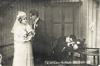
María is a 1922 Colombian silent film in black and white, directed by Máximo Calvo Olmedo and Alfredo del Diestro.
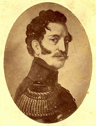
José María Cabal was a Neogranadine military and political leader during the Colombian War of Independence.


