Lac-Simon, Outaouais

Last updated

Lac-Simon
Lac-Simon QC 2.JPG
Lac-Simon (Outaouais) Quebec location diagram.png
Location within Papineau RCM
Canada Western Quebec location map.png
Red pog.svg
Lac-Simon
Location in western Quebec
Coordinates: 45°54′N75°06′W / 45.900°N 75.100°W / 45.900; -75.100 [1]
CountryFlag of Canada (Pantone).svg  Canada
Province Flag of Quebec.svg  Quebec
Region Outaouais
RCM Papineau
Settled1845
ConstitutedJanuary 1, 1881
Named for Marie-Louise Cimon [1]
Government
[2]
  MayorGaston A. Tremblay
   Federal riding Argenteuil—Papineau—Mirabel
   Prov. riding Papineau
Area
  Total121.90 km2 (47.07 sq mi)
  Land95.65 km2 (36.93 sq mi)
Population
 (2021) [3]
  Total1,057
  Density11.1/km2 (29/sq mi)
  Pop 2016-2021
Increase2.svg 12%
  Dwellings
1,304
Time zone UTC−5 (EST)
  Summer (DST) UTC−4 (EDT)
Postal code(s)
Area code 819
HighwaysQc315.svg R-315
Qc321.svg R-321
Website www.lac-simon.net OOjs UI icon edit-ltr-progressive.svg

Lac-Simon is a town and municipality in the Outaouais region of Quebec, Canada, part of the Papineau Regional County Municipality.

Contents

It is known for its sandy beaches on Lake Simon and provides services to vacationers and campers.

History

In 1845, the Métis Amable LeBlanc and his wife Marie-Louise Cimon, the niece of Basile Outik, chief of the Oka Indian tribe, went to settle on an island in the middle of a lake located 121 kilometres (75 mi) north-west of Oka. Eight families left with him to this region where hunting and fishing were very good. Three of these families were related to the parents of his wife and from then on, the residents of Oka, and later those of Montebello, called this lake "Lake Cimon", which became "Lake Simon". [4] The largest island in the lake is now called White Duck Island (Île du Canard Blanc) in honour of Amable LeBlanc who was nicknamed "White Duck" in reference to his slightly lighter skin colour as compared to his native relatives. [5]

Amable "White Duck" LeBlanc and his wife Marie-Louise Cimon Amable LeBlanc Marie-Louise Cimon.jpg
Amable "White Duck" LeBlanc and his wife Marie-Louise Cimon

Starting in 1852, Franco-Catholic colonists began to settle at the lake, working as log drivers, loggers, or farmers. [5] In 1857, a mission was established. [1] In 1864, Hartwell Township is formed (named after a place in central Buckinghamshire, England), [6] followed a few years later by the United Township Municipality of Hartwell-et-Suffolk. In 1880, the mission attained the status of parish under the name of Saint-Felix-de-Valois. [1]

In 1881, Hartwell-et-Suffolk separated and formed the Township Municipality of Hartwell and the Township Municipality of Suffolk. In 1893, Hartwell was merged with Preston Township, becoming the United Township Municipality of Hartwell-et-Preston.

In 1936, the united townships were separated again and formed the Township Municipality of Hartwell and the Municipality of Duhamel. In 1958, Hartwell became the Parish Municipality of Chénéville and finally became the Municipality of Lac-Simon in 1965. [1]

Lac-Simon's development as a resort area began in the 1950s, and accelerated when the provincial government acquired sites bordering the lake and opened a campground. Today, Lac-Simon is a popular year-round vacation resort. [5]

Demographics

Canada census – Lac-Simon community profile
2021 2016 2011
Population1,057 (+12.0% from 2016)944 (-4.1% from 2011)984 (13.2% from 2006)
Land area95.65 km2 (36.93 sq mi)97.48 km2 (37.64 sq mi)97.37 km2 (37.59 sq mi)
Population density11.1/km2 (29/sq mi)9.7/km2 (25/sq mi)10.1/km2 (26/sq mi)
Median age60.0 (M: 60.4, F: 59.2)59.6 (M: 60.4, F: 58.8)57.5 (M: 58.0, F: 56.9)
Private dwellings1,304 (total)  554 (occupied)1,373 (total) 1,145 (total) 
Median household income$68,500$57,088
References: 2021 [7] 2016 [8] 2011 [9] earlier [10] [11]
Historical census populations – Lac-Simon, Quebec
YearPop.±%
1986 471    
1991 583+23.8%
1996 667+14.4%
2001 683+2.4%
2006 869+27.2%
2011 984+13.2%
2016 944−4.1%
2021 1,057+12.0%
Lac-Simon Lac-Simon QC 1.JPG
Lac-Simon

Mother tongue: [3]

Related Research Articles

<span class="mw-page-title-main">La Pêche</span> Municipality in Quebec, Canada

La Pêche is a municipality along both sides of the Gatineau River in Les Collines-de-l'Outaouais Regional County Municipality in the Outaouais region of Quebec, Canada, about 30 km (19 mi) north of downtown Gatineau.

<span class="mw-page-title-main">Mulgrave-et-Derry, Quebec</span> Municipality in Quebec, Canada

Mulgrave-et-Derry, is a village north of Mayo, in the Papineau Regional County Municipality, Quebec, Canada. The region includes a number of notable lakes, including Gull Lake, Hawk Lake, Lady Lake, Smallian Lake, Lac St. Sixte, Lac La Blanche and Little Lake. Community buildings include the Hill and Gully Riders Snowmobile Club, St. Matthew's Evangelical Lutheran Church, and Our Lady of Light Roman Catholic Church.

<span class="mw-page-title-main">L'Ange-Gardien, Outaouais, Quebec</span> Municipality in Quebec, Canada

L'Ange-Gardien is a municipality in the Outaouais region of Quebec, Canada. It constitutes the easternmost part of Les Collines-de-l'Outaouais Regional County Municipality, north of the Buckingham Sector of the City of Gatineau.

<span class="mw-page-title-main">Harrington, Quebec</span> Township municipality in Quebec, Canada

Harrington is a township municipality in the Laurentides region of Quebec, Canada, part of the Argenteuil Regional County Municipality. It is located in the Laurentian Mountains, about 40 kilometres (25 mi) north-west of Lachute.

<span class="mw-page-title-main">Litchfield, Quebec</span> Municipality in Quebec, Canada

Litchfield is a municipality in the Outaouais region, part of the Pontiac Regional County Municipality, Quebec, Canada. It is located on the shores of the eastern channel of the Ottawa River at Calumet Island.

<span class="mw-page-title-main">Bristol, Quebec</span> Municipality in Quebec, Canada

Bristol is a municipality in the Ottawa Valley, on the Quebec side in the Outaouais region, part of the Pontiac Regional County Municipality, Quebec, Canada. It is located on the north shore of Lac des Chats across from Arnprior, Ontario.

<span class="mw-page-title-main">Thorne, Quebec</span> Municipality in Quebec, Canada

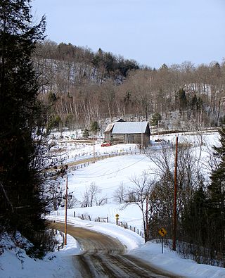
Thorne is a municipality in the Pontiac Regional County Municipality, Quebec, Canada, about 63 kilometres (39 mi) northwest of Downtown Gatineau, part of the Outaouais region.

<span class="mw-page-title-main">Bowman, Quebec</span> Municipality in Quebec, Canada

Bowman is a village and municipality in the Outaouais region of Quebec, Canada. It is located in the Laurentian Hills, 72 kilometres (45 mi) north-east of Gatineau.

<span class="mw-page-title-main">Val-des-Bois, Quebec</span> Municipality in Quebec, Canada

Val-des-Bois is a town and municipality in the Papineau Regional County Municipality in the Outaouais region of Quebec, Canada. The town is located on the eastern shores of the Du Lièvre River, 47 kilometers (29 mi) north of Buckingham.

<span class="mw-page-title-main">Montpellier, Quebec</span> Municipality in Quebec, Canada

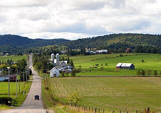
Montpellier is a town and municipality in the Papineau Regional County Municipality in the Outaouais region of Quebec, Canada. The town is located 30 kilometres (19 mi) northwest of Papineauville.

<span class="mw-page-title-main">Duhamel, Quebec</span> Municipality in Quebec, Canada

Duhamel is a town and municipality in the Outaouais region of Quebec, Canada. It is the largest municipality in surface area in the Papineau Regional County Municipality.

<span class="mw-page-title-main">Chénéville, Quebec</span> Municipality in Quebec, Canada

Chénéville is a town and municipality in the Outaouais region of Quebec, Canada, part of the Papineau Regional County Municipality.

<span class="mw-page-title-main">Notre-Dame-de-la-Paix, Quebec</span> Municipality in Quebec, Canada

Notre-Dame-de-la-Paix is a town and municipality in the Outaouais region of Quebec, Canada, part of the Papineau Regional County Municipality.

<span class="mw-page-title-main">Namur, Quebec</span> Municipality in Quebec, Canada

Namur is a town and municipality in the Outaouais region of Quebec, Canada, part of the Papineau Regional County Municipality. It is nicknamed "la Nouvelle Belgique".

<span class="mw-page-title-main">Saint-Émile-de-Suffolk, Quebec</span> Municipality in Quebec, Canada

Saint-Émile-de-Suffolk is a municipality in the Outaouais region of Quebec, Canada, part of the Papineau Regional County Municipality. Until 1994 it was known as United Township Municipality of Suffolk-et-Addington.

<span class="mw-page-title-main">Lac-des-Plages, Quebec</span> Municipality in Quebec, Canada

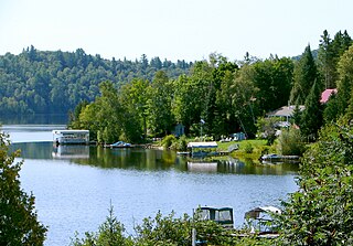
Lac-des-Plages is a town and municipality in the Outaouais region of Quebec, Canada, part of the Papineau Regional County Municipality. It is named after Lac des Plages which attracts many vacationers with the beauty of its beaches.

<span class="mw-page-title-main">Sainte-Anne-du-Lac</span> Municipality in Quebec, Canada

Sainte-Anne-du-Lac is a municipality and village in the Laurentides region of Quebec, Canada, part of the Antoine-Labelle Regional County Municipality.

<span class="mw-page-title-main">Saint-Aimé-du-Lac-des-Îles</span> Municipality in Quebec, Canada

Saint-Aimé-du-Lac-des-Îles is a municipality in the Laurentides region of Quebec, Canada, part of the Antoine-Labelle Regional County Municipality.

<span class="mw-page-title-main">Lac-des-Écorces, Quebec</span> Municipality in Quebec, Canada

Lac-des-Écorces is a municipality and village in the Laurentides region of Quebec, Canada, part of the Antoine-Labelle Regional County Municipality.

<span class="mw-page-title-main">Lac-Saguay</span> Village municipality in Quebec, Canada

Lac-Saguay is a village municipality in Antoine-Labelle Regional County Municipality in the Laurentides region of Quebec, Canada.

References

  1. 1 2 3 4 5 "Reference number 33359 in Banque de noms de lieux du Québec". toponymie.gouv.qc.ca (in French). Commission de toponymie du Québec.
  2. 1 2 "Geographic code 80095 in the official Répertoire des municipalités". www.mamh.gouv.qc.ca (in French). Ministère des Affaires municipales et de l'Habitation.
  3. 1 2 3 "Data table, Census Profile, 2021 Census of Population - Lac-Simon, Municipalité (MÉ) [Census subdivision], Quebec". 9 February 2022.
  4. "Lac Simon (lake)" (in French). Commission de toponymie du Québec. Retrieved 2008-12-02.
  5. 1 2 3 "Centre touristique du Lac-Simon, History". La Sépaq. Retrieved 2008-12-04.
  6. "Hartwell (Canton)" (in French). Commission de toponymie du Québec. Retrieved 2008-12-03.
  7. "2021 Community Profiles". 2021 Canadian Census . Statistics Canada. February 4, 2022. Retrieved 2023-10-19.
  8. "2016 Community Profiles". 2016 Canadian Census . Statistics Canada. August 12, 2021. Retrieved 2019-12-20.
  9. "2011 Community Profiles". 2011 Canadian Census . Statistics Canada. March 21, 2019. Retrieved 2019-12-20.
  10. "2006 Community Profiles". 2006 Canadian Census . Statistics Canada. August 20, 2019.
  11. "2001 Community Profiles". 2001 Canadian Census . Statistics Canada. July 18, 2021.

Commons-logo.svg Media related to Lac-Simon, Outaouais, Quebec at Wikimedia Commons