Related Research Articles

Seneca County is located in the U.S. state of New York. As of the 2020 census, the population was 33,814. The primary county seat is Waterloo, moved there from the original county seat of Ovid in 1819. It became a two-shire county in 1822, which currently remains in effect and uses both locations as county seats although the majority of Seneca County administrative offices are located in Waterloo. Therefore, most political sources list only Waterloo as the county seat. The county's name comes from the Seneca Nation of the Haudenosaunee (Iroquois), who occupied part of the region.

Seneca County is a county located in the northwestern part of the U.S. state of Ohio. As of the 2020 census, the population was 55,069. Its county seat is Tiffin. The county was created in 1820 and organized in 1824. It is named for the Seneca Indians, the westernmost nation of the Iroquois Confederacy. This people were based in present-day New York but had territory extending into Pennsylvania and Ohio.

Ashtabula County is the northeasternmost county in the U.S. state of Ohio. As of the 2020 census, the population was 97,574. The county seat is Jefferson, while its largest city is Ashtabula. The county was created in 1808 and later organized in 1811. The name Ashtabula derives from the Lenape language phrase ashte-pihële, which translates to 'always enough (fish) to go around, to be given away' and is a contraction of apchi ('always') + tepi ('enough') + hële. Ashtabula County is part of the Cleveland, OH Metropolitan Statistical Area.

Senecaville is a village in Guernsey County, Ohio, United States. The population was 422 at the 2020 census.

Seneca is a city in Oconee County, South Carolina, United States. The population was 8,102 at the 2010 census. It is the principal city of the Seneca Micropolitan Statistical Area, an (MSA) that includes all of Oconee County, and that is included within the greater Greenville-Spartanburg-Anderson, South Carolina Combined Statistical Area. Seneca was named for the nearby Cherokee town of Isunigu, which English colonists knew as "Seneca Town".

Fostoria is a city located at the convergence of Hancock, Seneca, and Wood counties in the northwestern part of the U.S. state of Ohio. The population was 13,046 at the 2020 Census, slightly down from 13,441 at the 2010 Census. It is approximately 40 miles (64 km) south of Toledo and 90 miles (140 km) north of Columbus. The community grew substantially during the end of the 19th century, coinciding with the northwest Ohio gas boom. Typical of Rust Belt cities, Fostoria peaked in size in 1970.

Green Springs is a village in Sandusky and Seneca counties in the U.S. state of Ohio. The population was 1,233 at the 2020 census.

Seneca Falls is a town in Seneca County, New York, United States. The population was 9,027 at the 2020 census.

Lewistown is an unincorporated community and census-designated place (CDP) in central Washington Township, Logan County, Ohio, United States. As of the 2020 census, the population was 202.
Ohio's 5th congressional district is in northwestern and north central Ohio and borders Indiana. The district is currently represented by Republican Bob Latta.

Thompson Township is one of the sixteen townships of Geauga County, Ohio, United States. As of the 2020 census the population was 2,144.

Ballville Township is one of the twelve townships of Sandusky County, Ohio, United States. As of the 2020 census, 6,042 people lived in the township.

Hopewell Township is one of the fifteen townships of Seneca County, Ohio, United States. The 2020 census found 2,672 people in the township.
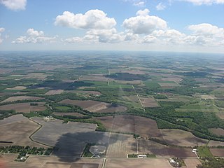
Pleasant Township is one of the fifteen townships of Seneca County, Ohio, United States. The 2020 census found 1,477 people in the township.
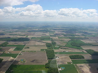
Seneca Township is one of the fifteen townships of Seneca County, Ohio, United States. The 2020 census found 1,444 people in the township.

The Toledo Metropolitan Area, or Greater Toledo, or Northwest Ohio is a metropolitan area centered on the American city of Toledo, Ohio. As of the 2020 census, the four-county Metropolitan Statistical Area (MSA) had a population of 646,604. It is the sixth-largest metropolitan area in the state of Ohio, behind Cincinnati–Northern Kentucky, Cleveland, Columbus, Dayton, and Akron.

Old Fort is a census-designated place located in northern Pleasant Township, Seneca County, Ohio, United States; located about a mile east of Ohio State Route 53 where N. Township Rd. 73 intersects with E. County Rd. 51. The ZIP code is 44861. The population was 143 at the 2020 census.

Seneca Township is one of the fifteen townships of Noble County, Ohio, United States. The 2020 census found 423 people in the township.

Kansas is a census-designated place in northwestern Liberty Township, Seneca County, Ohio, United States. It has a post office with the ZIP code 44841. It is located along State Route 635. The population was 175 at the 2020 census.

Fort Seneca is a census-designated place in Pleasant Township, Seneca County, Ohio, United States. It is located on State Route 53, approximately 6 miles (9.7 km) North of Tiffin. The population was 230 at the 2020 census.
References
- 1 2 U.S. Geological Survey Geographic Names Information System: Lake Seneca, Ohio
- ↑ "Lake Seneca CPD, Ohio - Census Bureau Profile". United States Census Bureau. Retrieved September 12, 2023.
- ↑ Pakulski, Gary T. (August 22, 2004). "Bargain values at troubled Lake Seneca". Toledo Blade. Retrieved December 20, 2015.
Municipalities and communities of Williams County, Ohio, United States | ||
|---|---|---|
| City |  | |
| Villages | ||
| Townships | ||
| CDPs | ||
| Unincorporated communities | ||
| Ghost town | ||
| | This Williams County, Ohio state location article is a stub. You can help Wikipedia by expanding it. |