
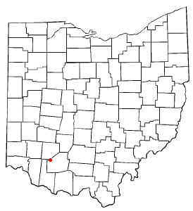
Williams County is a county located in the U.S. state of Ohio. As of the 2020 census, the population was 37,102. Its county seat is Bryan. The county was created in 1820 and later organized in 1824. It is named for David Williams, one of the captors of John André in the American Revolutionary War.

Cridersville is a village in Auglaize County, Ohio, United States. The population was 1,791 at the 2020 census. It is included in the Wapakoneta, Ohio Micropolitan Statistical Area.
Belmont is a village in central Belmont County, Ohio, United States. The population was 414 at the 2020 census. It is part of the Wheeling metropolitan area.

New Waterford is a village in northeastern Columbiana County, Ohio, United States. The population was 1,194 at the 2020 census. It is part of the Salem micropolitan area, about 18 miles (29 km) south of Youngstown.

Castalia is a village in Erie County, Ohio, United States. The population was 774 at the 2020 census. It is part of the Sandusky, Ohio Metropolitan Statistical Area.
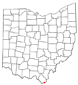
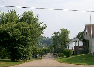
Proctorville is a village in Lawrence County, Ohio, United States, along the Ohio River. The population was 523 at the 2020 census. The East End Bridge connects Proctorville to Huntington, West Virginia across the Ohio River.
Covington is a village in Miami County, Ohio, United States. The population was 2,548 at the 2020 census. It is part of the Dayton Metropolitan Statistical Area. The village was incorporated as Covington in 1835 on the site of the 1793 Fort Rowdy.

McArthur is a village in and the county seat of Vinton County, Ohio, United States. It is located 27 miles (43 km) southeast of Chillicothe. The population was 1,783 at the 2020 census.

Beverly is a village in Washington County, Ohio, United States. The population was 1,233 at the 2020 census. It is part of the Marietta micropolitan area.
Alvordton is a census-designated place in central Mill Creek Township, Williams County, Ohio, United States. The population was 200 at the 2020 census.

Blakeslee is a village in Williams County, Ohio, United States. The population was 104 at the 2020 census.
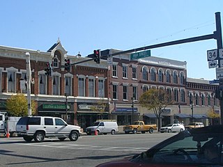
Bryan is a city in, and the county seat of, Williams County, Ohio, United States. It is located in the state's northwestern corner, 53 miles (85 km) southwest of Toledo. The population was 8,729 at the 2020 census.

Edgerton is a village in Williams County, Ohio, United States in the extreme northwest corner of the state. The population was 1,881 at the 2020 census.
Edon is a village in Williams County, Ohio, United States. The population was 796 at the 2020 census.

Holiday City is a village in Williams County, Ohio, United States. The population was 48 at the 2020 census.

Sycamore is a village in Wyandot County, Ohio, United States. The population was 793 at the 2020 census.
Lynchburg is a village in Clinton and Highland counties in the U.S. state of Ohio. The population was 1,510 at the 2020 census.

Washingtonville is a village in northern Columbiana and southern Mahoning counties in the U.S. state of Ohio. The population was 712 at the 2020 census. Southern Washingtonville is included in the Salem micropolitan area, while northern Washingtonville is part of the Youngstown–Warren metropolitan area.

Burkettsville is a village in Darke and Mercer counties in the U.S. state of Ohio. The population was 272 at the 2020 census.

Mogadore is a village in Portage and Summit counties in the U.S. state of Ohio. The population was 3,811 at the 2020 census. A suburb of Akron, it is part of the Akron metropolitan area.


