Lalgun has existed for a long time. Warghat Prant(country above the ghats) was under the control of Chhatrapati Shivaji. Later, during the reign of Chhatrapati Shahu-I, the Warghat Province from Wai to Kopal on the Tungabhadra was placed under Dattaji Pant Waknis. Chhatrapati Shahu-I's Jabita Swarajya i.e. a Statement of Swarajya (dated 9 September 1718) enumerated the list of provinces in which Warghat province was consists of 16 Subhas. Under the Subha Prant Khatao there were 11 Talukas viz Khatao, Malawadi, Wangi, Nimsod, Mayani, Lalgun, Aundh, Vita, Khanapur, Kaledhon & Bhalwani.[3][4] During the time of Peshwa the qasaba Lalgun-Budh panchgaon was under the supervision of the Watandars.[5] The British also ruled this region till independence of India. In 1871-72, British administration opened a school at Lalgun.[6]
Geography
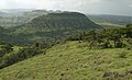
Lalgun is located 17.779N, 74.294E, approximately 38km east of Satara city [7] and 120km from Swargate (Pune).[8] It has an average elevation of 832 metres (2,730 feet)[9] and surrounded by mountainous region of the Sahyadri. Geomorphologically, Lalgun forms the part of Deccan Plateau, which is composed of basalt rock.[10]
Lalgun is situated on the banks of the Yerla River, a tributary of Krishna River.[11] The Yerla River is the lifeline of this village, and fulfills its agricultural water demands. The Ner Dam on the Yerla River lies about 3km south of Lalgun, and was completed in 1881. The Taluka Headquarters (Tehsil Office) of Lalgun is located about 35km away at Vaduj.
Agriculture
The main economic activities of this village are agriculture and animal husbandry. Major crops are Soybean, Common beans, Potato, Onion, Jowar, etc. Recently some watershed development has increased the area under sugarcane cultivation. Hence this village is also famous for Jaggery processing.
In popular culture
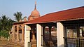
Lalgun is famous for the Nagnath Yatra held every year in the month of Shravan.[12] This yatra is observed at Nagnath Temple at Nagnathwadi near Lalgun. This shrine has equal importance of Lord Shiva and Nag devtas. The festival of Rama Navami is also celebrated every year by the people of Lalgun.[13]
Lalgun is famous for its Jangi Kusti Maidan (Mega Wrestling event), which is held every year on the occasion of Vetalba Yatra in Baisakh (in the month of May)[14][15][16][17]
Lalgun is the native village of Kailash Katkar, the founder and CEO of 'Quick Heal' a famous multinational software company headquartered in Pune[21][22] and Nikhil Navanath Ghadge, the City Secretary of Nationalist Youth Congress Party, PCMC, Pune.
In Lalgun, the facility of education is available in both Marathi and English medium till class 10th. A government school was started at Lalgun on 1 June 1871. Lalgun is also famous for private academies for career in Police and Defense.
This page is based on this Wikipedia article Text is available under the CC BY-SA 4.0 license; additional terms may apply. Images, videos and audio are available under their respective licenses.