Lalitpur, India

Last updated

Lalitpur
City
Kshetrapal Jain Temple - cave (15).jpg
Abhinandanoday Jain Teerth Kshetra
India Uttar Pradesh location map.svg
Red pog.svg
Lalitpur
India location map 3.png
Red pog.svg
Lalitpur
Coordinates: 24°41′N78°25′E / 24.69°N 78.41°E / 24.69; 78.41
CountryFlag of India.svg  India
State Uttar Pradesh
District Lalitpur
Elevation
428 m (1,404 ft)
Population
 (2011)
  Total133,305 [1]
  Density242/km2 (630/sq mi)
Languages
  Official Hindi
Time zone UTC+5:30 (IST)
Vehicle registration UP-94
Sex ratio 0.917 [2] /
Website www.lalitpur.nic.in

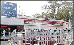
Lalitpur is a city and a municipal board in Lalitpur District, India in the Indian state of Uttar Pradesh. It is also district headquarters of Lalitpur district. The city is part of Bundelkhand region.

Contents

History

Lalitpur was Ruled By Bundela Rajputs. Raja Mardan Singh Bundela, the Bundela king of Lalitpur at the time was one of the prominent figures to take up arms against the British in the First War of Independence in 1857. [3] Abdul Karim, the appointed munshi and royal servant of Queen Victoria was born at a Muslim household in Lalitpur .

Demographics

As per provisional data of 2011 census, Lalitpur had a population of 133,305, out of which males were 69,529 and females were 54,062. The literacy rate is 82.39% with male literacy being 89.12% and female literacy being 75.06%. [4]

Religion in Lalitpur City
ReligionPercent
Hindus
76.27%
Muslims
13.72%
Jains
8.99%
Others
1.02%

Out of the total population, Hinduism is practised by 76.27% people, Islam 13.72%, Jainism 8.99% and the rest 1.02% follow other faiths. [5]

Block list of Lalitpur

The Block is established for state government.

Block list of Lalitpur district

Tourism

Deogarh is a village in Lalitpur district of the Indian state of Uttar Pradesh. It is located on the right bank of Betwa River and to the west of Lalitpur hills. It is known for Gupta monuments and for many ancient monuments of Hindu and Jain origins inside and outside the walls of the fort.The Dashavatara Temple is an early 6th century Vishnu Hindu temple located at Deogarh, Uttar Pradesh which is 25 kilometers from Lalitpur, in the Betwa River valley in northern-central India. It has a simple, one cell square plan and is one of the earliest Hindu stone temples still surviving today. Built in the Gupta Period, the Dashavatara Temple at Deogarh shows the ornate Gupta style architecture. Neelkantheshwar Temple is an ancient temple of Lord Shiva is situated at Lalitpur which is famous for its beautiful architecture.

Transport

Railway

Railway Station Lalitpur Lal01.jpg
Railway Station Lalitpur

Lalitpur Junction has very good rail connections with major Indian cities including New Delhi, Mumbai, Chennai, Patna, Indore, Bhopal, Gwalior, Jabalpur, Ujjain, Saugor, Puri, Allahabad, Bengaluru, Damoh, Jhansi. [6] A new railway line connecting Lalitpur to Tikamgarh started in 2013.Now this line is extended up to Khajuraho. [7] The nearest junctions are Jhansi Junction and Bina Junction in Madhya Pradesh.

The important trains such as the shatabdi express Malwa Express, Punjab Mail, Bhopal - Lucknow Express, Jabalpur - Jammu Tawi Express, Gondwana Express, Bhopal Express, Shatabdi Express, sachkhand express, shatabdi express, mahamana express, pathankot express, Pushpak Express, Kushinagar Express and many other trains stop at Lalitpur.

Road

Bus Stand Lalitpur Lalitpur01.jpg
Bus Stand Lalitpur

The proposed North-south-Corridor of the Golden-Quadrilateral Highway project passes through lalitpur is completed. A village road named madawara road goes to madawara village

Air

Lalitpur is the only place in Bundelkhand Region having an Airstrip maintained by the Airport Authority of India. Considering the Govt of India's new scheme to operate subsidized flights to small towns the strip is likely to be converted into a small airport.

Education

The city has several schools and colleges. The schools are affiliated to ISC, ICSE, CBSE and uttar pradesh board. Some of them are as follows - 1. St. Dominic Savio English medium and Hindi medium school 2. Maharaja Agrasen Public School , Eng. Medium , civil Lines 3. Rani Laxmibai Public school 4. Modern Public school 5. kendriya vidyalay 6. Navoday 7. Sanskaar Valley academy 8. Siddhi sagar academy 9. Maheshwari academy 10. Shri varni jain inter college 11. P. N. Inter college 12. GIC and GGIC. 13. Pahalvan Gurudeen public school CBSE board & up board

The colleges are affiliated to the Bundelkhand University (Jhansi) and Uttar Pradesh Rajarshi Tandon Open University (Allahabad). IGNOU also has a campus in Lalitpur.Some of them are as follows - 1. Nehru Mahavidyalay 2. RMV College 3. Deepchand chaudhary 4.Pahalvan Gurudeen mahila mahavidyalay 5. Pahalvan Gurudeen prashikshan mahavidyalay 6.pahalvan Gurudeen vidhi mahavidyalay 7 . Pahalvan Gurudeen College of science and technology

Related Research Articles

<span class="mw-page-title-main">Bundelkhand</span> Geographical and cultural region in central India

Bundelkhand is a geographical and cultural region and a proposed state and also a mountain range in central & North India. The hilly region is now divided between the states of Uttar Pradesh and Madhya Pradesh, with the larger portion lying in the latter state.

<span class="mw-page-title-main">Jhansi</span> Metropolis in Uttar Pradesh, India

Jhansi is a historic city in the Indian state of Uttar Pradesh. Balwant Nagar was the old name of Jhansi. It lies in the region of Bundelkhand on the banks of the Pahuj River, in the extreme south of Uttar Pradesh. Jhansi is the administrative headquarters of Jhansi district and Jhansi division. Also called the Gateway to Bundelkhand, Jhansi is situated near and around the rivers Pahuj and Betwa at an average elevation of 285 m (935 ft). It is about 420 kilometres (261 mi) from national capital New Delhi and 315 kilometres (196 mi) from state capital Lucknow.

<span class="mw-page-title-main">Orchha</span> Town in Madhya Pradesh, India

Orchha is a town, near the city of Niwari in the Niwari district of Madhya Pradesh state, India. The town was established by a Bundela rajput ruler Rudra Pratap Singh some time after 1501, as the seat of an eponymous former princely state of covering parts of central & north India, in the Bundelkhand region. Orchha lies on the Betwa River, 80 km from Tikamgarh & 15 km from Jhansi in Uttar Pradesh.

Ashoknagar is a city and a Municipality Council in Ashoknagar District in Madhya Pradesh state of central India. It is the administrative headquarters of Ashoknagar District. Earlier it was part of Guna district. Ashoknagar is well known for its Grain Mandi and "Sharbati Gaihu", a type of wheat. The nearest city Guna 45 km from the city. Ashoknagar was formerly known as Pachar. The railway line passes from the middle of the city. Ashoknagar has a railway station and Two Bus stations. Ashoknagar is connected to the main cities of Madhya Pradesh by road and railway.

<span class="mw-page-title-main">Tikamgarh</span> City in Madhya Pradesh, India

Tikamgarh is a town and a tehsil in Tikamgarh district in the Indian state of Madhya Pradesh. The city serves as a district headquarters. The earlier name of Tikamgarh was Tehri consisting of three hamlets, forming a rough triangle. In Tikamgarh town there is locality still known as 'Purani Tehri'. Until Indian independence in 1947, Tikamgarh, formerly called Tehri, was part of the kingdom of Orchha, which was founded in the 16th century by the Bundeli chief Rudra Pratap Singh, who became the first King of Orchha. In 1783 the capital of the state was moved to Tehri, about 40 miles (64 km) south of Orchha, which was home to the fort of Tikamgarh, and the town eventually took the name of the fort. The district is famous for the old fort of Kundar known as Garh Kundar, which was built by Khangars and remained the capital of Khangar rulers from 1180 to 1347.

<span class="mw-page-title-main">Jainism in Bundelkhand</span>

Bundelkhand, a region in central India, has been an ancient center of Jainism. It covers northern part of Madhya Pradesh and south western part of Uttar Pradesh.

<span class="mw-page-title-main">Tikamgarh district</span> District of Madhya Pradesh in India

Tikamgarh district is one of the 52 districts of Madhya Pradesh state in central India. Tikamgarh town is the district headquarters. The district is part of Sagar Division.

<span class="mw-page-title-main">Lalitpur district, India</span> District in Uttar Pradesh, India

Lalitpur District is one of the districts of Uttar Pradesh state of India. Lalitpur district is a part of Jhansi Division. Lalitpur is the main town and administrative headquarters. The district occupies an area of 5,039 km².

<span class="mw-page-title-main">Jhansi district</span> District of Uttar Pradesh in India

Jhansi district is one of the districts of Uttar Pradesh state in northern India. The city of Jhansi is the district headquarters. The district is bordered on the north by Jalaun District, to the east by Hamirpur and Mahoba districts, to the south by Tikamgarh District of Madhya Pradesh state, to the southwest by Lalitpur District, which is joined to Jhansi District by a narrow corridor, and on the east by the Datia and Bhind districts of Madhya Pradesh. Population 19,98,603. Lalitpur District, which extends into the hill country to the south, was added to Jhansi District in 1891, and made a separate district again in 1974.

Badagaon Dhasan is a town and a Nagar Parishad in Tikamgarh district in the state of Madhya Pradesh, India.

<span class="mw-page-title-main">Bina-Etawa</span> City in Madhya Pradesh, India

Bina-Etawa, shortened to Bina, is a city in the Sagar district in the Indian state of Madhya Pradesh. The name Bina-etawa is derived from the Bina River flowing nearby the city. Four more rivers are flowing through the surrounding area of the city. Motichur, Betwa, Narayani, and Silar. Bina-etawa is an emerging as well as fastest growing city of MP.The Development in City going to be all around in the city as well as outside of City.The city is an important center of economic and industrial activities for the state;a Major Oil Refinery(BPCL Bina Refinery,formerly known as BORL-Bharat Oman Refinery limited) that is located in Bina. This region is known for its high-quality wheat which is exported internationally.

Talbehat is a nagar panchayat city in Lalitpur district in the Indian state of Uttar Pradesh.

<span class="mw-page-title-main">Parwar (Jain community)</span>

Parwar, also spelt as Paravāra, is a major Jain community from the Bundelkhand region, which is largely in Madhya Pradesh, but also includes the two districts of Lalitpur and Jhansi in Uttar Pradesh. Apart from them, Nagpur district (Maharashtra) have also a very large Parwar community. There is an area in Itwari of Nagpur known as Parwar-Pura having large number of Parwar's homes and shops. Most of the Nagpur's Parwar are migrated from Sagar, Deori, and other small villages of Sagar District of MP. Parwar exclusively follow the Digambar Jain tradition. Parwar usually preferred their marriage within community. There are 12 Gotra in Parwar community. Each Gotra has 12 Moor (lineages). A marriage within the same gotra or lineage are not allowed. Traditionally a marriage within any of the 8 branches was not permitted and hence the community was termed ashta-shakha.

<span class="mw-page-title-main">Golapurva</span>

Golapurva is an ancient Jain community from the Bundelkhand region of Madhya Pradesh.

<span class="mw-page-title-main">Dashavatara Temple, Deogarh</span> Early 6th century Vishnu Hindu temple located at Deogarh, Jakhlaun District, Lalitpur, Uttar Pradesh

The Dashavatara Temple is an early 6th century Lord Vishnu Hindu temple located at Deogarh, Uttar Pradesh which is 125 kilometers from Jhansi, in the Betwa River valley in northern-central India. It has a simple, one cell square plan and is one of the earliest Hindu stone temples still surviving today. Built in the Gupta Period, the Dashavatara Temple at Deogarh shows the ornate Gupta style architecture.

<span class="mw-page-title-main">Matatila Dam</span> Betwa Lalitpur

The Matatila Dam is a dam in district Lalitpur, Uttar Pradesh, India, that was built in 1958 on the Betwa River. Situated 50 km from Jhansi and 93 km away from Deogarh, this earthen dam is 35 m high. The dam has 23 Spillway gates. The catchment area is around 20 km2 with a maximum storage capacity of 1132 million cubic metres.

<span class="mw-page-title-main">Deogarh, Uttar Pradesh</span> Village in Uttar Pradesh, India

Deogarh is a village in Lalitpur district of the Indian state of Uttar Pradesh. It is located on the right bank of Betwa River and to the west of Lalitpur hills. It is known for Gupta monuments and for many ancient monuments of Jain origins inside and outside the walls of the fort.

<span class="mw-page-title-main">Jhansi Junction railway station</span> Railway Station in Uttar Pradesh, India

Jhansi Junction railway station (JHS), officially Virangana Lakshmibai Jhansi Railway Station (VGLJ), is a major railway junction in the city of Jhansi in Bundelkhand region of Uttar Pradesh. It is one of the busiest and largest railway stations in India. It hosts various trains of Indian Railways like the Gatimaan Express, which is the fastest train of India, as well as others like Bundelkhand Express. It is a major halt for various important trains of Indian Railways like five sets of Rajdhani Express bound for Mumbai, Chennai, Bengaluru, Hyderabad etc. One set of Bhopal Shatabdi Express, three Duronto Express trains, Punjab Mail one of the oldest running trains in India, Kerala Express, Karnataka Express, etc.

Lalitpur Junction railway station is an important railway station in Lalitpur district, Uttar Pradesh, India. Its code is LAR. It serves Lalitpur city and towns such as Chanderi in nearby Madhya Pradesh. The station consists of three platforms. The platforms are not well sheltered. The station was connected with Tikamgarh in 2013and further to Khajuraho by 2016.

<span class="mw-page-title-main">Jain temples at Deogarh</span>

The Jain Temple complex is group of 31 Jain temples located at Deogarh in Lalitpur district, Uttar Pradesh built around 8th to 17th century CE. The Jain complex in Deogarh are protected by the Department of Archaeology of the Archaeological Survey of India (ASI), and managed through its Northern Circle Office located in Lucknow. ASI maintain an archaeological museum at the Deogarh site, which is noted for its treasured archaeological sculptures.

References

  1. "Lalitpur City Census 2011 data". Census 2011 - Census of India.
  2. "Lalitpur City Census 2011 data". Census 2011 - Census of India.
  3. "Raja Mardan Singh". Indian Culture, Government of India.
  4. "Lalitpur City Census 2011 data". Census 2011 - Census of India.
  5. "Lalitpur City Census 2011 data". Census 2011 - Census of India.
  6. "List of trains passing through Lalitpur", Retrieved on 7 May 2015,
  7. "Tikamgarh of Madhya Pradesh connected with Rail Services", Jagran Josh , 27 April 2013. Retrieved on 7 May 2015