Rabwah, officially known as Chenab Nagar, is a city in Chiniot, Punjab, Pakistan on the bank of Chenab River. It was the headquarters of the Ahmadiyya Muslim Community from September 20, 1948 when the community relocated from Qadian, India to the newly created state of Pakistan, where the community bought the area of present-day Rabwah from the government to establish its home. This continued until 1984 and the establishment of Ordinance XX. In 1984, the headquarters were moved to the United Kingdom with Mirza Tahir Ahmed, first to London and then in 2019 to the Islamabad compound in Tilford, Surrey.
Kaithal is a city and municipal council in the Kaithal district of the Indian state of Haryana. Kaithal was previously a part of Karnal district and later, Kurukshetra district until 1 November 1989, when it became the headquarters of the Kaithal. It shares a border with the Patiala district of state Punjab and the Kurukshetra, Jind and Karnal districts of Haryana. Kaithal district is situated in the North-West of the Haryana state. Its North-West boundaries, which include Guhla-Cheeka are attached to Punjab.

Farīduddīn Masūd Ganjshakar, commonly known as Bābā Farīd or Sheikh Farīd, was a 13th-century Punjabi Muslim mystic, poet and preacher. Revered by Muslims, Hindus and Sikhs alike, he remains one of the most revered Muslim mystics of South Asia during the Islamic Golden Age.
Bahawalnagar District, is a district of Punjab province in Pakistan. Before the independence of Pakistan, Bahawalnagar was part of Bahawalpur state governed by the Nawab of Bahawalpur. The city of Bahawalnagar is the capital of the district.
Rahim Yar Khan District, is a district in the province of Punjab, Pakistan. Its headquarters is the city of Rahim Yar Khan.
Lalian is a town in Lalian Tehsil and in the Chiniot District of Punjab province, in Pakistan. It is located at 31°49'21N 72°47'50E with an altitude of 171 metres (564 feet) and is situated on the Faisalabad-to-Sargodha road.

Khuldabad is a city and a Taluka of Aurangabad district in the Indian state of Maharashtra. It is known as the Valley of Saints, or the Abode of Eternity, because in the 14th century, several Sufi saints chose to reside here. The Bhadra Maruti Temple and Dargah of Zar Zari Zar Baksh, Shaikh Burhan ud-din Gharib Chisti and Shaikh Zain-ud-din Shirazi, along with the tomb of the Mughal emperor Aurangzeb and his trusted General Asif Jah I, the first Nizam of Hyderabad, are located in this town. It is a holy and spiritual city of Islamic saints.

Bangarmau is a tehsil and a municipal board in Unnao district in the state of Uttar Pradesh, India. It is located on high ground overlooking the left bank of the Kalyani river, about 50 km northwest of Unnao and 22 km northwest of Safipur. Roads fan out in all directions from Bangarmau, including the main Unnao-Hardoi road SH38 that passes through town. Major commodities produced here include wheat flour, rice, and pulses. As of 2011, the population of Bangarmau is 44,204, in 7,600 households.
Gopamau is a town and nagar panchayat in Hardoi district, Uttar Pradesh, India. Located just west of the Gomti river, Gopamau is a historic town that once served as a pargana headquarters. Important industries include cap making, tobacco, and agricultural products. As of 2011, the population of Gopamau is 15,526, in 2,346 households. The town has several slum areas, which are home to 36.07% of town residents.
Muftian is a village situated in Tehsil Dina Jhelum District, Punjab, Pakistan.

Kahuta Tehsil is one of the seven tehsils (subdivisions) of Rawalpindi District in the Punjab province of Pakistan. The neighbouring tehsil of Kallar Sayedan used to be part of Kahuta, but was later created as separate tehsil. The name Kahuta was derived from "Koh" a local medicinal tree and "Boota".
Potha Sharif is a village and union council of Murree Tehsil in the Murree District of Punjab, Pakistan. It is located in the north-east of the tehsil at 33°57'0N 73°30'0E, and is bounded to the north by Phagwari, to the south by Sehr Bagla, to the west by Rawat and to the east by Kashmir. The village contains the mazar of the Sufi saint Hazarat Dada Malik Suraj Abbasi, forefather of the Potha Shareef people. He had seven sons and their descendants are currently present in Potha Shareef. People visit the mazar from different areas of the country to offer tribute.
Mian Wali Qureshian is a town in Rahim Yar Khan District, Punjab, Pakistan. It was founded more than 450 years ago by Makhdoom Rohullah Shah I. The Saraiki language is spoken.

Renala Khurd is an administrative subdivision (tehsil) of Okara District in the Punjab province of Pakistan. It is administratively subdivided into 18 Union Councils, two of which form the tehsil capital Renala Khurd.
Khudian Khas, is a large town and Municipal Committee of Kasur District in the Punjab province of Pakistan..Khudian is part of Kasur Tehsil and is at an altitude of 177 meters (583 feet) above sea level. The Sutlej River, which flows on the India-Pakistan border, is 20 kilometers from Khudian. It is 33 kilometers from India-Pakistan border of Ganda Singh Wala All the lines are written and approved by Faheem Jawad a Notable publisher at Khudian khas.

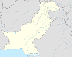
Chiniot District, is a district in the Punjab province of Pakistan. It became the district in July 2009. Before this, it was a tehsil of Jhang District.
Mouza Adlana is a town in the tehsil of Bhawana City in Chiniot District, Punjab, Pakistan. It is situated approximately 29 km away from Chiniot City and about 16 km from Bhawana.
Samundri Tehsil is an administrative subdivision of Faisalabad District in the Punjab province of Pakistan. Samundri is the city and headquarters of the tehsil. Samundri Tehsil farms are irrigated by Gugera Branch Canal and Burala Branch Canal.
Mouza Talib is a village in District Chiniot on Chak Jhumra Road, Punjab, Pakistan. It is in Tehsil Chiniot's Union Council # 13 and is 8 km away from the Faisalabad to Pindi Bhattian Motorway M3 Sahianwala Interchange. Its latitude is 31° 41' 28.08"N, and longitude is 73° 0' 59.49"E. Via M3, Talib is 140 kilometers from Lahore and 30 kilometers from Faisalabad. Nearby towns are Chak Jhumra, Chiniot, Sargodha, Lalian, Bhawana, Rabwah, Faisalabad and Pindi Bhattian. By road, Talib is connected to Barnala, Chak Jhumra, and Chiniot. The most famous things in Talib are Darbar Baba gard Ali, Canal Bridge, Government Primary school for Boys Girls and Government Middle school for girls.
Behak Mekan is a small town located in the Sargodha District of Punjab, Pakistan. It was established during the British Empire era. The town is situated 16.5 kilometres (10.3 mi) from the city of Sargodha and 10 kilometres (6.2 mi) away from Dhreema. Due to its strategic location, the British Royal Air Force constructed an airstrip near "godhay wala" which became later significant to the Pakistan Air Force after the independence of Pakistan.