Related Research Articles

Clermont is a city in Lake County in central Florida, United States, about 22 miles (35 km) west of Orlando and 22 miles (35 km) southeast of Leesburg. The population was 43,021 in 2020. The city is residential in character and its economy is centered in retail trade, lodging, and tourism-oriented restaurants and bars. It is part of the Orlando–Kissimmee–Sanford Metropolitan Statistical Area.

Fruitland Park is a city in Lake County, Florida, United States. The population was 4,078 at the 2010 census. The Census Bureau estimated the population in 2018 to be 10,122. It is part of the Orlando–Kissimmee–Sanford Metropolitan Statistical Area.
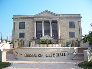
Leesburg is a city in Lake County, Florida, United States. The population was 20,117 at the 2010 census. As of 2019, the population recorded by the U.S. Census Bureau was 23,671.
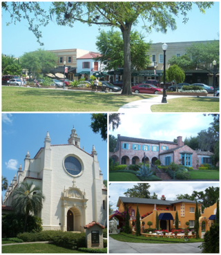
Winter Park is a city in Orange County, Florida, United States. The population was 29,795 according to the 2020 census. It is part of the Orlando–Kissimmee–Sanford, Florida Metropolitan Statistical Area.

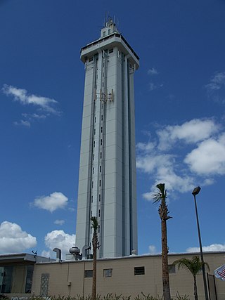
Oldsmar is a city in Pinellas County, Florida, United States. As of the 2020 census, the city had a population of 14,898. The Oldsmar name dates to April 12, 1916, when automobile pioneer Ransom E. Olds purchased 37,541 acres (151.92 km2) of land north of Tampa Bay to establish a planned community.

Carlock is a village in McLean County, Illinois, United States. The population was 548 at the 2020 census. It is part of the Bloomington–Normal Metropolitan Statistical Area.

Midland is a census-designated place (CDP) in Pierce County, Washington. The population was 9,962 at the time of the 2020 census.

In the United States, a plat (plan) is a cadastral map, drawn to scale, showing the divisions of a piece of land. United States General Land Office surveyors drafted township plats of Public Lands Surveys to show the distance and bearing between section corners, sometimes including topographic or vegetation information. City, town or village plats show subdivisions broken into blocks with streets and alleys. Further refinement often splits blocks into individual lots, usually for the purpose of selling the described lots; this has become known as subdivision.
Ernest Kouwen-Hoven (1875–1940) came to the U.S at the age of 20 from the Netherlands. In 1908, his son, Jack, was born. His daughter, Phylis, followed in 1910. In 1915, the family arrived in Melbourne, Florida from California. He purchased land and platted it in 1916, thus founding Indialantic, Florida. The plat was later revised in 1919. In the same year, he began construction of his toll bridge across the Indian River. His original "Indialantic, Florida Land Sales" office, which was destroyed by fire in 1919, was built on Front Street in Melbourne.
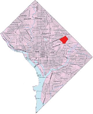
Langdon, is a neighborhood located in Ward 5 of Northeast Washington, D.C. Historical surveys of D.C. recognize Langdon as a neighborhood dating back to at least 1903. Langdon is bounded by Montana Ave. NE to the west/southwest, New York Ave. NE to the south, Bladensburg Rd. NE to the southeast, South Dakota Ave. NE to the northeast, and Rhode Island Ave. NE to the north/northwest. Langdon is adjacent to the Northeast D.C. neighborhoods of Brentwood (west), Woodridge (east), Fort Lincoln (southeast), Gateway (south), and Brookland (north).
Lake–Sumter State College is a public college with multiple campuses in Central Florida: three campuses in Lake and Sumter Counties; the original campus in Leesburg; the South Lake Campus in Clermont; and the Sumter Campus in Sumterville. It is a member of the Florida College System. The college also partners with The Villages Charter High School as a dual enrollment site.
Seabreeze is a beachside neighborhood in Daytona Beach, Florida, which existed as an independent city from May 24, 1901 until January 1, 1926, when it merged with Daytona and Daytona Beach to become one consolidated city.
Forest Meadow is a suburban residential neighborhood within the Lake Highlands area of Dallas, Texas. The neighborhood is thought of today as being bounded by Greenville Avenue on the west, Whitehurst Drive on the south, Abrams Road on the east, and an alley demarcating the neighborhood from businesses and apartment blocks on Forest Lane to the north. However, the earliest plats identified by the name "Forest Meadows" were east of Abrams Road and some plats were south of Whitehurst Drive. These eastern areas are now generally considered part of Town Creek for neighborhood association purposes. Earlier plats used the name "Forest Meadows" and this nomenclature is also in use to describe neighborhoods in the area.

Lemuel Milk (1820–1893) was an early settler to Eastern Illinois and, at one point, the largest landholder in the state. Born in New York, Milk came to Illinois after purchasing a large tract of land in Iroquois County. Milk came to own over 25,000 acres (10,000 ha) of land in Illinois, Indiana, and North Dakota. He also found success with a general store in Chebanse, Illinois and an ice harvesting company in Kankakee, Illinois. Milk is the namesake of Milks Grove Township, Iroquois County, Illinois.
Manhattan was a proposed city in a development that was located in northern Manatee County, Florida near the present-day town of Parrish during the Florida land boom in the 1920s. The town was intended to be the centerpiece of an agricultural community called Manatee River Park Estates.

Waldeck is a ghost town in Marion County, Kansas, United States. It is currently a ghost town that was located approximately 3.5 miles north of Lehigh next to a railroad. No buildings remain of this former community.
The Lake County Public Library System (LCLS) is a library system located in Lake County, Florida.
Robert Coles was a 17th-century New England colonist who is known for the scarlet-letter punishment he received in the Massachusetts Bay Colony and his role in establishing the Providence Plantations, now the state of Rhode Island.
References
1895 U.S. Atlas Dead link
Municipalities and communities of Lake County, Florida, United States | ||
|---|---|---|
| Cities |  | |
| Towns | ||
| CDPs | ||
| Unincorporated communities | ||
| Ghost towns | ||
| Footnotes | ‡This populated place also has portions in an adjacent county or counties | |