Fort Mason, Florida | |
|---|---|
 Fort Mason  Fort Mason | |
| Coordinates: 28°52′37″N81°42′03″W / 28.87694°N 81.70083°W | |
| Country | United States |
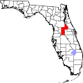
| State | Florida |
| County | Lake |
| Elevation | 69 ft (21 m) |
| Time zone | UTC-5 (Eastern (EST)) |
| • Summer (DST) | UTC-4 (EDT) |
| Area code | 352 |
| GNIS feature ID | 305696 [1] |
Fort Mason is an unincorporated community in Lake County, Florida, United States. [1] The community is located along Florida State Road 19 between Eustis and Dona Vista.
Fort Mason was the junction of the main line and the Lane Park branch of the St. Johns and Lake Eustis Railway, which was acquired by the Plant System in 1896 and the Atlantic Coast Line Railroad in 1902.