Umatilla, Florida

Last updated

Umatilla, Florida
City of Umatilla
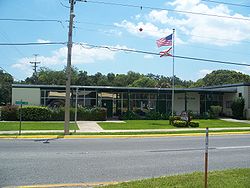
Umatilla City Hall02.jpg
Umatilla City Hall
Motto: 
"Nature's Hometown" [1]
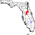
Lake County Florida Incorporated and Unincorporated areas Umatilla Highlighted.svg
Location in Lake County and the state of Florida
Coordinates: 28°55′38″N81°39′54″W / 28.92722°N 81.66500°W / 28.92722; -81.66500
Country Flag of the United States.svg  United States of America
State Flag of Florida.svg  Florida
County Flag of Lake County, Florida.png Lake
Incorporated November 8, 1904 [2]
Government
  Type Council-Manager
   Mayor Chris Creech
   Vice Mayor Kent Adcock
   Council Members Brian Butler,
John Nichols, and
Katherine "Kaye" Adams
   City Manager Scott Blankenship
   City Clerk Jessica Burnham
Area
[3]
  Total4.27 sq mi (11.06 km2)
  Land3.59 sq mi (9.30 km2)
  Water0.68 sq mi (1.76 km2)
Elevation
[4]
98 ft (30 m)
Population
 (2020)
  Total3,685
  Density1,026.18/sq mi (396.26/km2)
Time zone UTC-5 (Eastern (EST))
  Summer (DST) UTC-4 (EDT)
ZIP code
32784
Area code 352
FIPS code 12-73025 [5]
GNIS feature ID2405622 [4]
Website www.umatillafl.org

Umatilla is a city in Lake County, Florida, United States. The population was 3,685 at the 2020 census. Umatilla is known as the Gateway to the Ocala National Forest, located in northern Lake County. [1]

Contents

History

The city was named after Umatilla, Oregon. [2] In 1998 it was the site of a Mediterranean fruit fly outbreak at the Golden Gem citrus plant. [6]

Geography

The City of Umatilla is in northern Lake County, and its exact coordinates are located at 28°55′59″N81°39′52″W / 28.93306°N 81.66444°W / 28.93306; -81.66444 (28.933134, –81.664430). [7]

Florida State Road 19 passes through the center of town, leading south 11 miles (18 km) to Tavares, the county seat, and north 58 miles (93 km) through the Ocala National Forest to Palatka. Umatilla is 38 miles (61 km) northwest of Orlando and 49 miles (79 km) southwest of Daytona Beach.

According to the United States Census Bureau, the city has a total area of 4.2 square miles (11.0 km2), of which 3.6 square miles (9.3 km2) are land and 0.69 square miles (1.8 km2), or 16.00%, are water. [8]

Demographics

Historical population
CensusPop.Note
1910 283
1920 640126.1%
1930 90741.7%
1940 1,14926.7%
1950 1,31214.2%
1960 1,71730.9%
1970 1,600−6.8%
1980 1,87217.0%
1990 2,35025.5%
2000 2,214−5.8%
2010 3,45656.1%
2020 3,6856.6%
U.S. Decennial Census [9]

2010 and 2020 census

Umatilla racial composition
(Hispanics excluded from racial categories)
(NH = Non-Hispanic)
RacePop 2010 [10] Pop 2020 [11] % 2010% 2020
White (NH)2,9382,99685.01%81.30%
Black or African American (NH)110603.18%1.63%
Native American or Alaska Native (NH)9110.26%0.30%
Asian (NH)6190.17%0.52%
Pacific Islander or Native Hawaiian (NH)020.00%0.05%
Some other race (NH)390.09%0.24%
Two or more races/Multiracial (NH)201270.58%3.45%
Hispanic or Latino (any race)37046110.71%12.51%
Total3,4563,685100.00%100.00%

As of the 2020 United States census, there were 3,685 people, 1,680 households, and 1,061 families residing in the city. [12]

As of the 2010 United States census, there were 3,456 people, 1,403 households, and 968 families residing in the city. [13]

2000 census

As of the census [5] of 2000, there were 2,214 people, 867 households, and 582 families residing in the city. The population density was 871.4 inhabitants per square mile (336.4/km2). There were 987 housing units at an average density of 388.5 per square mile (150.0/km2). The racial makeup of the city was 93.54% White, 3.52% African American, 0.23% Native American, 0.32% Asian, 0.95% from other races, and 1.45% from two or more races. Hispanic or Latino of any race were 3.93% of the population.

In 2000, there were 867 households, out of which 29.6% had children under the age of 18 living with them, 49.8% were married couples living together, 13.1% had a female householder with no husband present, and 32.8% were non-families. 28.1% of all households were made up of individuals, and 15.0% had someone living alone who was 65 years of age or older. The average household size was 2.48 and the average family size was 3.01.

In 2000, in the city, the population was spread out, with 24.3% under the age of 18, 8.4% from 18 to 24, 26.3% from 25 to 44, 20.5% from 45 to 64, and 20.6% who were 65 years of age or older. The median age was 39 years. For every 100 females, there were 89.6 males. For every 100 females age 18 and over, there were 81.1 males.

In 2000, the median income for a household in the city was $29,628, and the median income for a family was $37,500. Males had a median income of $25,500 versus $21,741 for females. The per capita income for the city was $17,739. About 7.2% of families and 11.9% of the population were below the poverty line, including 13.9% of those under age 18 and 17.9% of those age 65 or over.
Parks and recreation

The city offers many outdoor activities such as boating, fishing, camping and hiking. Nearby Alexander Springs features a section of the Florida Trail, an unpaved hiking trail, 1,300 miles (2,100 km) long, spanning the state of Florida from north to south.

Notable people

Related Research Articles

<span class="mw-page-title-main">Wauchula, Florida</span> City in Florida, United States of America

Wauchula is a city and the county seat of Hardee County, Florida, United States. As of the 2020 census, it had a population of 5,001.

<span class="mw-page-title-main">Avon Park, Florida</span> City in Florida, United States

Avon Park is a city in Highlands County, Florida, United States. As of the 2020 census, the population was 9,658, up from the 2010 census when the population was 8,836, but down from the estimated population of 10,695 in 2018. It is the oldest city in Highlands County, and was named after Stratford-upon-Avon, England.

<span class="mw-page-title-main">Lake Magdalene, Florida</span> Census-designated place in Florida, United States

Lake Magdalene is a census-designated place (CDP) in Hillsborough County, Florida, United States. It is part of the Tampa Bay area. The population was 30,742 at the 2020 census.

<span class="mw-page-title-main">Lady Lake, Florida</span> Town in the state of Florida, United States

Lady Lake is a town in Lake County, Florida, United States. It is part of the Orlando–Kissimmee–Sanford Metropolitan Statistical Area. Area history is exhibited at the Lady Lake Historical Society Museum. The population was 15,970 at the 2020 census.

<span class="mw-page-title-main">Mascotte, Florida</span> City in Florida

Mascotte is a city in Lake County, Florida, United States. As of the 2020 census, the population was 6,609, up from 5,101 in 2010. It is part of the Orlando–Kissimmee–Sanford Metropolitan Statistical Area.

<span class="mw-page-title-main">Minneola, Florida</span> City in Florida

Minneola is a city in Lake County, Florida, United States. It is part of the Orlando–Kissimmee–Sanford Metropolitan Statistical Area. The Minneola tangelo is named after the city. The population was 13,843 at the 2020 census.

<span class="mw-page-title-main">Tavares, Florida</span> City in Florida

Tavares is a city and the county seat of Lake County, Florida. The population at the 2020 census was 19,003, and in 2019 the population was estimated to be 17,749. It is part of the Orlando–Kissimmee–Sanford Metropolitan Statistical Area.

<span class="mw-page-title-main">North Fort Myers, Florida</span> Census-designated place in Florida, United States

North Fort Myers is an unincorporated area and census-designated place (CDP) in Lee County, Florida, United States. It is part of the Cape Coral-Fort Myers, Florida Metropolitan Statistical Area. The population was 42,719 at the 2020 census.

<span class="mw-page-title-main">Pinewood, Florida</span> Census-designated place in Florida

Pinewood is an unincorporated community and census-designated place (CDP) in Miami-Dade County, Florida, United States. It is part of the Miami metropolitan area of South Florida. The population was 17,246 at the 2020 census.

<span class="mw-page-title-main">Three Lakes, Florida</span> Census-designated place in Florida

Three Lakes is a census-designated place (CDP) and planned community in Miami-Dade County, Florida, United States. It is part of the Miami metropolitan area of South Florida. The population was 16,540 at the 2020 census, up from 15,047 in 2010.

<span class="mw-page-title-main">Westview, Florida</span> Census-designated place in Florida

Westview is a census-designated place (CDP) in Miami-Dade County, Florida, United States. It is part of the Miami metropolitan area of South Florida. The population was 9,923 at the 2020 census.

<span class="mw-page-title-main">Westwood Lakes, Florida</span> Census-designated place in Florida

Westwood Lakes is a census-designated place and unincorporated community of Miami-Dade County, Florida, United States. It is part of the Miami metropolitan area of South Florida. The population was 11,373 at the 2020 census.

<span class="mw-page-title-main">Belle Isle, Florida</span> City in Florida, United States

Belle Isle is a city in Orange County, Florida, United States. The population was 7,032 at the 2020 census. It is part of the Orlando–Kissimmee–Sanford Metropolitan Statistical Area.

<span class="mw-page-title-main">East Lake, Pinellas County, Florida</span> Census-designated place in Florida, United States

East Lake is a census-designated place (CDP) in Pinellas County, Florida, United States. It was one of the last areas in the densely populated county to develop and often confused with East Lake in neighboring Hillsborough County. The population was 32,344 at the 2020 census.

<span class="mw-page-title-main">Dundee, Florida</span> Town in the state of Florida, United States

Dundee is a town in Polk County, Florida, United States. The population was 5,235 at the 2020 census. It is part of the Lakeland–Winter Haven Metropolitan Statistical Area.

<span class="mw-page-title-main">Casselberry, Florida</span> City in Florida

Casselberry is a city in Seminole County, Florida, United States. The city is part of the Orlando–Kissimmee–Sanford Metropolitan Statistical Area. Its population was 28,794 at the 2020 census.

<span class="mw-page-title-main">Holly Hill, Florida</span> City in Florida, United States

Holly Hill is a city in Volusia County, Florida, United States. Holly Hill's city limits lie entirely on the Florida mainland, unlike the larger cities on either side of it, Daytona Beach and Ormond Beach, which encompass both the mainland and the beachfront barrier island across the Halifax River. The population was 12,958 at the 2020 census.

<span class="mw-page-title-main">Orange City, Florida</span> City in the United States

Orange City is a city in Volusia County, Florida, United States. It is a part of the Deltona–Daytona Beach–Ormond Beach metropolitan area. As of the 2020 US census, the city had a population of 12,632.

<span class="mw-page-title-main">South Daytona, Florida</span> City in Florida, United States

South Daytona is a city in Volusia County, Florida, United States. The population was 12,865 at the 2020 census.

<span class="mw-page-title-main">Alafaya, Florida</span> Census-designated place in Florida, United States

Alafaya is a census-designated place and unincorporated area in Orange County, Florida, United States. The population was 92,452 at the 2020 US census. It is part of the Orlando–Kissimmee–Sanford, Florida Metropolitan Statistical Area. It is most known for being near the University of Central Florida, Avalon Park and Waterford Lakes.

References

  1. 1 2 "The City of Umatilla, Florida". The City of Umatilla, Florida. Retrieved September 19, 2012.
  2. 1 2 "History of Umatilla". City of Umatilla Florida. Archived from the original on March 2, 2022. Retrieved November 8, 2019.
  3. "2020 U.S. Gazetteer Files". United States Census Bureau. Retrieved December 2, 2021.
  4. 1 2 U.S. Geological Survey Geographic Names Information System: Umatilla, Florida
  5. 1 2 "U.S. Census website". United States Census Bureau . Retrieved January 31, 2008.
  6. Campbell, Ramsey (April 30, 1998). "52 Medflies Turn Up in Lake Traps". Orlando Sentinel. Retrieved November 8, 2019.
  7. "US Gazetteer files: 2010, 2000, and 1990". United States Census Bureau. February 12, 2011. Retrieved April 23, 2011.
  8. "U.S. Gazetteer Files: 2019: Places: Florida". U.S. Census Bureau Geography Division. Retrieved November 8, 2019.
  9. "Census of Population and Housing". Census.gov. Retrieved June 4, 2015.
  10. "P2 HISPANIC OR LATINO, AND NOT HISPANIC OR LATINO BY RACE - 2010: DEC Redistricting Data (PL 94-171) - Umatilla city, Florida". United States Census Bureau .
  11. "P2 HISPANIC OR LATINO, AND NOT HISPANIC OR LATINO BY RACE - 2020: DEC Redistricting Data (PL 94-171) - Umatilla city, Florida". United States Census Bureau .
  12. "S1101 HOUSEHOLDS AND FAMILIES - 2020: Umatilla city, Florida". United States Census Bureau .
  13. "S1101 HOUSEHOLDS AND FAMILIES - 2010: Umatilla city, Florida". United States Census Bureau .