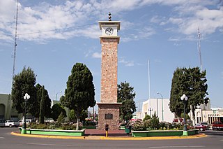
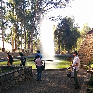
Las Delicias is a city in the municipality of Tijuana in the Mexican state of Baja California. The city had a population of 15,486 as of 2010.
Contents
Las Delicias observes Daylight Saving Time (DST) with time zone PDT (GMT -07:00)
Las Delicias is a city in the municipality of Tijuana in the Mexican state of Baja California. The city had a population of 15,486 as of 2010.
Las Delicias observes Daylight Saving Time (DST) with time zone PDT (GMT -07:00)

Cempoala or Zempoala is an important Mesoamerican archaeological site located in the municipality of Úrsulo Galván in the Mexican state of Veracruz. The site was inhabited mainly by Totonacs, Chinantecas and Zapotecs. It was one of the most important Totonac settlements during the postclassical Mesoamerican period and the capital of the kingdom of Totonacapan. It is located one kilometer from the shore of the Actopan River and six kilometres from the coast.
Santiago de Puringla is a municipality in the Honduran department of La Paz. The municipality is situated on a plain bordered by the River Puringla. South of the municipality runs the River Lepasale.

Delicias is a city in the Mexican state of Chihuahua and serves as the seat of the municipality of the same name. The current president of this town is Mr. Leonardo Jiménez, who has also been a participant in the creation of first-level cities. It is located southeast of the state capital, Chihuahua. Delicias was declared an official municipality of the state of Chihuahua on January 7, 1935. Delicias is a small industrial city and a major agricultural center located in the Conchos River Valley. As of 2015, the city of Delicias had a population of 148,045 inhabitants, while the metropolitan area had a population of 223,993 inhabitants. It was founded on 30 April 1933, making it one of Mexico's youngest cities. The municipality of Delicias is one of the smallest in the state in terms of size area.
Delicias may refer to:

The banderas monumentales are a collection of tall flagpoles containing large flags of Mexico located throughout Mexico. They are part of a program started in 1999 under President Ernesto Zedillo that is currently administered by the Secretariat of National Defense. The main feature of these monuments is a giant Mexican flag flying off a 50-meter-high (160-ft) flagpole. The size of the flag was 14.3 by 25 metres and it was flown on a pole that measured 50 metres (160 ft) high. In the time after the decree was issued, many more banderas monumentales have been installed throughout the country in various sizes. Many of the locations were chosen due to significant events in Mexican history that occurred there.

Las Merindades is a comarca located north of the province of Burgos, in the autonomous community of Castile and León. It is bounded on the north-west by the province of Cantabria, north-east by the province of Biscay, south by La Bureba, south-east by Ebro, south-west by Páramos, and on the east by the province of Álava.

Plaza Las Delicias is the main plaza in the city of Ponce, Puerto Rico. The square is notable for its fountains and for the various monuments it contains. The historic Parque de Bombas and Ponce Cathedral buildings are located within the plaza, which actually consists of two squares: Plaza Muñoz Rivera on the north end, and Plaza Degetau on the southern end. The square is the center of the Ponce Historic Zone, and it is flanked by the historic Ponce City Hall to the south, the early 19th-century Teatro Fox Delicias to the north, the NRHP-listed Banco Crédito y Ahorro Ponceño and Banco de Ponce buildings to the east, and the Armstrong-Poventud Residence to the west. The square dates back to the early Spanish settlement in Ponce of 1670. It is the main tourist attraction of the city, receiving about a quarter of a million visitors per year.

Douzhangzhuang railway station (豆张庄站) is a fourth-class station at 97 km on Jingshan railway.
Simpkins is an unincorporated community in Northampton County, Virginia, United States.

Ullevål Hageby is a residential area and garden city in borough Nordre Aker of Oslo, Norway. All housing in the area is part of the housing cooperative Oslo Havebyselskap. The area borders on Ullevål University Hospital to the east, Blindern in the west, and Berg to the north.
Valle de las Palmas is located between two hamlets Espuela and Seco in the municipalities of Tijuana and Tecate, Baja California, Mexico. It is the site of a long-term planned urban development which would take advantage of proximity to the existing cities of Tijuana to the north west and Mexicali to the north east to create a similar sized city of one million people by the year 2030, on Mexican Federal Highway 3 around an existing industrial park and university campus Unidad Valle De Las Palmas. The first project in Valle de las Palmas, named Valle San Pedro, is proposed by the Mexican Federal Government, the State of Baja California, Urbi and Banobras. It has been certified as the first Integral Sustainable Urban Development or DUIS in Mexico, which establishes criteria in collaboration with Interamerican Development Bank IDB to evaluate projects that will receive inter-secretarial technical support and public investment. The locality reported a population of 1,860 inhabitants in the 2010 federal census. It is located at an altitude of 282 m. (925 ft.) above sea level.
Spring Valley is a hamlet in Terrell Rural Municipality No. 101 in the province of Saskatchewan, Canada. Located at the end of highway 715, and approximately 62 km south of the city of Moose Jaw.

Arganzuela is one of the 21 districts of the city of Madrid, Spain.
North Charleston Air Force Station is a closed United States Air Force General Surveillance Radar station. It is located in the City of North Charleston, South Carolina. It was closed in 1980.

Acacias or Las Acacias is an administrative neighborhood (barrio) of Madrid belonging to the district of Arganzuela. It has an area of 1.074172 km2 (0.414740 sq mi). As of 1 February 2020, it has a population of 37,049.
Rincón Zapotec is a Zapotec language of Oaxaca, Mexico.

Santo Tomás a town in Ensenada Municipality, Baja California, on the Pacific Coast of Mexico. Santo Tomás is a primarily a wine-growing region, though it is increasingly a tourist destination.

Embajadores is an administrative neighborhood (barrio) of Madrid, belonging to the Centro District.
Jacumba Valley is a valley in San Diego and Imperial Counties, California. Its head is at 32°37′00″N116°10′07″W Carrizo Creek has its source in Jacumba Valley, 1.2 miles north of the California-Mexico State boundary, at 32°38′09″N116°07′05″W at an elevation of 3,210 feet, on the west side of the divide between Jacumba Valley and the valley of upper Boulder Creek. Carrizo Creek flows west then north northwest through Jacumba Valley to its mouth at the head of Carrizo Gorge. Just south of the Jacumba and In-ko-pah Mountains, the terrain consists of large, flat desert plains and hills of granite boulders. The wider region, including the Jacumba Wilderness, which sits just east of the valley, has been greatly affected by the construction of the US/Mexico border and has become a site of great numbers of migrations along migrant paths.

La Cinco y Diez, is the name of an intersection, pedestrian overpass over that intersection, public transportation hub and major retail district in La Mesa borough, Tijuana, Mexico. The name exists because a branch of the Luján/Cardenas family's "La Cinco y Diez" five and dime store once stood here, and Tijuana residents taking taxis or buses would ask to be let off by "La Cinco y Diez".
32°24′32″N116°56′37″W / 32.40889°N 116.94361°W