Laurelia | |
|---|---|
| Coordinates: 30°58′11.27″N94°49′20.28″W / 30.9697972°N 94.8223000°W | |
| Country | |
| State | Texas |
| County | Polk |
| Time zone | UTC-6 (Central (CST)) |
| • Summer (DST) | UTC-5 (CDT) |
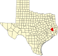
Laurelia is a ghost town in central Polk County, Texas, United States. The town was founded after Judge Claiborne Holshausen built a sawmill in 1880. The location grew into a town and was named for the laurels that dominated the area. [1] The mill remained the nucleus of the town, and after the sawmill burned in 1913, the town dwindled. [1]


