Leggett, Texas

Last updated

Leggett
USA Texas location map.svg
Red pog.svg
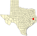
Leggett
Location within the state of Texas
Usa edcp location map.svg
Red pog.svg
Leggett
Leggett (the United States)
Coordinates: 30°49′05″N94°52′14″W / 30.81806°N 94.87056°W / 30.81806; -94.87056
CountryFlag of the United States.svg  United States
StateFlag of Texas.svg  Texas
County Polk
Population
 (2000)
  Total
500
Time zone UTC-6 (Central (CST))
  Summer (DST) UTC-5 (CDT)
GNIS feature ID1361059 [1]

Leggett is an unincorporated community in Polk County, Texas, United States. It is located at the junction of U.S. Highway 59 (future Interstate 69) and Farm to Market Road 942. As of 2000, the community had about 500 residents. [2]

Contents

The Leggett Independent School District serves area students.

History

In 1919, Leggett, described as a sundown town, a white council set a curfew for blacks, banned black fraternal and church meetings, and forbade African Americans from visiting the railroad station or the post office. [3] :164

Climate

The climate in this area is characterized by hot, humid summers and generally mild to cool winters. According to the Köppen climate classification, Leggett has a humid subtropical climate (Cfa on climate maps). [4]

See also

References

  1. U.S. Geological Survey Geographic Names Information System: Leggett, Texas
  2. "Leggett, Texas". The Handbook of Texas online. Retrieved March 17, 2008.
  3. McWhirter, Cameron (2011). Red Summer. The Summer of 1919 and the Awakening of Black America. Henry Holt. ISBN   9780805089066.
  4. Climate Summary for Leggett, Texas