Moscow | |
---|---|
Coordinates: 30°54′48″N94°49′31″W / 30.91333°N 94.82528°W | |
Country | United States |
State | Texas |
County | Polk |
Named for | Moscow, Russia |
Elevation | 105 m (345 ft) |
Population (2000) | |
• Total | 170 |
Time zone | UTC-6 (Central (CST)) |
• Summer (DST) | UTC-5 (CDT) |
ZIP code | 75960 [2] |
Area code | 936 |
GNIS feature ID | 1363185 [1] |
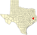
Moscow is an unincorporated community in Polk County, Texas, United States. As of the year 2000, the community had approximately 170 residents.
Moscow is at the junction of U.S. Highway 59 and Farm to Market Road 350, ninety miles north of Houston in central Polk County.
David and Matilda Green first settled the area in the 1840s. The first post office was established in 1847 under Green's name. The community's name was changed to Moscow, after Moscow, Russia, in 1853 as the postal authorities deemed the proposed name of Greenville as being too similar to Greensboro, Texas. [3] The First Baptist Church was established in 1849. Moscow became a trading center for Polk County farmers during the latter 1850s and a stage stop on the Liberty-Nacogdoches Road, with cotton gins, shops, saloons and a hotel. [4]
The town was noted for its school, the Moscow Masonic Academy (or Moscow Masonic High School depending on source). Built in 1853 as the Moscow Masonic Male and Female Academy, the institution served the community under its latter name from 1857. Future Texas Governor William P. Hobby attended the school. The school burned down around 1935. [5] [6]
The Houston, East and West Texas Railway reached the town in 1880 followed by the seven-mile long Moscow, Camden and San Augustine Railroad in 1899, one of the shortest railroads in Texas. A mule-drawn streetcar line linked the train station with the business district. [4]
Sawmills in Moscow supported the burgeoning logging industry. A cannery for vegetables and fruit and a column factory (making architectural columns) were early industries in the town that helped diversify Moscow's economy. [7]
In 1880, with an estimated 228 residents, Moscow was the largest town in Polk County. By 1900 its population had reached 263. [4] By the 1920s, the lumber supply in East Texas began to dwindle due to overharvesting. During the Great Depression, many farmers went bankrupt and lumber companies left the area due to the economic conditions. With the decline of logging and agriculture, Moscow's population began to decline also and per 2000 census was 170.
It's a small peaceful quiet town[ according to whom? ] with a Hobby Park, Big Jake's restaurant, and Kundi Ranch near U.S. Route 59.
Moscow is served by Corrigan-Camden Independent School District.
Montgomery County is a county in the U.S. state of Texas. As of the 2020 U.S. census, the county had a population of 620,443. The county seat is Conroe. The county was created by an act of the Congress of the Republic of Texas on December 14, 1837, and is named for the town of Montgomery. Between 2000 and 2010, its population grew by 55%, the 24th-fastest rate of growth of any county in the United States. Between 2010 and 2020, its population grew by 36%. According to the U.S. Census Bureau, the estimated population is 711,354 as of July 1, 2023.
Polk County is a county located in the U.S. state of Texas. As of the 2020 census, its population was 50,123. Its county seat is Livingston. The county is named after James K. Polk.
Liberty County is a county in the U.S. state of Texas. As of the 2020 census, its population was 91,628. The county seat is Liberty. It was founded in 1831, as a municipality in Mexico as Villa de la Santísima Trinidad de la Libertad by commissioner José Francisco Madero and organized as a county of the Republic of Texas in 1836. Its name was anglicized as Liberty based on the ideal of American liberty.
Houston County is a county located in the U.S. state of Texas. As of the 2020 census, its population was 22,066. Its county seat is Crockett. Houston County was one of 46 entirely dry counties in the state of Texas, until voters in a November 2007 special election legalized the sale of alcohol in the county.
Falls County is a county in the U.S. state of Texas. As of the 2020 census, its population was 16,968. The county seat is Marlin. It is named for the original 10-foot-tall waterfall on the Brazos River, which existed until the river changed course during a storm in 1866. The present falls is two miles northeast of the original falls, at the Falls on the Brazos Park, a camping site only a few miles out of Marlin on Farm to Market Road 712.
Dallas County is a county located in the U.S. state of Missouri. As of the 2010 census, the population was 17,071. Its county seat is Buffalo. The county was organized in 1842 as Niangua County and then renamed in 1844 for George M. Dallas, who served as Vice President under James K. Polk.
Brazoria is a city in Brazoria County, [{Texas]], United States, and is part of the Houston–The Woodlands–Sugar Land metropolitan area. As of the 2020 census, the city population was 2,866.
West Columbia is a city in Brazoria County, Texas, United States. The city is centered on the intersection of Texas Highways 35 & 36, 55 miles (89 km) southwest of downtown Houston. The population was 3,644 at the 2020 census.
Gonzales is a city in the U.S. state of Texas, with a population of 7,165 at the 2020 census. It is the county seat of Gonzales County. The "Come and Take It" incident, the ride of the Immortal 32 into the Alamo, and the Runaway Scrape after the fall of the Alamo, all integral events in the War for Texas Independence from Mexico, originated in Gonzales.
Anderson is a city and county seat of Grimes County, Texas, United States. The population was 193 as of the 2020 census. The town and its surroundings are listed on the National Register of Historic Places as the Anderson Historic District.
Crosby is a census-designated place in Harris County, Texas, United States. The population was 3,417 at the 2020 census.
Willis is a city in Montgomery County, Texas, United States, located eight miles north of Conroe in north central Montgomery County. The city began to develop in 1870 after what is now the Union Pacific Railroad built track through the area. As a part of the Piney Woods, the Willis economy has historically been driven by lumber, agriculture, and the manufacture of lumber and agriculture equipment. From the late nineteenth to early twentieth century, it produced tobacco as a commodity crop. Competition from Cuba reduced its contribution to the economy.
Corrigan is a town in north central Polk County, Texas, United States. It is located along U.S. Highway 59 and is approximately 100 miles from Houston. Its population was 1,477 in the 2020 census.
Livingston is a town in and the county seat of Polk County, Texas, United States. With a population of 5,640 at the 2020 census, it is the largest city in Polk County. It is located approximately 46 miles (74 km) south of Lufkin and roughly 74 miles (119 km) northeast of Houston and was originally settled in 1835 as Springfield. Its name was changed in 1846 to Livingston, when it was designated as the county seat of Polk County.
Trinity is a city in Trinity County, Texas, United States. The population was 2,343 at the 2020 census.
Washington-on-the-Brazos is an unincorporated community along the Brazos River in Washington County, Texas, United States. The town is best known for being the site of the Convention of 1836 and the signing of the Texas Declaration of Independence.
Prairie Lea is an unincorporated community in Caldwell County, Texas, United States. According to the Handbook of Texas, the community had an estimated population of 255 in 2000. It is part of the Austin–Round Rock Metropolitan Statistical Area.
Camden is an unincorporated community in east central Polk County, Texas, United States. It is located at the junction of Farm to Market Roads 942 and 62, eighty miles north-northwest of Beaumont. As of the year 2000, the community had approximately 1,200 residents.
Black Rock is an unincorporated community and former logging camp in Polk County, Oregon, United States. It is located about three miles west of Falls City, in the Central Oregon Coast Range on the Little Luckiamute River.