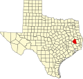
Dallardsville, Texas

Last updated

Dallardsville
USA Texas location map.svg
Red pog.svg
Dallardsville
Location within the state of Texas
Usa edcp location map.svg
Red pog.svg
Dallardsville
Dallardsville (the United States)
Coordinates: 30°37′43″N94°37′55″W / 30.62861°N 94.63194°W / 30.62861; -94.63194
CountryFlag of the United States.svg  United States
StateFlag of Texas.svg  Texas
County Polk
Elevation
[1]
70 m (240 ft)
Population
  Total
350
Time zone UTC-6 (Central (CST))
  Summer (DST) UTC-5 (CDT)
GNIS feature ID1355553 [1]

Dallardsville is an unincorporated community in Polk County, Texas, United States. In 2000, the community had approximately 350 residents. [2]

The Big Sandy Independent School District serves area students.

Related Research Articles

<span class="mw-page-title-main">Austin, Texas</span> Capital city of Texas

Austin is the capital of the U.S. state of Texas and the county seat and most populous city of Travis County, with portions extending into Hays and Williamson counties. Incorporated on December 27, 1839, it is the 26th-largest metropolitan area in the United States, the 11th-most populous city in the United States, the fourth-most populous city in the state after Houston, San Antonio, and Dallas, and the second-most populous state capital city after Phoenix, the capital of Arizona. It has been one of the fastest growing large cities in the United States since 2010. Downtown Austin and Downtown San Antonio are approximately 80 miles (129 km) apart, and both fall along the Interstate 35 corridor. This combined metropolitan region of San Antonio–Austin has approximately 5 million people. Austin is the southernmost state capital in the contiguous United States and is considered a Gamma + level global city as categorized by the Globalization and World Cities Research Network.

<span class="mw-page-title-main">Texas</span> U.S. state

Texas is the most populous state in the South Central region of the United States. It borders Louisiana to the east, Arkansas to the northeast, Oklahoma to the north, New Mexico to the west, and an international border with the Mexican states of Chihuahua, Coahuila, Nuevo León, and Tamaulipas to the south and southwest. Texas has a coastline on the Gulf of Mexico to the southeast. Covering 268,596 square miles (695,660 km2), and with some 31 million residents as of 2024, it is the second-largest state by both area and population. Texas is nicknamed the Lone Star State for its former status as an independent republic.

<span class="mw-page-title-main">Fort Worth, Texas</span> City in Texas, United States

Fort Worth is a city in the U.S. state of Texas and the seat of Tarrant County, covering nearly 350 square miles (910 km2) into Denton, Johnson, Parker, and Wise counties. According to the 2024 United States census estimate, Fort Worth's population was 996,756 making it the fourth-most populous city in the state and the 12th-most populous in the United States. Fort Worth is the second-largest city in the Dallas–Fort Worth metroplex, which is the fourth-most populous metropolitan area in the United States and the most populous in Texas.

<span class="mw-page-title-main">Texas hold 'em</span> Variation of the card game of poker

Texas hold 'em is the most popular variant of the card game of poker. Two cards, known as hole cards, are dealt face down to each player, and then five community cards are dealt face up in three stages. The stages consist of a series of three cards, later an additional single card, and a final card. Each player seeks the best five-card poker hand from any combination of the seven cards: the five community cards and their two hole cards. Players have betting options to check, call, raise, or fold. Rounds of betting take place before the flop is dealt and after each subsequent deal. The player who has the best hand and has not folded by the end of all betting rounds wins all of the money bet for the hand, known as the pot. In certain situations, a "split pot" or "tie" can occur when two players have hands of equivalent value. This is also called "chop the pot". Texas hold 'em is also the H game featured in HORSE and HOSE.

<span class="mw-page-title-main">Williamson County, Texas</span> County in Texas, United States

Williamson County is a county in the U.S. state of Texas. As of the 2020 census, its population was 609,017. Its county seat is Georgetown. The county is named for Robert McAlpin Williamson, a community leader and a veteran of the Battle of San Jacinto.

<span class="mw-page-title-main">Harris County, Texas</span> County in Texas, U.S.

Harris County is a county located in the U.S. state of Texas; as of the 2020 census, the population was 4,731,145, making it the most populous county in Texas and the third-most populous county in the United States. Its county seat is Houston, the most populous city in Texas and fourth-most populous city in the United States. The county was founded in 1836 and organized in 1837. It is named for John Richardson Harris, who founded the town of Harrisburg on Buffalo Bayou in 1826. According to the July 2023 census estimate, Harris County's population has shifted to 4,835,125 comprising over 16% of Texas's population. Harris County is included in the nine-county Houston–The Woodlands–Sugar Land metropolitan statistical area, which is the fifth-most populous metropolitan area in the United States.

<span class="mw-page-title-main">Sugar Land, Texas</span> City in the United States

Sugar Land is the largest city in Fort Bend County, Texas, United States, located in the southwestern part of the Houston–The Woodlands–Sugar Land metropolitan area. Located about 19 miles (31 km) southwest of downtown Houston, Sugar Land is a populous suburban municipality centered around the junction of Texas State Highway 6 and Interstate 69/U.S. Route 59.

<span class="mw-page-title-main">Conroe, Texas</span> City in Texas, United States

Conroe is a city in and the county seat of Montgomery County, Texas, United States, about 40 miles (64 km) north of Houston. It is a principal city in the Houston–The Woodlands–Sugar Land metropolitan area.

<span class="mw-page-title-main">Tyler, Texas</span> City in Texas, United States

Tyler is a city in and the county seat of Smith County, Texas, United States. As of 2020, the population is 105,995. Tyler was the 38th most populous city in Texas and 289th in the United States. It is the principal city of the Tyler metropolitan statistical area, which is the 198th most populous metropolitan area in the U.S. and 16th in Texas after Waco and the College Station–Bryan areas, with a population of 233,479 in 2020. The city is named for John Tyler, the tenth President of the United States.

<span class="mw-page-title-main">Georgetown, Texas</span> City in Texas, United States

Georgetown is a city in Texas and the county seat of Williamson County, Texas, United States. The population was 67,176 at the 2020 census, and according to 2023 census estimates, the city is estimated to have a population of 96,312. It is 30 miles (48 km) north of Austin and is part of the Austin–Round Rock–San Marcos metropolitan statistical area.

<span class="mw-page-title-main">Frisco, Texas</span> City in Texas, United States

Frisco is a city in the U.S. state of Texas, located in Collin and Denton counties. It is part of the Dallas–Fort Worth metroplex (DFW) and about 25 miles (40 km) from both Dallas Love Field and Dallas/Fort Worth International Airport. Its population was 200,509 in the 2020 U.S. census.

<span class="mw-page-title-main">Greater Houston</span> Metropolitan Statistical Area in Texas, United States

Greater Houston, designated by the United States Office of Management and Budget as Houston–The Woodlands–Sugar Land, is the fifth-most populous metropolitan statistical area in the United States, encompassing nine counties along the Gulf Coast in Southeast Texas. With a population of 7,510,253 in 2023, Greater Houston is the second-most populous metropolitan area in Texas after the Dallas–Fort Worth metroplex.

<span class="mw-page-title-main">Northeast Texas</span> Region in Texas, United States

Northeast Texas is a cultural and geographic region in the northeast corner of the U.S. state of Texas. Geographically centered on two metropolitan areas strung along Interstate 20—Tyler in the west and Kilgore, Longview, Marshall to the east, the areas of Greenville, Mount Pleasant, Sulphur Springs, Paris, and Texarkana in the north primarily along Interstate 30, and Jacksonville and Palestine to the south are also major cities within the region. Most of Northeast Texas is included in the interstate region of the Ark-La-Tex.

<span class="mw-page-title-main">Montague, Texas</span> Census-designated place in Texas, US

Montague is a census-designated place and unincorporated community in Montague County, Texas, United States. It is the county seat of Montague County and had an estimated population of 400 in 2000, according to the Handbook of Texas. Its population was 304 as of the 2010 census.

<span class="mw-page-title-main">Area code 936</span> Area code in Texas, United States

North American area code 936 is a state of Texas telephone area code for numbers in the Nacogdoches-Huntsville area, as well as a few outer portions of the Houston metropolitan area. It was created February 19, 2000, in a code-split from area code 409. It primarily serves the Deep East Texas area.

Big Sandy Independent School District is a public school district based in the community of Dallardsville, Texas (USA). The district consists of one school serving all grades.

According to the U.S. Census Bureau, as of 2023, Texas was the second largest state in population after California, with a population of 30,503,301, an increase of more than 1.3 million people, or 4.7%, since the 29,145,505 of the 2020 census. Its apportioned population in 2020 was 29,183,290. Since the beginning of the 21st century, the state of Texas has experienced strong population growth. Texas has many major cities and metropolitan areas, along with many towns and rural areas. Much of the population is concentrated in the major cities of Dallas–Fort Worth, Austin, San Antonio, Houston, McAllen, and El Paso and their corresponding metropolitan areas. The first four aforementioned main urban centers are also referred to as the Texas Triangle megaregion.

<span class="mw-page-title-main">Greater Austin</span> Metropolitan Statistical Area in Texas, United States

The Austin–Round Rock–San Marcos metropolitan statistical area, or Greater Austin, is a five-county metropolitan area in the U.S. state of Texas, as defined by the Office of Management and Budget. The metropolitan area is situated in Central Texas on the western edge of the American South and on the eastern edge of the American Southwest, and borders Greater San Antonio to the south. It forms part of the larger Austinonio metroplex.

Big Sandy High School or Big Sandy School is a public high school located in Dallardsville, Texas and classified as a 2A school by the UIL. It is a part of the Big Sandy Independent School District in Polk County, Texas. In 2015, the school was rated "Met Standard" by the Texas Education Agency.

Big Sandy High School may mean:

References

  1. 1 2 U.S. Geological Survey Geographic Names Information System: Dallardsville, Texas
  2. Wooster, Robert. "DALLARDSVILLE, TX". The Handbook of Texas online. Retrieved March 17, 2013.