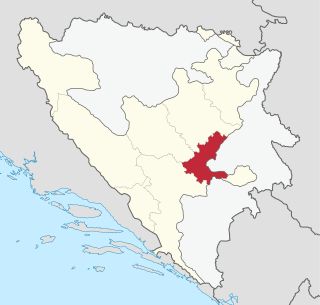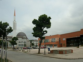
Vogošća is a town and a municipality located in Sarajevo Canton of the Federation of Bosnia and Herzegovina, an entity of Bosnia and Herzegovina. The municipality is located about 6 kilometers north of the city of Sarajevo and is its secondary suburb, after Ilidža. According to the 2013 census, the town has a population of 10,568 inhabitants, with 26,343 inhabitants in the municipality.

The Sarajevo Canton, officially the Canton of Sarajevo is one of 10 cantons of the Federation of Bosnia and Herzegovina in Bosnia and Herzegovina. Its cantonal seat is the city of Sarajevo, also the capital city of Bosnia and Herzegovina.

Ilijaš is a town and municipality located in Sarajevo Canton of the Federation of Bosnia and Herzegovina, an entity of Bosnia and Herzegovina. It is located north-west of the inner city of Sarajevo and was established in May 1952 with the organization of people's committees. Those local people's committees founded the local municipalities, which led to self-management of the municipalities, including the municipality of Ilijaš.

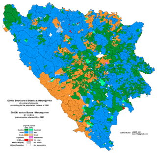
This article is about the Demographic history of Bosnia and Herzegovina, and deals with the country's documented demographics over time. For an overview of the various ethnic groups and their historical development, see Ethnic groups in Bosnia and Herzegovina.

The 1991 population census in Bosnia and Herzegovina was the last census of the population undertaken in the Socialist Republic of Bosnia and Herzegovina before the Bosnian War. It was conducted during the final week of March 1991. For the 1991 census there were 109 municipalities of which ten were part of Sarajevo.

Doljani is a village in Bosnia and Herzegovina. According to the 1991 census, the village is located in the municipality of Čapljina.

Vranovina is a village in the municipality of Bosanski Petrovac, Bosnia and Herzegovina.

Martin Brod is a village in the municipality of Bihać, Bosnia and Herzegovina. It is mostly known for its proximity to Una National Park, which is Bosnia and Herzegovina's largest national park.

Šajinovac is a village in the municipality of Drvar, Bosnia and Herzegovina.

Česim is a village in the municipalities of Konjic and Nevesinje, Bosnia and Herzegovina.

Donji Prijeslop is a village in the municipality of Konjic, Bosnia and Herzegovina.

Bila is a village in the municipality of Livno, Bosnia and Herzegovina.

Lipa is a village in the municipality of Livno, Canton 10 of the Federation of Bosnia and Herzegovina in Bosnia and Herzegovina.

Miši is a village in the municipality of Livno in Canton 10 of the Federation of Bosnia and Herzegovina in Bosnia and Herzegovina. In the 1991 census, it had a population of 919 inhabitants, a majority of whom are Croats.

Potkraj is a village in the municipality of Livno, Bosnia and Herzegovina.

Žabljak is a village in the municipality of Livno, Bosnia and Herzegovina.

Blažuj is a village in the municipality of Tomislavgrad, Bosnia and Herzegovina.

Seonica is a village in the municipality of Tomislavgrad, Bosnia and Herzegovina.

Vrnograč is a town in Bosnia and Herzegovina. It is located in the municipality of Velika Kladuša and the Una-Sana Canton Federation of Bosnia and Herzegovina. In the census of 1991, it had 1,201 people, including a majority of Bosniaks. According to the 2013 census, its population was 762.

Potok is a village in the municipality of Livno, Bosnia and Herzegovina.


