
Saint-Louis is the fifth-largest commune in the French overseas department of Réunion. It is located on the southwest part of the island of Réunion, adjacent to Saint-Pierre.

Aviron is a commune in the Eure department in Normandy in northern France.
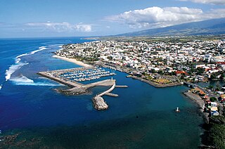
Saint Pierre is the third-largest commune in the French overseas department and region of Réunion. Located on the southwest side of the island, it is the capital of the French Southern and Antarctic Lands. It developed from a port built from 1854 to 1882, which was used for the trade between Asia and Europe. Today, it features 400 sites for fishing and pleasure boats, while most of the commercial traffic moved north to Le Port.

Saint-Paul is the second-largest commune in the French overseas department of Réunion. It is located on the extreme west side of the island of Réunion.

Saint-Benoît is a commune in the French overseas department of Réunion. It is located on the eastern part of the island of Réunion, about 40 kilometres southeast of Saint-Denis, the capital.

The 4 arrondissements of the Réunion department are:
- Arrondissement of Saint-Benoît, with 6 communes. The population of the arrondissement was 126,777 in 2016.
- Arrondissement of Saint-Denis, with 3 communes. The population of the arrondissement was 204,304 in 2016.
- Arrondissement of Saint-Paul, with 5 communes. The population of the arrondissement was 214,073 in 2016.
- Arrondissement of Saint-Pierre, with 10 communes. The population of the arrondissement was 307,770 in 2016.

The arrondissement of Saint-Paul is an arrondissement of France in the Réunion department in the Réunion region. It has five communes. Its population is 214,073 (2016), and its area is 537.2 km2 (207.4 sq mi).

The arrondissement of Évreux is an arrondissement of France in the Eure department in the Normandy region. It has 103 communes. Its population is 140,039 (2016), and its area is 958.7 km2 (370.2 sq mi).

The arrondissement of Saint-Pierre is an arrondissement of France in the Réunion department in the Réunion region. It has 10 communes. Its population is 307,770 (2016), and its area is 942.8 km2 (364.0 sq mi).
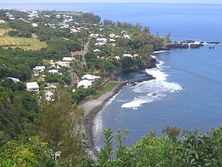
Saint-Joseph is a commune in the French overseas department of Réunion. It is located on the extreme south end of the island of Réunion. As such, it features the southernmost point of the European Union. The village Vincendo is part of the commune.
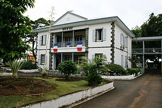
Sainte-Marie is a commune in the French overseas department of Réunion. It is located on the north side of the island of Réunion, just east of, and adjacent to, the capital of Saint-Denis.

La Possession is a commune in the French overseas department of Réunion. It is located on the northwest side of the island of Réunion, between the capital of Saint-Denis and the commune of Le Port.

L'Étang-Salé is a commune in the department and region of Réunion. It is bordered by the communes of Les Avirons and Saint-Louis. Within the commune is the Étang-Salé forest. There is also a beach with black sand in the commune that is a popular surfing spot.

Sainte-Rose is a commune on the east coast of the French island and department of Réunion.

Sainte-Suzanne is a commune on the north coast of the French island and department of Réunion.

Saint-Philippe is a commune in the French overseas department of Réunion. It is located in south-eastern Reunion.

Les Trois-Bassins is a commune in the department of Réunion. It is found on the west coast of the island, and the summit of Grand Bénare lies within its borders. The commune borders Cilaos to the west, Saint-Paul to the north and Saint-Leu to the south. The commune of Trois-Bassins was created on 27 February 1897.
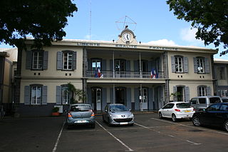
Saint-André is the fifth-largest commune in the French overseas department of Réunion. It is located on the northeast part of the island of Réunion. The small lake Étang de Bois Rouge is located in the commune.
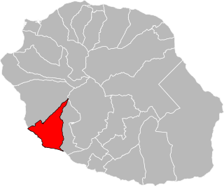
The canton of L'Étang-Salé is an administrative division of Réunion, an overseas department and region of France. Its borders were modified at the French canton reorganisation which came into effect in March 2015. Its seat is in L'Étang-Salé.
Communauté intercommunale des Villes solidaires (CIVIS) is the communauté d'agglomération, an intercommunal structure, centred on the city of Saint-Pierre. It is located in Réunion, an overseas department and region of France. It was created in December 2002. Its area is 378.1 km2. Its population was 181,704 in 2018, of which 84,961 in Saint-Pierre proper.


