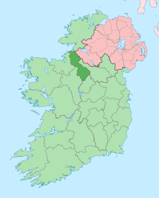
County Leitrim is a county in Ireland. It is in the province of Connacht and is part of the Northern and Western Region. It is named after the village of Leitrim. Leitrim County Council is the local authority for the county, which had a population of 35,199 according to the 2022 census.

County Sligo is a county in Ireland. It is in the Northern and Western Region and is part of the province of Connacht. Sligo is the administrative capital and largest town in the county. Sligo County Council is the local authority for the county. The population of the county was 70,198 at the 2022 census. It is noted for Benbulben Mountain, one of Ireland's most distinctive natural landmarks.
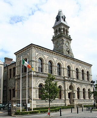
Sligo is a coastal seaport and the county town of County Sligo, Ireland, within the western province of Connacht. With a population of 20,608 in 2022, it is the county's largest urban centre and the 24th largest in the Republic of Ireland.

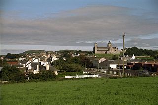
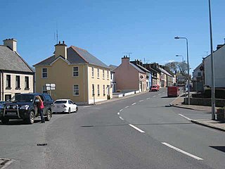
Enniscrone – also spelt Inniscrone and officially named Inishcrone – is a small seaside town in County Sligo, Ireland. Its sandy beach, tourist campsite, and golf course all attract visitors. As of the 2022 census, the town had a population of 1,291 people.
Carndonagh is a town on the Inishowen peninsula in County Donegal, Ireland, close to Trawbreaga Bay. It is the site of the Donagh Cross, believed to date to the 7th century. The Irish name, Carn Domhnach, means "the cairn or mound of the church".
Aghabullogue or Aghabulloge is a village and parish in the barony of Muskerry East in County Cork, Ireland. It lies around 30 km (19 mi) west of Cork City, south of the Boggeragh Mountains and north of the River Lee.

Lough Gill is a freshwater lough (lake) mainly situated in County Sligo, but partly in County Leitrim, in Ireland. Lough Gill provides the setting for William Butler Yeats' poem "The Lake Isle of Innisfree".

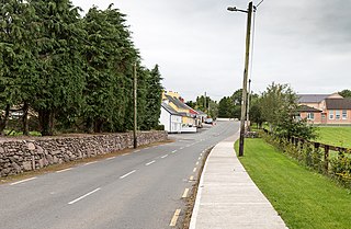
Ballintra is a village in the parish of Drumholm in the south of County Donegal, Ireland, just off the N15 road between Donegal town and Ballyshannon. Ballintra lies on the northern bank of the Blackwater river. The river rises in the hills that lie inland from the town, and flows through a number of small lakes before spilling over a small waterfall in a gorge behind the village.

Achonry is a village in County Sligo, Ireland. The old name is Achad Cain Conairi. St. Nath Í ua hEadhra (O'Hara) founded a monastery here. The foundation gave the later diocese its name. The monastery was founded on land granted by the Clan Conaire. Nath Í was the teacher of St. Féichín of Ballysadare. The village is in a townland and civil parish of the same name.

Ballysadare, locally also Ballisodare, is a town in County Sligo, Ireland. It is about 7 km (4 mi) south of Sligo town. The town developed on an important crossing of the Owenmore River. Ballysadare is in a townland and civil parish of the same name.

Kilglass or Kilglas is a rural townland in County Sligo, Ireland, in the hinterland of Enniscrone. Kilglass is in a civil parish of the same name.

Riverstown, historically called Ballyederdaowen, is a village in County Sligo, Ireland. Known for its musical tradition it is located at a bridging point of the River Unshin (Arrow), 17.2 km south of Sligo town and 4 km east of the N4 road.

Rosses Point is a village in County Sligo, Ireland and also the name of the surrounding peninsula.
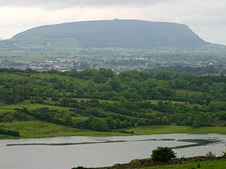
Knocknarea is a large prominent hill west of Sligo town in County Sligo, Ireland, with a height of 327 metres (1,073 ft). Knocknarea is visually striking as it has steep limestone cliffs and stands on the Cúil Irra peninsula overlooking the Atlantic coast. At the summit is one of Ireland's largest cairns, known as Queen Maeve's Cairn, which is believed to contain a Neolithic passage tomb. In recent years there has been concern that the ancient cairn, a protected National Monument, is being damaged by climbers. There are also remains of several smaller tombs on the summit. Knocknarea overlooks the Carrowmore tombs and is thought to have been part of an ancient ritual landscape.
Drumkeeran, also Drumkeerin, is a village and townland in County Leitrim, Ireland, located at the junction of the R280 and R200 roads. It is situated in drumlin hills at the foot of Corry Mountain, just north of Lough Allen.

Lissadell House is a neo-classical Greek revivalist style country house in County Sligo, Ireland.

The Garavogue or Garvoge (Irish: An Gharbhóg is a river in County Sligo, northwest Ireland, known historically as the Sligeach or Sligo River.

Bunnanadden, Bunnanaddan or Bunninadden is a small village in south County Sligo, Ireland. It is on the R296 road, 9 km from Tubbercurry and 8 km from Ballymote.

Miosgán Meadhbha, anglicized Miosgan Meva and also called Maeve's Cairn, is a large cairn on the summit of Knocknarea in County Sligo, Ireland. It is thought to conceal a passage tomb from the Neolithic. It is the largest cairn in Ireland, excepting those at Brú na Bóinne in Meath.

The Lung is a river in Ireland flowing through counties Mayo and Roscommon. It runs in a generally north-easterly direction mainly through Mayo but also forms the border between the two counties in three places until it reaches Lough Gara near the town of Ballaghaderreen in County Roscommon. The river and its lakes provides facilities for anglers to fish.

