Light's Vision

Last updated

Coordinates: 34°54′46″S138°35′38″E / 34.9128°S 138.5940°E / -34.9128; 138.5940

Geographic coordinate system Coordinate system

A geographic coordinate system is a coordinate system that enables every location on Earth to be specified by a set of numbers, letters or symbols. The coordinates are often chosen such that one of the numbers represents a vertical position and two or three of the numbers represent a horizontal position; alternatively, a geographic position may be expressed in a combined three-dimensional Cartesian vector. A common choice of coordinates is latitude, longitude and elevation. To specify a location on a plane requires a map projection.

Contents

The Light's Vision commemoration at Montefiore Hill in North Adelaide Light's Vision.jpg
The Light's Vision commemoration at Montefiore Hill in North Adelaide
The Light's Vision commemoration at Montefiore Hill in North Adelaide, at night Montefiore hill, Adelaide, at Night.JPG
The Light's Vision commemoration at Montefiore Hill in North Adelaide, at night

The first surveyor-general of Adelaide, South Australia, Colonel William Light designed a layout and development programme for the city. This plan is now known as "Light's Vision". Notable aspects of Light's plan are that the city centre is laid out in a grid-like pattern, with squares in the centre of the city and in the centres of the four quarters of the city, (NW, NE, SE, SW), and the city is surrounded by Parklands.

Adelaide City in South Australia

Adelaide is the capital city of the state of South Australia, and the fifth-most populous city of Australia. In June 2017, Adelaide had an estimated resident population of 1,333,927. Adelaide is home to more than 75 percent of the South Australian population, making it the most centralised population of any state in Australia.

South Australia State of Australia

South Australia is a state in the southern central part of Australia. It covers some of the most arid parts of the country. With a total land area of 983,482 square kilometres (379,725 sq mi), it is the fourth-largest of Australia's states and territories by area, and fifth largest by population. It has a total of 1.7 million people, and its population is the second most highly centralised in Australia, after Western Australia, with more than 77 percent of South Australians living in the capital, Adelaide, or its environs. Other population centres in the state are relatively small; Mount Gambier, the second largest centre, has a population of 28,684.

William Light Australian land surveyer

Colonel William Light was a British naval and army officer and a painter. He was the first Surveyor-General of the Colony of South Australia and he is famous for choosing the site of the province's capital, Adelaide, and for designing the layout of its streets and parks – in the Adelaide city centre and the Adelaide Park Lands.

Light's Vision commemoration

Light's work was acknowledged by the "Light's Vision commemoration" statue, by Glaswegian sculptor Birnie Rhind, which was unveiled in the northwest of Victoria Square (opposite the GPO) on 27 November 1906. [1]

Victoria Square, Adelaide square in Adelaide, South Australia, Australia

Victoria Square, also known as Tarntanyangga or Tarndanyangga, is a public square in the South Australian capital of Adelaide. The area was named "Victoria Square" by the Street Naming Committee on 23 May 1837, after Princess Victoria, then heir presumptive of the British throne. Less than a month later the King died and Victoria became Queen. The Kaurna people know the area as Tarndanyangga, "The Dreaming Place of the Red Kangaroo". In line with the Adelaide City Council's recognition of Kaurna country, the area is officially referred to as Victoria Square/Tarndanyangga. The square was upgraded in 2014, new lighting was added and the fountain was moved from the northern end to the southern tip of the square. During the Christmas period, it is traditional for a 24.5 m high Christmas tree to be erected in the northern part of the square.

The General Post Office was the name of the British postal system from 1660 until 1969.

Legend has it that William Light stood on Montefiore Hill (in the North Parklands adjacent to North Adelaide) in 1837, pointed at what would one day become the Adelaide city centre, and said "This is the place for a city". The statue was moved from Victoria Square to Montefiore Hill in 1938. Since then, the statue has depicted Light pointing at the City of Adelaide below. With the passage of time, the commemorative statue, and the piece of land on which it stands, have both come to be referred to as "Light's Vision", rather than the official full name "Light's Vision commemoration".

Adelaide Park Lands

The Adelaide Park Lands are the figure-eight of land spanning both banks of the River Torrens between Hackney and Thebarton and separating the City of Adelaide from the surrounding suburbia of greater Metropolitan Adelaide, the capital city of South Australia. They were laid out by Colonel William Light in his design for the city, and originally consisted of 2,300 acres (930 ha) "exclusive of 32 acres (13 ha) for a public cemetery". One copy of Light's plan shows areas for a cemetery and a Post and Telegraph Store on West Tce, a small Government Domain and Barracks on the central part of North Tce, a hospital on East Tce, a Botanical Garden on the River Torrens west of North Adelaide, and a school and a storehouse southwest of North Adelaide.

North Adelaide Suburb of Adelaide, South Australia

North Adelaide is a predominantly residential precinct and suburb of the City of Adelaide in South Australia, situated north of the River Torrens and within the Adelaide Park Lands.

Adelaide city centre Suburb of Adelaide, South Australia

Adelaide city centre is the innermost locality of Greater Adelaide, the capital city of South Australia. It is known by locals simply as "The City" or "Town" to distinguish it from Greater Adelaide and from the City of Adelaide. The locality is split into two key geographical distinctions: the city "square mile", bordered by North, East, South and West Terraces; and the section of the parklands south of the River Torrens which separates the built up part of the city from the surrounding suburbs and North Adelaide.

However, there is evidence that the declaration was made from a lower hill near the corner of North Terrace and West Terrace, [2] and there is a plaque placed in that vicinity by the Adelaide City Council in 1928. [3]

North Terrace, Adelaide road in Adelaide

North Terrace is one of the four terraces that bound the central business and residential district of Adelaide, the capital city of South Australia. It runs east-west, along the northern edge of "the square mile". The western end continues on to Port Road, and the eastern end continues across the Adelaide Parklands as Botanic Road.

West Terrace, Adelaide street in Adelaide, South Australia

West Terrace is a street in Adelaide, South Australia. It is the western-most street of the Adelaide city centre. It ends at North Terrace and South Terrace, and connects to Port Road and Anzac Highway.

Behind the statue (north and north-east) is Aquinas College, which is affiliated with the University of Adelaide. To the north-west is Carclew. In front of the statue are parklands which include the Adelaide Oval and Memorial Drive, and, of course, a view over the Adelaide city centre which is the realisation of "Light's Vision".

Aquinas College (University of Adelaide) residential college of the University of Adelaide, South Australia

Aquinas College is a Catholic Residential College for tertiary students to live at whilst studying at one of South Australia's three major tertiary institutions, the University of Adelaide, Flinders University, and the University of South Australia.

University of Adelaide public university in Adelaide, South Australia

The University of Adelaide is a public university located in Adelaide, South Australia. Established in 1874, it is the third-oldest university in Australia. The university's main campus is located on North Terrace in the Adelaide city centre, adjacent to the Art Gallery of South Australia, the South Australian Museum and the State Library of South Australia.

Adelaide Oval stadium in Adelaide, South Australia

Adelaide Oval is a sports ground in Adelaide, South Australia, located in the parklands between the city centre and North Adelaide. The venue is predominantly used for cricket and Australian rules football, but has also played host to rugby league, rugby union, soccer, tennis among other sports as well as regularly being used to hold concerts. Austadiums.com described Adelaide Oval as being "one of the most picturesque Test cricket grounds in Australia, if not the world". After the completion of the grounds most recent redevelopment in 2014, sports journalist Gerard Whateley described the venue as being "the most perfect piece of modern architecture because it's a thoroughly contemporary stadium with all the character that it's had in the past".

Montefiore Hill

Montefiore Hill redirects here

Montefiore Hill is a small hill in North Adelaide, South Australia, named after Jacob Barrow Montefiore, a Jewish Colonising Commissioner who was a cousin of the British philanthropist, Moses Montefiore. The location was named by the committee of prominent colonists in the South Australian Company who had named all of the main streets and squares of Adelaide, 23 May 1837 [4] . It offers a vantage point over Adelaide Oval, Memorial Drive Tennis Courts, the northern sections of the Adelaide Parklands, and the Adelaide city centre.

History

Light's decision on Adelaide's location was initially unpopular among the settlers, foremost with South Australia's first governor, John Hindmarsh, but Light and the resident commissioner James Hurtle Fisher were empowered to decide the location of the colony's first city. Hindmarsh, a maritime hero (Battle of the Nile) was fixated on Encounter Bay on the basis of it being the location of the mouth of the River Murray, and the inland river transport anticipated. Hindmarsh was recalled to London to answer charges of misconduct, George Gawler replacing him.

The indecision caused by the dispute over the final location of the capital created uncertainty and a long delay in the survey of country sections. This, and an early property boom in the Adelaide Square Mile damaged the cashflow of the settlement which was found to be officially bankrupt after Gawler invested heavily in town development, including the generously proportioned Adelaide Gaol.

Related Research Articles

Gawler is the oldest country town on the Australian mainland in the state of South Australia, and is named after the second Governor of the colony of South Australia, George Gawler. It is about 40–44 km (25–27 mi) north of the centre of the state capital, Adelaide, and is close to the major wine producing district of the Barossa Valley. Topographically, Gawler lies at the confluence of two tributaries of the Gawler River, the North and South Para rivers, where they emerge from a range of low hills.

History of Adelaide

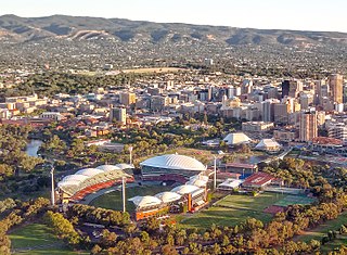
This article details the History of Adelaide from the first human activity in the region to the 20th century. Adelaide is a planned city founded in 1836 and the capital of South Australia.

Prospect, South Australia Suburb of Adelaide, South Australia

Prospect is the seat of the City of Prospect and an inner northern suburb of greater Adelaide. It is located 5 km (3.1 mi) north of Adelaide's centre.

Government House, Adelaide residence of the Governor of South Australia, Australia

Government House, located in Adelaide on the corner of North Terrace and King William Road, is the official residence of the Governor of South Australia.

Light Square square in Adelaide, South Australia

Light Square also known as Wauwi is one of five squares in the City of Adelaide. Located in the centre of the north-western quarter of the Adelaide city centre, the Square is named after the city's planner, Colonel William Light.

Hindmarsh Square square in Adelaide, South Australia

Hindmarsh Square is a public square in Adelaide, South Australia. It is located in the centre of the north-eastern quarter of the city, and surrounds the intersection of Grenfell and Pulteney Streets, near the eastern end of the Rundle Mall. Pirie Street forms the southern boundary of the square. It was named by the Street Naming Committee after John Hindmarsh, the first Governor of South Australia.

Gouger Street, Adelaide street in Adelaide

Gouger Street is a main street in the centre of Adelaide, South Australia. It was named after Robert Gouger, first Colonial Secretary of South Australia. Gouger Street is known for its high-end international restaurants and cafes. Cuisines found along Gouger Street include Italian, French, Argentinian, Malaysian, Vietnamese, Chinese and Thai. Many of the restaurants on Gouger Street have won awards; some of the better known ones are Star of Siam, La Porchetta (Italian) and Chi on Gouger.

Ovingham, South Australia Suburb of Adelaide, South Australia

Ovingham is an inner northern suburb of Adelaide, South Australia. It is located in the cities of Charles Sturt and Prospect.

Pulteney Street, Adelaide street in Adelaide

Pulteney Street is a main road which runs north-south through the middle of the eastern half of the Adelaide city centre, in Adelaide, South Australia. It runs north-south from North Terrace, through Hindmarsh and Hurtle Squares, to South Terrace, where it becomes Unley Road, and subsequently,, becomes Belair Road.

Morphett Street, Adelaide road in Adelaide

Morphett Street is a main street in the west of the city centre of Adelaide, South Australia. It runs from south to north between South and North Terraces, and passes around and through two of the five squares in the Adelaide city centre: Light Square and Whitmore Square. At Hindley Street it transforms into the start of the bridge which crosses North Terrace, the railway yards and the River Torrens.

Frome Road, Adelaide road in Adelaide, South Australia

Frome Road is a connecting road in the South Australian capital city of Adelaide. It starts from North Terrace in the Adelaide city centre, running in a northerly direction past the University of South Australia, the old Royal Adelaide Hospital, the Institute of Medical and Veterinary Science and the University of Adelaide, and then through the Adelaide Parklands to the Adelaide Zoo where it turns northeasterly, crosses the River Torrens via Albert Bridge, and continues through the parklands to the intersection with Melbourne Street and Brougham Place in North Adelaide. Adelaide's newest school has just opened here and it's called Adelaide Botanic high school. It is one of the three roads connecting the city centre to North Adelaide, the others being King William Road and Montefiore Road.

Grenfell Street, Adelaide street in Adelaide

Grenfell Street is a major street in the north-east quarter of the centre of the city of Adelaide, South Australia. The street runs west-east from King William Street to East Terrace. On the other side of King William Street, it continues as Currie Street. Its intersection with Pulteney Street is encircled by Hindmarsh Square.

East Terrace, Adelaide street in Adelaide, South Australia, Australia

East Terrace marks the eastern edge of the city centre of Adelaide, the capital city of South Australia. It is one of the main north-south thoroughfares through the east side of the city. Although the terrace essentially runs north-south between North Terrace and South Terrace, unlike Adelaide's other three terraces, its path is far from a straight line; travelling the entire length of East Terrace requires turning at right angles at most intersections. After crossing South Terrace, the street continues through the parklands as Beaumont Road, but unlike other roads through the parklands it is not a thoroughfare; there is a break in the middle of it.

Waymouth Street, Adelaide street in Adelaide, South Australia

Waymouth Street is an east-west street running between West Terrace and King William Street in the centre of Adelaide, the capital city of South Australia. The street is named after Henry Waymouth, a founding director of the South Australian Company. Until 1863 it was almost invariably spelled "Weymouth"; the eponymous director was then given either spelling interchangeably.

References

  1. The Colonel Light Statue - Unveiling Ceremony - An immense gathering., Adelaide Advertiser, Wednesday 28 November 1906, pg.7. (via trove.nla.gov.au)
  2. Location of "Light's Vision" disputed. Archived 18 July 2006 at the Wayback Machine . Adelaide Review, July 2004.
  3. Monument and plaque near the corner of North & West Terraces.
    (Due to construction of the new Royal Adelaide Hospital, this monument is not currently (2013) visible to the public.)
  4. Elton, Jude. "Montefiore Hill". Adelaidia. History SA. Retrieved 9 August 2017.