Linden, West Virginia

Last updated
Linden
Unincorporated community
USA West Virginia location map.svg
Red pog.svg
Linden
Location within the state of West Virginia
Usa edcp location map.svg
Red pog.svg
Linden
Linden (the US)
Coordinates: 38°43′11″N81°12′39″W / 38.71972°N 81.21083°W / 38.71972; -81.21083 Coordinates: 38°43′11″N81°12′39″W / 38.71972°N 81.21083°W / 38.71972; -81.21083
Country United States
State West Virginia
County Roane
Time zone Eastern (EST) (UTC-5)
  Summer (DST) EDT (UTC-4)

Linden is an unincorporated community in Roane County, West Virginia, United States, along the Henry Fork. [1] Its elevation is 755 feet (230 m). [2]

Unincorporated area Region of land not governed by own local government

In law, an unincorporated area is a region of land that is not governed by a local municipal corporation; similarly an unincorporated community is a settlement that is not governed by its own local municipal corporation, but rather is administered as part of larger administrative divisions, such as a township, parish, borough, county, city, canton, state, province or country. Occasionally, municipalities dissolve or disincorporate, which may happen if they become fiscally insolvent, and services become the responsibility of a higher administration. Widespread unincorporated communities and areas are a distinguishing feature of the United States and Canada. In most other countries of the world, there are either no unincorporated areas at all, or these are very rare; typically remote, outlying, sparsely populated or uninhabited areas.
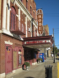
Roane County, West Virginia County in the United States

Roane County is a county located in the U.S. state of West Virginia. As of the 2010 census, the population was 14,926. Its county seat is Spencer. The county was founded in 1856 and is named for Spencer Roane.

West Virginia State of the United States of America

West Virginia is a state located in the Appalachian region in the Southern United States that is also considered to be a part of the Middle Atlantic States. It is bordered by Pennsylvania to the north, Maryland to the east and northeast, Virginia to the southeast, Kentucky to the southwest, and Ohio to the northwest. West Virginia is the 41st largest state by area, and is ranked 38th in population. The capital and largest city is Charleston.

The community has the name of Charles Linden Broadus, a Confederate Army officer. [3]

Related Research Articles

Cold Stream, West Virginia Unincorporated community in West Virginia, United States

Cold Stream is an unincorporated community in Hampshire County in the U.S. state of West Virginia. Cold Stream is located north of Capon Bridge on Cold Stream Road. Referred to as Edwards Run in its past, the community of Cold Stream is in proximity to where Edwards Run empties into the Cacapon River. The community most likely took its name from a nearby stream of the same name noted for the cold water it contains. Their post office has been closed.

Sherman, West Virginia Unincorporated community in West Virginia, United States

Sherman is an unincorporated community in northern Jackson County, West Virginia, United States, along the Ohio River. It lies along West Virginia Route 68 north of the city of Ravenswood. Its elevation is 600 feet (183 m).

Belva, West Virginia Census-designated place in West Virginia, United States

Belva is an unincorporated community and census-designated place in west Nicholas County and north Fayette County, West Virginia, United States; while the CDP only includes the Nicholas County portion, the Fayette County portion is considered part of the community. The town is situated at the bottomland surrounding the convergence of Bells Creek with Twentymile Creek and, subsequently, Twenty Mile Creek with the Gauley River. Belva is also the location of the convergence of two state highways: West Virginia Route 16 and West Virginia Route 39.

Neola, West Virginia Unincorporated community in West Virginia, United States

Neola is an unincorporated community in northeastern Greenbrier County, West Virginia, United States. It lies along West Virginia Route 92 north of the city of White Sulphur Springs. Its elevation is 2,037 feet (621 m).

Linwood, West Virginia Unincorporated community in West Virginia, United States

Linwood is an unincorporated community in Pocahontas County, West Virginia, United States. Linwood is located at the junction of U.S. Route 219, West Virginia Route 55, and West Virginia Route 66 14 miles (23 km) north-northeast of Marlinton.

Muses Bottom, West Virginia Unincorporated community in West Virginia, United States

Muses Bottom is an unincorporated community in Jackson County, West Virginia, United States. Muses Bottom is located on the Ohio River and West Virginia Route 68 6.5 miles (10.5 km) north of Ravenswood. Muses Bottom once had a post office, which is now closed.

Greyeagle, West Virginia Unincorporated community in West Virginia, United States

Greyeagle is an unincorporated community in Mingo County, West Virginia. Their post office no longer exists.

Surosa, West Virginia Unincorporated community in West Virginia, United States

Surosa is an unincorporated community in Mingo County, West Virginia. Their post office no longer exists.

Pedlar, West Virginia Unincorporated community in West Virginia, United States

Pedlar is an unincorporated community in Monongalia County, West Virginia. Its Post Office has been closed.

Olcott, West Virginia Unincorporated community in West Virginia, United States

Olcott is an unincorporated community and coal town in Kanawha County, West Virginia, United States. Its post office is closed.

Wickham, West Virginia Unincorporated community in West Virginia, United States

Wickham is an unincorporated community in Raleigh County, West Virginia, United States. Its post office is closed.

Sattes, West Virginia Unincorporated community in West Virginia, United States

Sattes is an unincorporated community in Kanawha County, West Virginia. Its post office is closed.

Canterbury, West Virginia Unincorporated community in West Virginia, United States

Canterbury is an unincorporated community in Mingo County, West Virginia, United States. Its post office is closed.

Weir, West Virginia Unincorporated community in West Virginia, United States

Weir is an unincorporated community in Kanawha County, West Virginia, United States. Its post office is called Falling Rock.

Legg, West Virginia Unincorporated community in West Virginia, United States

Legg is an unincorporated community in Kanawha County, West Virginia, United States. Its post office is closed.

Copenhaver, West Virginia Unincorporated community in West Virginia, United States

Copenhaver was an unincorporated community in Kanawha County, West Virginia, United States. Its post office is closed.

Putney, West Virginia Unincorporated community in West Virginia, United States

Putney is an unincorporated community in Kanawha County, West Virginia, United States. Its post office is closed.

Rensford, West Virginia Unincorporated community in West Virginia, United States

Rensford is an unincorporated community in Kanawha County, West Virginia, United States. Its post office is closed. It was also known as Point Lick.

Maynor, West Virginia Unincorporated community in West Virginia, United States

Maynor is an unincorporated community in Raleigh County, West Virginia, United States. Its post office is closed.

Wevaco, West Virginia Unincorporated community in West Virginia, United States

Wevaco is an unincorporated community and former coal town in Kanawha County, West Virginia, United States. Its post office is closed.

References

  1. West Virginia Atlas & Gazetteer. Yarmouth, Me.: DeLorme. 1997. p. 44. ISBN   0-89933-246-3.
  2. U.S. Geological Survey Geographic Names Information System: Linden, West Virginia, Geographic Names Information System, 1980-06-27. Accessed 2008-02-01.
  3. Kenny, Hamill (1945). West Virginia Place Names: Their Origin and Meaning, Including the Nomenclature of the Streams and Mountains. Piedmont, WV: The Place Name Press. p. 374.